 |
|
Johnsons Strawberry Farm Airport |
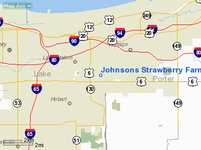
Location
& QuickFacts
|
FAA
Information Effective: |
2008-06-05 |
|
Airport
Identifier: |
9IN3 |
|
Airport
Status: |
Operational |
|
Longitude/Latitude: |
087-13-35.0000W/41-33-25.0000N
-87.226389/41.556944 (Estimated) |
|
Elevation: |
620 ft / 188.98 m (Estimated) |
|
Land: |
0 acres |
|
From nearest
city: |
3 nautical miles NE of Hobart, IN |
|
Location: |
Lake County, IN |
|
Magnetic
Variation: |
() |
Owner
& Manager
|
Ownership: |
Privately
owned |
|
Owner: |
Rodney Johnson |
|
Address: |
8960 E Ridge Road
Hobart, IN 46342 |
|
Phone
number: |
219-962-4035 |
|
Manager: |
Rodney Johnson |
|
Address: |
8960 E Ridge Road
Hobart, IN 46342 |
|
Phone
number: |
219-962-4035 |
Airport
Operations and Facilities
|
Airport
Use: |
Private |
|
Control
Tower: |
No |
|
Sectional
chart: |
Chicago |
|
Region: |
AGL - Great Lakes |
|
Boundary
ARTCC: |
ZAU - Chicago |
|
Tie-in
FSS: |
HUF - Terre Haute |
|
FSS Toll
Free: |
1-800-WX-BRIEF |
|
Runway Information
Runway 18/36
|
Dimension: |
2000 x 60 ft
/ 609.6 x 18.3 m |
|
Surface: |
TURF, |
|
|
Runway 18 |
Runway 36 |
|
Traffic
Pattern: |
Left |
Right |
|
Obstruction: |
30 ft pline, 900.0 ft from runway |
40 ft trees, 1000.0 ft from runway |
|
Radio Navigation
Aids
|
ID |
Type |
Name |
Ch |
Freq |
Var |
Dist |
|
VP |
NDB |
Sedly |
|
212.00 |
02W |
16.9 nm |
|
MGC |
NDB |
Michigan City |
|
203.00 |
01W |
20.5 nm |
|
IUL |
NDB |
La Porte |
|
356.00 |
03W |
20.8 nm |
|
MX |
NDB |
Kedzi |
|
248.00 |
01W |
23.6 nm |
|
HK |
NDB |
Ermin |
|
332.00 |
01W |
29.1 nm |
|
RZL |
NDB |
Rensselaer |
|
362.00 |
02W |
36.7 nm |
|
RWN |
NDB |
Winamac/dcmsnd |
|
335.00 |
00W |
39.5 nm |
|
CPB |
NDB |
Culver |
|
391.00 |
01W |
43.1 nm |
|
ME |
NDB |
Deana |
|
350.00 |
00E |
43.6 nm |
|
OXI |
VOR/DME |
Knox |
103X |
115.60 |
00E |
29.6 nm |
|
ORD |
VOR/DME |
Chicago O'hare |
086X |
113.90 |
02E |
39.9 nm |
|
IKK |
VOR/DME |
Kankakee |
053X |
111.60 |
00E |
40.4 nm |
|
CGT |
VORTAC |
Chicago Heights |
089X |
114.20 |
02E |
15.8 nm |
|
EON |
VORTAC |
Peotone |
079X |
113.20 |
02E |
30.8 nm |
|
GIJ |
VORTAC |
Gipper |
101X |
115.40 |
00E |
42.7 nm |
|
JOT |
VORTAC |
Joliet |
070X |
112.30 |
02E |
49.1 nm |
|
MDW |
VOT |
Chicago Midway |
|
111.00 |
|
27.3 nm |
|
ORD |
VOT |
Chicago O'hare Intl |
|
112.00 |
|
39.8 nm |
Remarks
- 200
FT CELL TWR 1/4 NM SW AND LGTD 494 FT TWR 1.5 NM SE OF RY.
- ALL
TFC PATTERNS ARE TO BE FLOWN ON THE E SIDE OF THE RY.
- PRVDD
ALL TFC PATTERNS ARE FLOWN E OF THE RY; CLEAR 20:1 APCHS; CLEAR OBSTACLE
FREE ZONE;AND CLEAR RY SAFETY AREAS.
Johnsons Strawberry Farm Airport
Address:
Lake County, IN
Tel:
219-962-4035
Images
and information placed above are from
http://www.airport-data.com/airport/9IN3/
We thank them for the
data!
We don't guarantee the information is fresh and accurate. The data may
be wrong or outdated.
For more up-to-date information please refer to other sources.
|
|


