 |
|
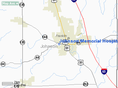
Johnson Memorial Hospital Heliport |
Location
& QuickFacts
|
FAA
Information Effective: |
2008-06-05 |
|
Airport
Identifier: |
55II |
|
Airport
Status: |
Operational |
|
Longitude/Latitude: |
086-04-39.9520W/39-28-48.1790N
-86.077764/39.480050 (Estimated) |
|
Elevation: |
742 ft / 226.16 m (Estimated) |
|
Land: |
0 acres |
|
From nearest
city: |
0 nautical miles W of Franklin, IN |
|
Location: |
Johnson County, IN |
|
Magnetic
Variation: |
02W (1985) |
Owner
& Manager
|
Ownership: |
Publicly
owned |
|
Owner: |
Johnson Meml Hospital 1 |
|
Address: |
1125 W Jefferson St
Franklin, IN 46131 |
|
Phone
number: |
317-736-3300 |
|
Manager: |
Gregg Bechtold |
|
Address: |
P O Box 549
Franklin, IN 46131 |
Airport
Operations and Facilities
|
Airport
Use: |
Private
MEDICAL USE. |
|
Wind indicator: |
Yes |
|
Segmented
Circle: |
No |
|
Control
Tower: |
No |
|
Lighting
Schedule: |
PHONE REQ |
|
Beacon
Color: |
Clear-Green-Yellow (heliport) |
|
Sectional
chart: |
St Louis |
|
Region: |
AGL - Great Lakes |
|
Boundary
ARTCC: |
ZID - Indianapolis |
|
Tie-in
FSS: |
HUF - Terre Haute |
|
FSS Toll
Free: |
1-800-WX-BRIEF |
|
Runway Information
Helipad H1
|
Dimension: |
53 x 53 ft /
16.2 x 16.2 m |
|
Surface: |
ASPH, |
|
|
Runway H1 |
Runway |
|
Traffic
Pattern: |
Left |
Left |
|
Radio Navigation
Aids
|
ID |
Type |
Name |
Ch |
Freq |
Var |
Dist |
|
HFY |
NDB |
Greenwood |
|
398.00 |
02W |
9.2 nm |
|
BA |
NDB |
Clifs |
|
410.00 |
03W |
15.3 nm |
|
UMP |
NDB |
Metropolitan |
|
338.00 |
03W |
27.5 nm |
|
HZP |
NDB |
Zionsville |
|
248.00 |
03W |
28.8 nm |
|
OVO |
NDB |
North Vernon |
|
374.00 |
02W |
34.1 nm |
|
BM |
NDB |
Claye |
|
382.00 |
02W |
35.2 nm |
|
TVX |
NDB |
Greencastle |
|
521.00 |
03W |
36.5 nm |
|
EQZ |
NDB |
Captain |
|
308.00 |
02W |
37.1 nm |
|
HLB |
NDB |
Batesville |
|
254.00 |
02W |
38.9 nm |
|
BFR |
NDB |
Bedford |
|
344.00 |
02W |
42.0 nm |
|
UWL |
NDB |
New Castle |
|
385.00 |
02W |
42.5 nm |
|
AI |
NDB |
Video |
|
371.00 |
03W |
44.1 nm |
|
CFJ |
NDB |
Crawfordsville |
|
388.00 |
02W |
49.1 nm |
|
SHB |
VORTAC |
Shelbyville |
057X |
112.00 |
01E |
14.9 nm |
|
VHP |
VORTAC |
Brickyard |
110X |
116.30 |
01E |
24.2 nm |
|
OOM |
VORTAC |
Hoosier |
039X |
110.20 |
02W |
32.1 nm |
|
IND |
VOT |
Indianapolis Intl |
|
109.60 |
|
17.5 nm |
Remarks
- PROVIDED
APCH/DEP OPERATIONS ARE CONDUCTED FM 180 TO 320 DEG; AREA IS MKD; WIND
INDICATOR IS MAINTAINED; SITE 2 IS SELECTED.
Johnson Memorial Hospital Heliport
Address:
Johnson County, IN
Tel:
317-736-3300
Images
and information placed above are from
http://www.airport-data.com/airport/55II/
We
thank them for the data!
| General
Info |
| Country |
United
States |
| State |
INDIANA
|
| FAA ID |
55II |
| Latitude |
39-28-48.179N
|
| Longitude |
086-04-39.952W
|
| Elevation |
742 feet
|
| Near City |
FRANKLIN
|
We don't guarantee the information is fresh and accurate. The data may
be wrong or outdated.
For more up-to-date information please refer to other sources.
|
|


