 |
|
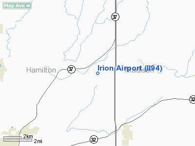
Location
& QuickFacts
|
FAA
Information Effective: |
2008-06-05 |
|
Airport
Identifier: |
II94 |
|
Airport
Status: |
Operational |
|
Longitude/Latitude: |
085-53-09.9310W/40-07-42.1380N
-85.886092/40.128372 (Estimated) |
|
Elevation: |
800 ft / 243.84 m (Estimated) |
|
Land: |
0 acres |
|
From nearest
city: |
8 nautical miles NE of Noblesville, IN |
|
Location: |
Hamilton County, IN |
|
Magnetic
Variation: |
02W (1985) |
Owner
& Manager
|
Ownership: |
Privately
owned |
|
Owner: |
Edgar E. Irion |
|
Address: |
23483 Newton Ave
Noblesville, IN 46060 |
|
Phone
number: |
317-734-5551 |
|
Manager: |
Edgar E. Irion |
|
Address: |
23483 Newton Ave
Noblesville, IN 46060 |
|
Phone
number: |
317-734-165* |
Airport
Operations and Facilities
|
Airport
Use: |
Private |
|
Segmented
Circle: |
No |
|
Control
Tower: |
No |
|
Sectional
chart: |
Chicago |
|
Region: |
AGL - Great Lakes |
|
Boundary
ARTCC: |
ZID - Indianapolis |
|
Tie-in
FSS: |
HUF - Terre Haute |
|
FSS on
Airport: |
No |
|
FSS Toll
Free: |
1-800-WX-BRIEF |
|
Runway Information
Runway E/W
|
Dimension: |
2640 x 60 ft
/ 804.7 x 18.3 m |
|
Surface: |
TURF, |
|
|
Runway E |
Runway W |
|
Traffic
Pattern: |
Left |
Left |
|
Radio Navigation
Aids
|
ID |
Type |
Name |
Ch |
Freq |
Var |
Dist |
|
UMP |
NDB |
Metropolitan |
|
338.00 |
03W |
13.7 nm |
|
AI |
NDB |
Video |
|
371.00 |
03W |
17.6 nm |
|
HZP |
NDB |
Zionsville |
|
248.00 |
03W |
20.2 nm |
|
UWL |
NDB |
New Castle |
|
385.00 |
02W |
30.1 nm |
|
HFY |
NDB |
Greenwood |
|
398.00 |
02W |
31.3 nm |
|
FKR |
NDB |
Frankfort |
|
278.00 |
02W |
32.2 nm |
|
IWH |
NDB |
Wabash |
|
329.00 |
03W |
38.4 nm |
|
GGP |
NDB |
Logansport |
|
263.00 |
01W |
41.4 nm |
|
PLD |
NDB |
Portland |
|
257.00 |
03W |
45.8 nm |
|
HHG |
NDB |
Huntington |
|
417.00 |
03W |
47.8 nm |
|
CFJ |
NDB |
Crawfordsville |
|
388.00 |
02W |
48.2 nm |
|
BA |
NDB |
Clifs |
|
410.00 |
03W |
48.6 nm |
|
TVX |
NDB |
Greencastle |
|
521.00 |
03W |
49.2 nm |
|
MIE |
VOR/DME |
Muncie |
091X |
114.40 |
03W |
23.5 nm |
|
MZZ |
VOR/DME |
Marion |
023X |
108.60 |
03W |
23.9 nm |
|
OKK |
VORTAC |
Kokomo |
082X |
113.50 |
00E |
25.3 nm |
|
VHP |
VORTAC |
Brickyard |
110X |
116.30 |
01E |
29.1 nm |
|
SHB |
VORTAC |
Shelbyville |
057X |
112.00 |
01E |
29.9 nm |
|
GUS |
VORTAC |
Grissom |
21Y |
108.45 |
02W |
33.3 nm |
|
IND |
VOT |
Indianapolis Intl |
|
109.60 |
|
30.4 nm |
Remarks
- FILED
FOR RECORD PURPOSES ONLY.
Irion Airport
Address:
Hamilton County, IN
Tel:
317-734-5551,
317-734-165
Images
and information placed above are from
http://www.airport-data.com/airport/II94/
We
thank them for the data!
| General
Info |
| Country |
United
States |
| State |
INDIANA
|
| FAA ID |
II94 |
| Latitude |
40-07-42.138N
|
| Longitude |
085-53-09.931W
|
| Elevation |
800 feet
|
| Near City |
NOBLESVILLE
|
We don't guarantee the information is fresh and accurate. The data may
be wrong or outdated.
For more up-to-date information please refer to other sources.
|
|


