 |
|
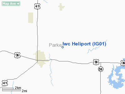
Indianapolis Water Company Heliport |
Location
& QuickFacts
|
FAA
Information Effective: |
2008-06-05 |
|
Airport
Identifier: |
IG01 |
|
Airport
Status: |
Operational |
|
Longitude/Latitude: |
087-11-00.9600W/39-47-01.1500N
-87.183600/39.783653 (Estimated) |
|
Elevation: |
700 ft / 213.36 m (Estimated) |
|
Land: |
0 acres |
|
From nearest
city: |
1 nautical miles NW of Indianapolis, IN |
|
Location: |
Marion County, IN |
|
Magnetic
Variation: |
02W (1995) |
Owner
& Manager
|
Ownership: |
Privately
owned |
|
Owner: |
Indianapolis Water Co. |
|
Address: |
1201 Waterway Blvd.
Indianapolis, IN 46202 |
|
Phone
number: |
219-944-5400 |
|
Manager: |
Randall Yoblonowsk |
|
Address: |
1201 Waterway Blvd.
Indianapolis, IN 46202 |
|
Phone
number: |
219-944-5400 |
Airport
Operations and Facilities
|
Airport
Use: |
Private |
|
Wind indicator: |
Yes |
|
Segmented
Circle: |
No |
|
Control
Tower: |
No |
|
Sectional
chart: |
St Louis |
|
Region: |
AGL - Great Lakes |
|
Boundary
ARTCC: |
ZID - Indianapolis |
|
Tie-in
FSS: |
HUF - Terre Haute |
|
FSS on
Airport: |
No |
|
FSS Toll
Free: |
1-800-WX-BRIEF |
|
Runway Information
Helipad H1
|
Dimension: |
50 x 50 ft /
15.2 x 15.2 m |
|
Surface: |
TURF, |
|
|
Runway H1 |
Runway |
|
Traffic
Pattern: |
Left |
Left |
|
Radio Navigation
Aids
|
ID |
Type |
Name |
Ch |
Freq |
Var |
Dist |
|
CFJ |
NDB |
Crawfordsville |
|
388.00 |
02W |
17.1 nm |
|
TVX |
NDB |
Greencastle |
|
521.00 |
03W |
17.9 nm |
|
PRG |
NDB |
Paris |
|
341.00 |
01E |
23.2 nm |
|
HU |
NDB |
Yinno |
|
245.00 |
02W |
25.8 nm |
|
HMJ |
NDB |
Homer |
|
281.00 |
01E |
38.4 nm |
|
FKR |
NDB |
Frankfort |
|
278.00 |
02W |
40.9 nm |
|
SIV |
NDB |
Sullivan |
|
326.00 |
02W |
42.1 nm |
|
HZP |
NDB |
Zionsville |
|
248.00 |
03W |
44.1 nm |
|
CZB |
NDB |
Casey |
|
359.00 |
00E |
47.6 nm |
|
TTH |
VORTAC |
Terre Haute |
100X |
115.30 |
02E |
18.0 nm |
|
DNV |
VORTAC |
Danville |
047X |
111.00 |
02E |
35.2 nm |
|
VHP |
VORTAC |
Brickyard |
110X |
116.30 |
01E |
37.7 nm |
|
OOM |
VORTAC |
Hoosier |
039X |
110.20 |
02W |
46.7 nm |
|
BVT |
VORTAC |
Boiler |
098X |
115.10 |
01E |
46.7 nm |
|
IND |
VOT |
Indianapolis Intl |
|
109.60 |
|
41.8 nm |
Remarks
- PRVDD
APCH/DEP 355 DEGS-060 DEGS; AREA IS MKD; WIND INDICATOR IS MAINTAINED.
Indianapolis Water Company Heliport
Address:
Marion County, IN
Tel:
219-944-5400
Images
and information placed above are from
http://www.airport-data.com/airport/IG01/
We
thank them for the data!
| General
Info |
| Country |
United
States |
| State |
INDIANA
|
| FAA ID |
IG01 |
| Latitude |
39-47-01.150N
|
| Longitude |
087-11-00.960W
|
| Elevation |
700 feet
|
| Near City |
INDIANAPOLIS
|
We don't guarantee the information is fresh and accurate. The data may
be wrong or outdated.
For more up-to-date information please refer to other sources.
|
|


