|
|
Indianapolis Metropolitan Airport |
| Indianapolis Metropolitan Airport |
| IATA: none â ICAO: KUMP â FAA LID: UMP |
| Summary |
| Airport type |
Public |
| Owner |
Indianapolis Airport Authority |
| Serves |
Indianapolis, Indiana |
| Location |
Fishers, Indiana |
| Elevation AMSL |
811 ft / 247 m |
| Coordinates |
39°56â²07â³N 086°02â²42â³W / 39.93528°N 86.045°W / 39.93528; -86.045 |
| Runways |
| Direction |
Length |
Surface |
| ft |
m |
| 15/33 |
3,850 |
1,173 |
Asphalt |
| Statistics (2006) |
| Aircraft operations |
58,008 |
| Based aircraft |
161 |
| Source: Federal Aviation Administration |
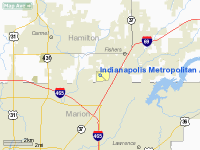
Indianapolis Metropolitan Airport (ICAO: KUMP, FAA LID: UMP) is a public airport located 2 miles (3.2 km) southwest of Fishers, a town in Hamilton County, Indiana, United States. Also located eight miles (13 km) northeast of the central business district of Indianapolis, it is owned by the Indianapolis Airport Authority and serves as a reliever airport for Indianapolis International Airport.
Although most U.S. airports use the same three-letter location identifier for the FAA and IATA, Indianapolis Metropolitan Airport is assigned UMP by the FAA but has no designation from the IATA.
Facilities and aircraft
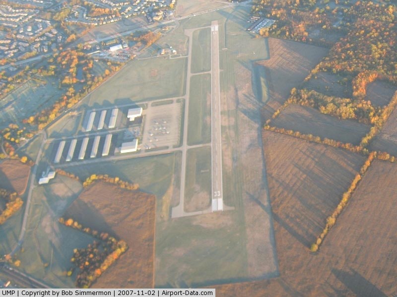
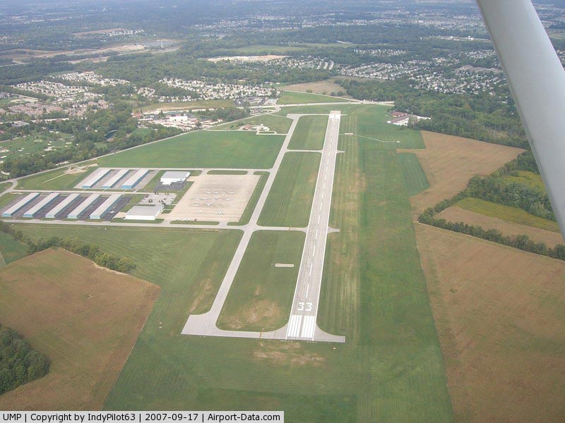
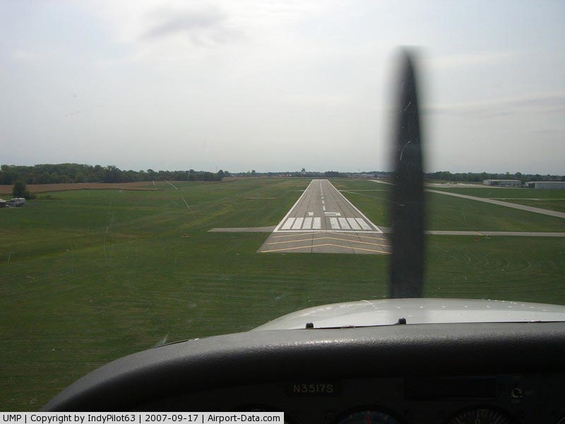
Indianapolis Metropolitan Airport covers an area of 445 acres (180 ha) which contains one runway designated 15/33 with a 3,850 x 100 ft (1,173 x 30 m) asphalt surface. For the 12-month period ending June 15, 2006, the airport had 58,008 aircraft operations, an average of 158 per day: 79% general aviation, 18% air taxi and 3% military. There are 161 aircraft based at this airport: 78% single-engine, 19% multi-engine, 2% jet and 1% helicopter.
The above content comes from Wikipedia and is published under free licenses – click here to read more.
|
 |
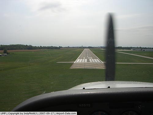
(Click on the photo to enlarge) |
|
 |
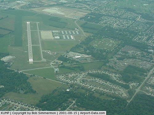
(Click on the photo to enlarge) |
|
 |
(Click on the photo to enlarge) |
|
 |
(Click on the photo to enlarge) |
Location
& QuickFacts
|
FAA
Information Effective: |
2008-06-05 |
|
Airport
Identifier: |
UMP |
|
Airport
Status: |
Operational |
|
Longitude/Latitude: |
086-02-41.8870W/39-56-06.5920N
-86.044969/39.935164 (Estimated) |
|
Elevation: |
811 ft / 247.19 m (Surveyed) |
|
Land: |
445 acres |
|
From nearest
city: |
8 nautical miles NE of Indianapolis, IN |
|
Location: |
Hamilton County, IN |
|
Magnetic
Variation: |
03W (1995) |
Owner
& Manager
|
Ownership: |
Publicly
owned |
|
Owner: |
Indianapolis Arpt Auth |
|
Address: |
Box 100 2500 S High School Rd
Indianapolis, IN 46241-4941 |
|
Phone
number: |
317-487-9594 |
|
Manager: |
Michael T. Medvescek |
|
Address: |
Box 100 2500 S High School Rd
Indianapolis, IN 46241-4941 |
|
Phone
number: |
317-487-5024 |
Airport
Operations and Facilities
|
Airport
Use: |
Open
to public |
|
Wind indicator: |
Yes |
|
Segmented
Circle: |
No |
|
Control
Tower: |
No |
|
Lighting
Schedule: |
DUSK-DAWN |
|
Beacon
Color: |
Clear-Green (lighted land airport) |
|
Landing
fee charge: |
No |
|
Sectional
chart: |
St Louis |
|
Region: |
AGL - Great Lakes |
|
Traffic
Pattern Alt: |
1000 ft |
|
Boundary
ARTCC: |
ZID - Indianapolis |
|
Tie-in
FSS: |
HUF - Terre Haute |
|
FSS on
Airport: |
No |
|
FSS Toll
Free: |
1-800-WX-BRIEF |
|
NOTAMs
Facility: |
HUF (NOTAM-d service avaliable) |
|
Federal
Agreements: |
NGY |
Airport
Communications
|
CTAF: |
123.000 |
|
Unicom: |
123.000
|
Airport
Services
|
Fuel
available: |
100LLA |
|
Airframe
Repair: |
MAJOR |
|
Power
Plant Repair: |
MAJOR |
|
Bottled
Oxygen: |
NONE |
|
Bulk Oxygen: |
NONE |
|
Runway Information
Runway 15/33
|
Dimension: |
3850 x 100 ft
/ 1173.5 x 30.5 m |
|
Surface: |
ASPH, Good Condition |
|
Surface Treatment: |
Aggregate Friction Seal Coat |
|
Weight Limit: |
Single wheel: 17000 lbs. |
|
Edge Lights: |
Medium |
|
|
Runway 15 |
Runway 33 |
|
Longitude: |
086-02-55.7073W |
086-02-27.8701W |
|
Latitude: |
39-56-22.4208N |
39-55-51.0374N |
|
Elevation: |
786.00 ft |
810.00 ft |
|
Alignment: |
127 |
127 |
|
Traffic
Pattern: |
Left |
Left |
|
Markings: |
Non-precision instrument, Good Condition |
Non-precision instrument, Good Condition |
|
Crossing
Height: |
37.00 ft |
27.00 ft |
|
VASI: |
4-light PAPI on left side |
4-light PAPI on left side |
|
Visual Glide
Angle: |
3.00° |
3.50° |
|
Runway End
Identifier: |
Yes |
Yes |
|
Obstruction: |
11 ft road, 530.0 ft from runway, 30:1 slope
to clear
160 FT STOPWAY N END. |
70 ft bldg, 2000.0 ft from runway, 25:1 slope
to clear |
|
Radio Navigation
Aids
|
ID |
Type |
Name |
Ch |
Freq |
Var |
Dist |
|
UMP |
NDB |
Metropolitan |
|
338.00 |
03W |
0.3 nm |
|
HZP |
NDB |
Zionsville |
|
248.00 |
03W |
9.4 nm |
|
HFY |
NDB |
Greenwood |
|
398.00 |
02W |
18.3 nm |
|
AI |
NDB |
Video |
|
371.00 |
03W |
25.9 nm |
|
FKR |
NDB |
Frankfort |
|
278.00 |
02W |
31.2 nm |
|
UWL |
NDB |
New Castle |
|
385.00 |
02W |
33.6 nm |
|
TVX |
NDB |
Greencastle |
|
521.00 |
03W |
37.6 nm |
|
BA |
NDB |
Clifs |
|
410.00 |
03W |
38.3 nm |
|
CFJ |
NDB |
Crawfordsville |
|
388.00 |
02W |
40.2 nm |
|
GGP |
NDB |
Logansport |
|
263.00 |
01W |
48.9 nm |
|
MIE |
VOR/DME |
Muncie |
091X |
114.40 |
03W |
35.0 nm |
|
MZZ |
VOR/DME |
Marion |
023X |
108.60 |
03W |
37.5 nm |
|
VHP |
VORTAC |
Brickyard |
110X |
116.30 |
01E |
16.5 nm |
|
SHB |
VORTAC |
Shelbyville |
057X |
112.00 |
01E |
20.9 nm |
|
OKK |
VORTAC |
Kokomo |
082X |
113.50 |
00E |
35.6 nm |
|
GUS |
VORTAC |
Grissom |
21Y |
108.45 |
02W |
42.9 nm |
|
IND |
VOT |
Indianapolis Intl |
|
109.60 |
|
16.8 nm |
Remarks
- OUTSIDE
PHONE AVBL.
- ACFT
TAKEOFF/LANDING FM RY 15 DURING CALM WIND/CROSSWIND CONDITIONS; DURING
ANY QUESTIONABLE PERIOD RY 15 SHALL BE PREFERRED RY - CALL AMGR 317-487-9594.
Based Aircraft
|
Aircraft
based on field: |
161 |
|
Single Engine
Airplanes: |
125 |
|
Multi Engine Airplanes: |
30 |
|
Jet Engine Airplanes: |
4 |
|
Helicopters: |
2 |
Operational Statistics
Time
Period: 2005-06-16 - 2006-06-15
|
Aircraft
Operations: |
159/Day |
|
Air Taxi: |
17.6% |
|
General Aviation
Local: |
48.9% |
|
General Aviation
Itinerant: |
30.6% |
|
Military: |
2.9% |
Indianapolis Metropolitan Airport
Address:
Hamilton County, IN
Tel:
317-487-9594,
317-487-5024
Images
and information placed above are from
http://www.airport-data.com/airport/UMP/
We
thank them for the data!
| General
Info |
| Country |
United
States |
| State |
INDIANA
|
| FAA ID |
UMP |
| Latitude |
39-56-06.729N
|
| Longitude |
086-02-41.832W
|
| Elevation |
811 feet
|
| Near City |
INDIANAPOLIS
|
We don't guarantee the information is fresh and accurate. The data may
be wrong or outdated.
For more up-to-date information please refer to other sources.
|
|