|
|
Huntington Municipal Airport |
| Huntington Municipal Airport |
| IATA: none â ICAO: KHHG â FAA LID: HHG |
| Summary |
| Airport type |
Public |
| Owner |
Huntington BOAC |
| Serves |
Huntington, Indiana |
| Elevation AMSL |
806 ft / 246 m |
| Coordinates |
40°51â²11â³N 085°27â²25â³W / 40.85306°N 85.45694°W / 40.85306; -85.45694 |
| Runways |
| Direction |
Length |
Surface |
| ft |
m |
| 9/27 |
5,001 |
1,524 |
Asphalt |
| Statistics (2004) |
| Aircraft operations |
17,139 |
| Based aircraft |
67 |
| Source: Federal Aviation Administration |
Huntington Municipal Airport (ICAO: KHHG, FAA LID: HHG) is a city-owned, public-use airport located three nautical miles (6 km) southeast of the central business district of Huntington, a city in Huntington County, Indiana, United States. According to the FAA's National Plan of Integrated Airport Systems for 2009â2013, it was classified as a general aviation airport.
Although most U.S. airports use the same three-letter location identifier for the FAA and IATA, this airport is assigned HHG by the FAA but has no designation from the IATA.
Facilities and aircraft
Huntington Municipal Airport covers an area of 118 acres (48 ha) at an elevation of 806 feet (246 m) above mean sea level. It has one runway designated 9/27 with an asphalt surface measuring 5,001 by 75 feet (1,524 x 23 m).
For the 12-month period ending December 31, 2004, the airport had 17,139 aircraft operations, an average of 46 per day: 99% general aviation and 1% air taxi. At that time there were 67 aircraft based at this airport: 88% single-engine and 12% multi-engine.
The above content comes from Wikipedia and is published under free licenses – click here to read more.
|
 |
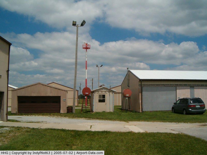
(Click on the photo to enlarge) |
|
 |
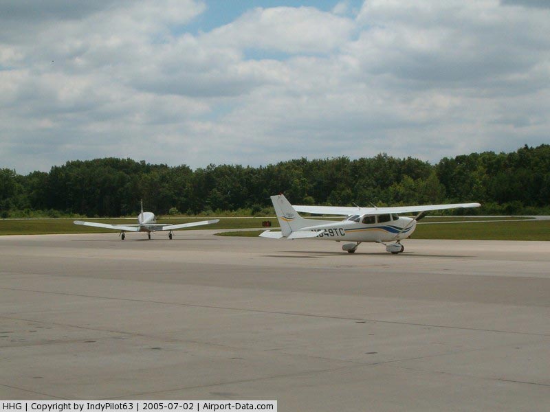
(Click on the photo to enlarge) |
|
 |
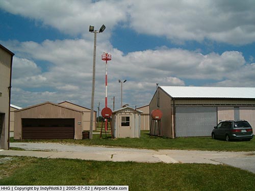
(Click on the photo to enlarge) |
|
 |
(Click on the photo to enlarge) |
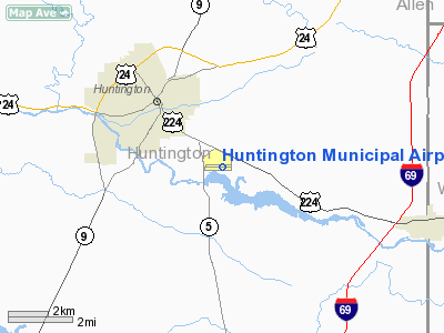
Location
& QuickFacts
|
FAA
Information Effective: |
2008-06-05 |
|
Airport
Identifier: |
HHG |
|
Airport
Status: |
Operational |
|
Longitude/Latitude: |
085-27-25.4640W/40-51-10.5110N
-85.457073/40.852920 (Estimated) |
|
Elevation: |
806 ft / 245.67 m (Estimated) |
|
Land: |
118 acres |
|
From nearest
city: |
3 nautical miles SE of Huntington, IN |
|
Location: |
Huntington County, IN |
|
Magnetic
Variation: |
03W (1990) |
Owner
& Manager
|
Ownership: |
Publicly
owned |
|
Owner: |
Huntington Boac |
|
Address: |
1365 Warren Rd
Huntington, IN 46750 |
|
Phone
number: |
219-356-8515 |
|
Manager: |
Steve Gray |
|
Address: |
1365 Warren Rd
Huntington, IN 46750 |
|
Phone
number: |
219-356-8515 |
Airport
Operations and Facilities
|
Airport
Use: |
Open
to public |
|
Wind indicator: |
Yes |
|
Segmented
Circle: |
No |
|
Control
Tower: |
No |
|
Lighting
Schedule: |
DUSK-DAWN
MIRL RY 09/27 PRESET ON LOW INTST; TO INCR INTST & ACTVT
REIL RYS 09 & 27 - CTAF. |
|
Beacon
Color: |
Clear-Green (lighted land airport) |
|
Landing
fee charge: |
No |
|
Sectional
chart: |
Chicago |
|
Region: |
AGL - Great Lakes |
|
Boundary
ARTCC: |
ZAU - Chicago |
|
Tie-in
FSS: |
HUF - Terre Haute |
|
FSS on
Airport: |
No |
|
FSS Toll
Free: |
1-800-WX-BRIEF |
|
NOTAMs
Facility: |
HUF (NOTAM-d service avaliable) |
|
Federal
Agreements: |
NGY |
Airport
Communications
|
CTAF: |
122.800 |
|
Unicom: |
122.800
|
Airport
Services
|
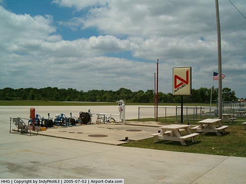
Fuel
available: |
100LLA |
|
Airframe
Repair: |
MAJOR |
|
Power
Plant Repair: |
MAJOR |
|
Bottled
Oxygen: |
NONE |
|
Bulk Oxygen: |
NONE |
|
Runway Information
Runway 09/27
|
Dimension: |
5001 x 75 ft
/ 1524.3 x 22.9 m |
|
Surface: |
ASPH, Good Condition |
|
Surface Treatment: |
Saw-cut or plastic Grooved |
|
Weight Limit: |
Single wheel: 38000 lbs.
Dual wheel: 50000 lbs. |
|
Edge Lights: |
Medium |
|
|
Runway 09 |
Runway 27 |
|
Longitude: |
085-27-57.9794W |
085-26-52.9490W |
|
Latitude: |
40-51-11.4623N |
40-51-09.5600N |
|
Elevation: |
804.00 ft |
805.00 ft |
|
Alignment: |
92 |
127 |
|
Traffic
Pattern: |
Left |
Left |
|
Markings: |
Non-precision instrument, Good Condition |
Non-precision instrument, Good Condition |
|
Crossing
Height: |
36.00 ft |
45.00 ft |
|
VASI: |
4-light PAPI on left side |
4-light PAPI on left side |
|
Visual Glide
Angle: |
3.00° |
3.00° |
|
Runway End
Identifier: |
Yes |
Yes |
|
Obstruction: |
30 ft trees, 800.0 ft from runway, 100 ft right
of centerline, 20:1 slope to clear |
45 ft trees, 1490.0 ft from runway, 28:1 slope
to clear |
|
Radio Navigation
Aids
|
ID |
Type |
Name |
Ch |
Freq |
Var |
Dist |
|
HHG |
NDB |
Huntington |
|
417.00 |
03W |
0.4 nm |
|
IWH |
NDB |
Wabash |
|
329.00 |
03W |
16.4 nm |
|
PLD |
NDB |
Portland |
|
257.00 |
03W |
32.3 nm |
|
RCR |
NDB |
Rochester |
|
216.00 |
03W |
35.6 nm |
|
VFU |
NDB |
Stanley |
|
411.00 |
05W |
38.3 nm |
|
GGP |
NDB |
Logansport |
|
263.00 |
01W |
42.6 nm |
|
CQA |
NDB |
Lakefield |
|
205.00 |
04W |
46.4 nm |
|
AI |
NDB |
Video |
|
371.00 |
03W |
47.2 nm |
|
CPB |
NDB |
Culver |
|
391.00 |
01W |
47.4 nm |
|
OLK |
VOR |
Wolf Lake |
|
110.40 |
03W |
23.8 nm |
|
MZZ |
VOR/DME |
Marion |
023X |
108.60 |
03W |
23.9 nm |
|
MIE |
VOR/DME |
Muncie |
091X |
114.40 |
03W |
37.1 nm |
|
FWA |
VORTAC |
Fort Wayne |
125X |
117.80 |
00E |
14.4 nm |
|
OKK |
VORTAC |
Kokomo |
082X |
113.50 |
00E |
33.6 nm |
|
GUS |
VORTAC |
Grissom |
21Y |
108.45 |
02W |
34.0 nm |
|
GSH |
VORTAC |
Goshen |
084X |
113.70 |
00E |
48.0 nm |
|
FWA |
VOT |
Fort Wayne Baer |
|
111.00 |
|
14.2 nm |
Remarks
- CTN:
DEER ON & IN VCNTY OF ARPT, ESPECIALLY EARLY MRNG & EVNG HRS.
- 24-HR
INSIDE PHONE AVBL.
Based Aircraft
|
Aircraft
based on field: |
80 |
|
Single Engine
Airplanes: |
75 |
|
Multi Engine Airplanes: |
5 |
Operational Statistics
Time
Period: 2004-01-02 - 2004-12-31
|
Aircraft
Operations: |
47/Day |
|
Air Taxi: |
1.0% |
|
General Aviation
Local: |
67.0% |
|
General Aviation
Itinerant: |
32.0% |
Huntington Municipal Airport
Address:
Huntington County, IN
Tel:
219-356-8515
Images
and information placed above are from
http://www.airport-data.com/airport/HHG/
We
thank them for the data!
| General
Info |
| Country |
United
States |
| State |
INDIANA
|
| FAA ID |
HHG |
| Latitude |
40-51-10.511N
|
| Longitude |
085-27-25.464W
|
| Elevation |
806 feet
|
| Near City |
HUNTINGTON
|
We don't guarantee the information is fresh and accurate. The data may
be wrong or outdated.
For more up-to-date information please refer to other sources.
|
|