 |
|
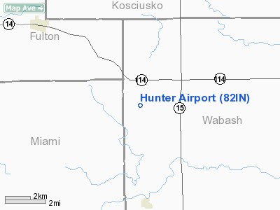
Location
& QuickFacts
|
FAA
Information Effective: |
2008-06-05 |
|
Airport
Identifier: |
82IN |
|
Airport
Status: |
Operational |
|
Longitude/Latitude: |
085-55-44.9670W/40-58-52.1570N
-85.929158/40.981155 (Estimated) |
|
Elevation: |
790 ft / 240.79 m (Estimated) |
|
Land: |
0 acres |
|
From nearest
city: |
7 nautical miles SW of North Manchester,
IN |
|
Location: |
Wabash County, IN |
|
Magnetic
Variation: |
03W (1985) |
Owner
& Manager
|
Ownership: |
Privately
owned |
|
Owner: |
John D. Hunter |
|
Address: |
Rr 1, Box 199
Roann, IN 46974 |
|
Phone
number: |
219-982-4063 |
|
Address: |
|
Airport
Operations and Facilities
|
Airport
Use: |
Private |
|
Wind indicator: |
No |
|
Segmented
Circle: |
No |
|
Control
Tower: |
No |
|
Landing
fee charge: |
No |
|
Sectional
chart: |
Chicago |
|
Region: |
AGL - Great Lakes |
|
Boundary
ARTCC: |
ZAU - Chicago |
|
Tie-in
FSS: |
HUF - Terre Haute |
|
FSS on
Airport: |
No |
|
FSS Toll
Free: |
1-800-WX-BRIEF |
|
Runway Information
Runway 18/36
|
Dimension: |
2165 x 80 ft
/ 659.9 x 24.4 m |
|
Surface: |
TURF, |
|
|
Runway 18 |
Runway 36 |
|
Traffic
Pattern: |
Left |
Left |
|
Radio Navigation
Aids
|
ID |
Type |
Name |
Ch |
Freq |
Var |
Dist |
|
RCR |
NDB |
Rochester |
|
216.00 |
03W |
12.9 nm |
|
IWH |
NDB |
Wabash |
|
329.00 |
03W |
14.4 nm |
|
HHG |
NDB |
Huntington |
|
417.00 |
03W |
22.4 nm |
|
CPB |
NDB |
Culver |
|
391.00 |
01W |
25.0 nm |
|
GGP |
NDB |
Logansport |
|
263.00 |
01W |
26.0 nm |
|
RWN |
NDB |
Winamac/dcmsnd |
|
335.00 |
00W |
31.4 nm |
|
MCX |
NDB |
White County |
|
377.00 |
03W |
41.2 nm |
|
IUL |
NDB |
La Porte |
|
356.00 |
03W |
49.2 nm |
|
OLK |
VOR |
Wolf Lake |
|
110.40 |
03W |
25.2 nm |
|
MZZ |
VOR/DME |
Marion |
023X |
108.60 |
03W |
31.5 nm |
|
OXI |
VOR/DME |
Knox |
103X |
115.60 |
00E |
38.5 nm |
|
GUS |
VORTAC |
Grissom |
21Y |
108.45 |
02W |
22.6 nm |
|
OKK |
VORTAC |
Kokomo |
082X |
113.50 |
00E |
27.9 nm |
|
GSH |
VORTAC |
Goshen |
084X |
113.70 |
00E |
33.0 nm |
|
FWA |
VORTAC |
Fort Wayne |
125X |
117.80 |
00E |
33.6 nm |
|
FWA |
VOT |
Fort Wayne Baer |
|
111.00 |
|
33.5 nm |
Remarks
- FILED
FOR RECORD PURPOSES ONLY.
Hunter Airport
Address:
Wabash County, IN
Tel:
219-982-4063
Images
and information placed above are from
http://www.airport-data.com/airport/82IN/
We
thank them for the data!
| General
Info |
| Country |
United
States |
| State |
INDIANA
|
| FAA ID |
82IN |
| Latitude |
40-58-52.157N
|
| Longitude |
085-55-44.967W
|
| Elevation |
790 feet
|
| Near City |
NORTH
MANCHESTER |
We don't guarantee the information is fresh and accurate. The data may
be wrong or outdated.
For more up-to-date information please refer to other sources.
|
|


