 |
|
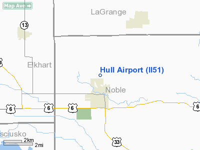
Location
& QuickFacts
|
FAA
Information Effective: |
2008-06-05 |
|
Airport
Identifier: |
II51 |
|
Airport
Status: |
Operational |
|
Longitude/Latitude: |
085-35-34.9460W/41-29-05.1770N
-85.593041/41.484771 (Estimated) |
|
Elevation: |
930 ft / 283.46 m (Estimated) |
|
Land: |
0 acres |
|
From nearest
city: |
1 nautical miles N of Ligonier, IN |
|
Location: |
Noble County, IN |
|
Magnetic
Variation: |
03W (1985) |
Owner
& Manager
|
Ownership: |
Privately
owned |
|
Owner: |
Tom Hull |
|
Address: |
Rr 3
Ligonier, IN 46767 |
|
Phone
number: |
219-894-3423 |
|
Address: |
|
Airport
Operations and Facilities
|
Airport
Use: |
Private |
|
Segmented
Circle: |
No |
|
Control
Tower: |
No |
|
Landing
fee charge: |
No |
|
Sectional
chart: |
Chicago |
|
Region: |
AGL - Great Lakes |
|
Boundary
ARTCC: |
ZAU - Chicago |
|
Tie-in
FSS: |
HUF - Terre Haute |
|
FSS Toll
Free: |
1-800-WX-BRIEF |
|
Runway Information
Runway 05/23
|
Dimension: |
2800 x 100 ft
/ 853.4 x 30.5 m |
|
Surface: |
TURF, |
|
|
Runway 05 |
Runway 23 |
|
Longitude: |
085-35-48.0400W |
085-35-19.8600W |
|
Latitude: |
41-28-56.2800N |
41-29-14.0800N |
|
Elevation: |
928.00 ft |
930.00 ft |
|
Traffic
Pattern: |
Left |
Left |
|
Obstruction: |
200 ft tower, 600.0 ft from runway |
|
|
Radio Navigation
Aids
|
ID |
Type |
Name |
Ch |
Freq |
Var |
Dist |
|
IRS |
NDB |
Sturgis |
|
382.00 |
04W |
21.0 nm |
|
ANQ |
NDB |
Angola |
|
347.00 |
05W |
24.6 nm |
|
HAI |
NDB |
Three Rivers |
|
407.00 |
02W |
28.5 nm |
|
RCR |
NDB |
Rochester |
|
216.00 |
03W |
36.9 nm |
|
HHG |
NDB |
Huntington |
|
417.00 |
03W |
38.3 nm |
|
CPB |
NDB |
Culver |
|
391.00 |
01W |
39.2 nm |
|
IWH |
NDB |
Wabash |
|
329.00 |
03W |
44.3 nm |
|
OLK |
VOR |
Wolf Lake |
|
110.40 |
03W |
14.9 nm |
|
AZO |
VOR/DME |
Kalamazoo |
027X |
109.00 |
01W |
45.2 nm |
|
ELX |
VOR/DME |
Keeler |
113X |
116.60 |
00E |
46.2 nm |
|
OXI |
VOR/DME |
Knox |
103X |
115.60 |
00E |
48.6 nm |
|
GSH |
VORTAC |
Goshen |
084X |
113.70 |
00E |
19.7 nm |
|
FWA |
VORTAC |
Fort Wayne |
125X |
117.80 |
00E |
35.5 nm |
|
GIJ |
VORTAC |
Gipper |
101X |
115.40 |
00E |
36.8 nm |
|
FWA |
VOT |
Fort Wayne Baer |
|
111.00 |
|
35.5 nm |
Remarks
- FILED
FOR RECORD PURPOSES ONLY.
Based Aircraft
|
Aircraft
based on field: |
1 |
|
Multi Engine Airplanes: |
1 |
Hull Noble Airport
Address:
Noble County, IN
Tel:
219-894-3423
Images
and information placed above are from
http://www.airport-data.com/airport/II51/
We
thank them for the data!
We don't guarantee the information is fresh and accurate. The data may
be wrong or outdated.
For more up-to-date information please refer to other sources.
|
|


