 |
|
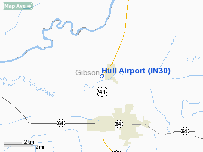
Location
& QuickFacts
|
FAA
Information Effective: |
2008-06-05 |
|
Airport
Identifier: |
IN30 |
|
Airport
Status: |
Operational |
|
Longitude/Latitude: |
087-35-58.0840W/38-24-08.1660N
-87.599468/38.402268 (Estimated) |
|
Elevation: |
423 ft / 128.93 m (Estimated) |
|
Land: |
6 acres |
|
From nearest
city: |
1 nautical miles W of Patoka, IN |
|
Location: |
Gibson County, IN |
|
Magnetic
Variation: |
00W (1985) |
Owner
& Manager
|
Ownership: |
Privately
owned |
|
Owner: |
John Hull |
|
Address: |
Route 1 Box 2
Patoka, IN 47666 |
|
Phone
number: |
812-779-2084 |
|
Manager: |
Emily Leon |
|
Address: |
Route 1 Box 2
Patoka, IN 47666 |
|
Phone
number: |
812-779-2803 |
Airport
Operations and Facilities
|
Airport Use: |
Private |
|
Wind
indicator: |
Yes |
|
Segmented
Circle: |
No |
|
Control
Tower: |
No |
|
Landing
fee charge: |
No |
|
Sectional
chart: |
St Louis |
|
Region: |
AGL - Great Lakes |
|
Boundary
ARTCC: |
ZID - Indianapolis |
|
Tie-in
FSS: |
HUF - Terre Haute |
|
FSS
on Airport: |
No |
|
FSS
Toll Free: |
1-800-WX-BRIEF |
Airport
Communications
Airport
Services
|
Airframe
Repair: |
NONE |
|
Power
Plant Repair: |
NONE |
|
Runway Information
Runway 18/36
|
Dimension: |
2917 x 100 ft
/ 889.1 x 30.5 m |
|
Surface: |
TURF, Fair Condition |
|
|
Runway 18 |
Runway 36 |
|
Longitude: |
087-35-58.0000W |
087-35-58.0000W |
|
Latitude: |
38-24-20.9800N |
38-23-55.0200N |
|
Elevation: |
420.00 ft |
410.00 ft |
|
Traffic
Pattern: |
Left |
Left |
|
Displaced
threshold: |
288.00 ft |
670.00 ft |
|
Obstruction: |
12 ft road, 300.0 ft from runway
APCH RATIO 19:1TO DSPLCD THR. |
10 ft road, 0.0 ft from runway, 40 ft right
of centerline
15:1 TO DSPLCD THLD DUE TO 62 FT TREES 330 FT S OF RY END,
100 FT W OF CNTRLN. |
|
Radio Navigation
Aids
|
ID |
Type |
Name |
Ch |
Freq |
Var |
Dist |
|
AJG |
NDB |
Mount Carmel |
|
524.00 |
02W |
13.9 nm |
|
OEA |
NDB |
Vincennes |
|
251.00 |
00E |
17.5 nm |
|
PDW |
NDB |
Evansville |
|
284.00 |
00E |
22.0 nm |
|
DCY |
NDB |
Washington |
|
212.00 |
03W |
28.2 nm |
|
CUL |
NDB |
Carmi |
|
332.00 |
01W |
30.8 nm |
|
OLY |
NDB |
Olney |
|
272.00 |
00W |
33.0 nm |
|
PLX |
NDB |
Palestine |
|
391.00 |
00W |
36.8 nm |
|
GVA |
NDB |
Geneva |
|
224.00 |
01W |
36.9 nm |
|
FNZ |
NDB |
Ferdinand |
|
239.00 |
00E |
37.1 nm |
|
FWC |
NDB |
Wayne County |
|
257.00 |
01E |
38.2 nm |
|
FOA |
NDB |
Elm River |
|
353.00 |
00E |
43.2 nm |
|
SIV |
NDB |
Sullivan |
|
326.00 |
02W |
43.3 nm |
|
TEL |
NDB |
Tell City |
|
206.00 |
02W |
48.9 nm |
|
LWV |
VOR/DME |
Lawrenceville |
025X |
108.80 |
01W |
22.1 nm |
|
SAM |
VOR/DME |
Samsville |
113X |
116.60 |
03E |
23.4 nm |
|
HNB |
VOR/DME |
Huntingburg |
029X |
109.20 |
00E |
31.7 nm |
|
RSV |
VOR/DME |
Robinson |
021X |
108.40 |
02E |
37.1 nm |
|
OWB |
VOR/DME |
Owensboro |
023X |
108.60 |
01E |
44.6 nm |
|
PXV |
VORTAC |
Pocket City |
080X |
113.30 |
03E |
29.5 nm |
Remarks
- ROAD
RUNS PARALLEL TO RY ON E SIDE.
- PVT
PHONE AVBL AT FIRST HOUSE NW OR PUBLIC PHONE AVBL AT NE GAS STATION.
Based Aircraft
|
Aircraft
based on field: |
1 |
|
Single Engine
Airplanes: |
1 |
Operational Statistics
Time
Period: 1994-06-20 - 1995-06-19
|
Aircraft
Operations: |
11/Week |
|
General Aviation
Local: |
28.6% |
|
General Aviation
Itinerant: |
71.4% |
Hull Gibson Airport
Address:
Gibson County, IN
Tel:
812-779-2084,
812-779-2803
Images
and information placed above are from
http://www.airport-data.com/airport/IN30/
We
thank them for the data!
| General
Info |
| Country |
United
States |
| State |
INDIANA
|
| FAA ID |
IN30 |
| Latitude |
38-24-08.166N
|
| Longitude |
087-35-58.084W
|
| Elevation |
423 feet
|
| Near City |
PATOKA
|
We don't guarantee the information is fresh and accurate. The data may
be wrong or outdated.
For more up-to-date information please refer to other sources.
|
|


