 |
|
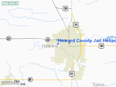
Howard County Jail Heliport |
Location
& QuickFacts
|
FAA
Information Effective: |
2008-06-05 |
|
Airport
Identifier: |
75IN |
|
Airport
Status: |
Operational |
|
Longitude/Latitude: |
086-09-28.9740W/40-28-51.1360N
-86.158048/40.480871 (Estimated) |
|
Elevation: |
800 ft / 243.84 m (Estimated) |
|
Land: |
0 acres |
|
From nearest
city: |
0 nautical miles S of Kokomo, IN |
|
Location: |
Howard County, IN |
|
Magnetic
Variation: |
02W (1990) |
Owner
& Manager
|
Ownership: |
Publicly
owned |
|
Owner: |
Howard County Sheriff's Dept |
|
Address: |
623 South Berkley Road
Kokomo, IN 46901 |
|
Phone
number: |
317-457-1105 |
|
Manager: |
Steve Maus |
|
Address: |
623 South Berkley Road
Kokomo, IN 46901 |
|
Phone
number: |
317-456-2031 |
Airport
Operations and Facilities
|
Airport
Use: |
Private |
|
Segmented
Circle: |
No |
|
Control
Tower: |
No |
|
Sectional
chart: |
Chicago |
|
Region: |
AGL - Great Lakes |
|
Boundary
ARTCC: |
ZAU - Chicago |
|
Tie-in
FSS: |
HUF - Terre Haute |
|
FSS on
Airport: |
No |
|
FSS Toll
Free: |
1-800-WX-BRIEF |
|
Runway Information
Helipad H1
|
Dimension: |
50 x 50 ft /
15.2 x 15.2 m |
|
Surface: |
ASPH, |
|
|
Runway H1 |
Runway |
|
Traffic
Pattern: |
Left |
Left |
|
Radio Navigation
Aids
|
ID |
Type |
Name |
Ch |
Freq |
Var |
Dist |
|
GGP |
NDB |
Logansport |
|
263.00 |
01W |
16.9 nm |
|
FKR |
NDB |
Frankfort |
|
278.00 |
02W |
22.4 nm |
|
IWH |
NDB |
Wabash |
|
329.00 |
03W |
23.6 nm |
|
MCX |
NDB |
White County |
|
377.00 |
03W |
30.8 nm |
|
HZP |
NDB |
Zionsville |
|
248.00 |
03W |
32.8 nm |
|
UMP |
NDB |
Metropolitan |
|
338.00 |
03W |
33.0 nm |
|
RCR |
NDB |
Rochester |
|
216.00 |
03W |
35.1 nm |
|
AI |
NDB |
Video |
|
371.00 |
03W |
38.6 nm |
|
HHG |
NDB |
Huntington |
|
417.00 |
03W |
38.8 nm |
|
RWN |
NDB |
Winamac/dcmsnd |
|
335.00 |
00W |
42.1 nm |
|
CPB |
NDB |
Culver |
|
391.00 |
01W |
45.4 nm |
|
CFJ |
NDB |
Crawfordsville |
|
388.00 |
02W |
46.0 nm |
|
MZZ |
VOR/DME |
Marion |
023X |
108.60 |
03W |
21.9 nm |
|
MIE |
VOR/DME |
Muncie |
091X |
114.40 |
03W |
37.9 nm |
|
OKK |
VORTAC |
Kokomo |
082X |
113.50 |
00E |
5.4 nm |
|
GUS |
VORTAC |
Grissom |
21Y |
108.45 |
02W |
9.9 nm |
|
VHP |
VORTAC |
Brickyard |
110X |
116.30 |
01E |
41.2 nm |
|
BVT |
VORTAC |
Boiler |
098X |
115.10 |
01E |
41.9 nm |
|
IND |
VOT |
Indianapolis Intl |
|
109.60 |
|
45.8 nm |
Remarks
- LACK
OF APCH/DEP ROUTES THAT PROVIDE OBSTRUCTION CLEARANCE & PERMIT SAFE
OPERATIONS.
Based Aircraft
|
Aircraft
based on field: |
1 |
|
Helicopters: |
1 |
Howard County Jail Heliport
Address:
Howard County, IN
Tel:
317-457-1105,
317-456-2031
Images
and information placed above are from
http://www.airport-data.com/airport/75IN/
We
thank them for the data!
| General
Info |
| Country |
United
States |
| State |
INDIANA
|
| FAA ID |
75IN |
| Latitude |
40-28-51.136N
|
| Longitude |
086-09-28.974W
|
| Elevation |
800 feet
|
| Near City |
KOKOMO
|
We don't guarantee the information is fresh and accurate. The data may
be wrong or outdated.
For more up-to-date information please refer to other sources.
|
|


