 |
|
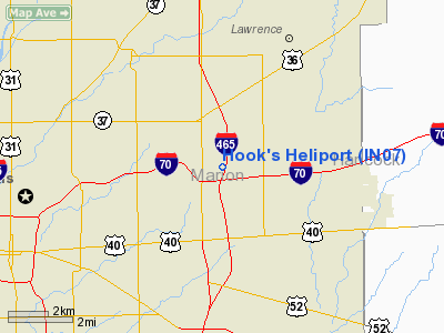
Location
& QuickFacts
|
FAA
Information Effective: |
2008-06-05 |
|
Airport
Identifier: |
IN07 |
|
Airport
Status: |
Operational |
|
Longitude/Latitude: |
086-02-00.9400W/39-48-18.1490N
-86.033594/39.805041 (Estimated) |
|
Elevation: |
850 ft / 259.08 m (Estimated) |
|
Land: |
0 acres |
|
From nearest
city: |
0 nautical miles N of Indianapolis, IN |
|
Location: |
Marion County, IN |
|
Magnetic
Variation: |
02W (1985) |
Owner
& Manager
|
Ownership: |
Privately
owned |
|
Owner: |
Revco Ds Inc |
|
Address: |
7590 Empire Drive
Indianapolis, IN 46219-0903 |
|
Phone
number: |
317-353-1451 |
|
Manager: |
Jess Findley |
|
Address: |
P.o. Box 19903
Indianaolis, IN 46219-0903 |
|
Phone
number: |
317-353-1451
EXT 3455. |
Airport
Operations and Facilities
|
Airport
Use: |
Private |
|
Wind indicator: |
Yes |
|
Segmented
Circle: |
No |
|
Control
Tower: |
No |
|
Sectional
chart: |
St Louis |
|
Region: |
AGL - Great Lakes |
|
Boundary
ARTCC: |
ZID - Indianapolis |
|
Tie-in
FSS: |
HUF - Terre Haute |
|
FSS on
Airport: |
No |
|
FSS Toll
Free: |
1-800-WX-BRIEF
OR LOCAL CALL 244-3316. |
|
Runway Information
Helipad H1
|
Dimension: |
100 x 80 ft
/ 30.5 x 24.4 m |
|
Surface: |
TURF, |
|
|
Runway H1 |
Runway |
|
Traffic
Pattern: |
Left |
Left |
|
Obstruction: |
500 ft tower |
|
|
Radio Navigation
Aids
|
ID |
Type |
Name |
Ch |
Freq |
Var |
Dist |
|
UMP |
NDB |
Metropolitan |
|
338.00 |
03W |
8.0 nm |
|
HFY |
NDB |
Greenwood |
|
398.00 |
02W |
10.7 nm |
|
HZP |
NDB |
Zionsville |
|
248.00 |
03W |
12.8 nm |
|
AI |
NDB |
Video |
|
371.00 |
03W |
28.9 nm |
|
BA |
NDB |
Clifs |
|
410.00 |
03W |
30.7 nm |
|
UWL |
NDB |
New Castle |
|
385.00 |
02W |
33.3 nm |
|
TVX |
NDB |
Greencastle |
|
521.00 |
03W |
36.1 nm |
|
FKR |
NDB |
Frankfort |
|
278.00 |
02W |
37.1 nm |
|
CFJ |
NDB |
Crawfordsville |
|
388.00 |
02W |
42.0 nm |
|
HLB |
NDB |
Batesville |
|
254.00 |
02W |
45.2 nm |
|
OVO |
NDB |
North Vernon |
|
374.00 |
02W |
49.6 nm |
|
MIE |
VOR/DME |
Muncie |
091X |
114.40 |
03W |
39.3 nm |
|
MZZ |
VOR/DME |
Marion |
023X |
108.60 |
03W |
44.5 nm |
|
SHB |
VORTAC |
Shelbyville |
057X |
112.00 |
01E |
14.2 nm |
|
VHP |
VORTAC |
Brickyard |
110X |
116.30 |
01E |
15.4 nm |
|
OKK |
VORTAC |
Kokomo |
082X |
113.50 |
00E |
43.5 nm |
|
OOM |
VORTAC |
Hoosier |
039X |
110.20 |
02W |
48.0 nm |
|
IND |
VOT |
Indianapolis Intl |
|
109.60 |
|
12.5 nm |
Remarks
- PRVDD
APCH ROUTES 060-090 & 240-300 DEGS; ALL DEP ROUTES 060-120 &
240-270 DEGS; NON-OBSTRUCTING WIND INDICATOR MAINTAINED.
Based Aircraft
|
Aircraft
based on field: |
1 |
|
Helicopters: |
1 |
Hook's Heliport
Address:
Marion County, IN
Tel:
317-353-1451
Images
and information placed above are from
http://www.airport-data.com/airport/IN07/
We
thank them for the data!
| General
Info |
| Country |
United
States |
| State |
INDIANA
|
| FAA ID |
IN07 |
| Latitude |
39-48-18.149N
|
| Longitude |
086-02-00.940W
|
| Elevation |
850 feet
|
| Near City |
INDIANAPOLIS
|
We don't guarantee the information is fresh and accurate. The data may
be wrong or outdated.
For more up-to-date information please refer to other sources.
|
|


