 |
|
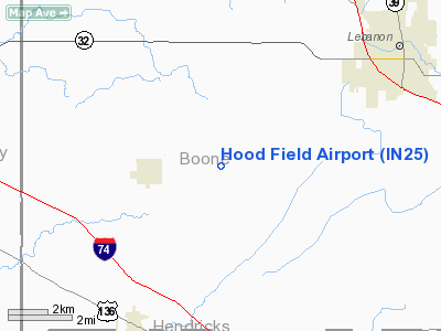
Location
& QuickFacts
|
FAA
Information Effective: |
2008-06-05 |
|
Airport
Identifier: |
IN25 |
|
Airport
Status: |
Operational |
|
Longitude/Latitude: |
086-34-38.0000W/39-59-53.0000N
-86.577222/39.998056 (Estimated) |
|
Elevation: |
930 ft / 283.46 m (Estimated) |
|
Land: |
0 acres |
|
From nearest
city: |
5 nautical miles NE of Jamestown, IN |
|
Location: |
Boone County, IN |
|
Magnetic
Variation: |
03W (1995) |
Owner
& Manager
|
Ownership: |
Privately
owned |
|
Owner: |
Thomas J. Hood |
|
Address: |
5830 W 300 South
Jamestown, IN 46147 |
|
Phone
number: |
765-676-9449 |
|
Manager: |
Thomas J. Hood |
|
Address: |
5830 W 300 South
Jamestown, IN 46147 |
|
Phone
number: |
765-676-9449 |
Airport
Operations and Facilities
|
Airport
Use: |
Private |
|
Segmented
Circle: |
No |
|
Control
Tower: |
No |
|
Sectional
chart: |
St Louis |
|
Region: |
AGL - Great Lakes |
|
Boundary
ARTCC: |
ZID - Indianapolis |
|
Tie-in
FSS: |
HUF - Terre Haute |
|
FSS Toll
Free: |
1-800-WX-BRIEF |
|
Runway Information
Runway 09/27
|
Dimension: |
2200 x 100 ft
/ 670.6 x 30.5 m |
|
Surface: |
TURF, |
|
|
Runway 09 |
Runway 27 |
|
Traffic
Pattern: |
Left |
Left |
|
Displaced
threshold: |
400.00 ft
RY 09 DSPLCD THLD MKD WITH CONES. |
0.00 ft |
|
Obstruction: |
35 ft pline, 400.0 ft from runway |
|
|
Radio Navigation
Aids
|
ID |
Type |
Name |
Ch |
Freq |
Var |
Dist |
|
HZP |
NDB |
Zionsville |
|
248.00 |
03W |
15.5 nm |
|
CFJ |
NDB |
Crawfordsville |
|
388.00 |
02W |
15.6 nm |
|
FKR |
NDB |
Frankfort |
|
278.00 |
02W |
16.4 nm |
|
TVX |
NDB |
Greencastle |
|
521.00 |
03W |
20.1 nm |
|
UMP |
NDB |
Metropolitan |
|
338.00 |
03W |
24.5 nm |
|
HFY |
NDB |
Greenwood |
|
398.00 |
02W |
31.4 nm |
|
MCX |
NDB |
White County |
|
377.00 |
03W |
43.6 nm |
|
GGP |
NDB |
Logansport |
|
263.00 |
01W |
43.7 nm |
|
AI |
NDB |
Video |
|
371.00 |
03W |
49.3 nm |
|
VHP |
VORTAC |
Brickyard |
110X |
116.30 |
01E |
14.7 nm |
|
OKK |
VORTAC |
Kokomo |
082X |
113.50 |
00E |
39.8 nm |
|
BVT |
VORTAC |
Boiler |
098X |
115.10 |
01E |
40.4 nm |
|
SHB |
VORTAC |
Shelbyville |
057X |
112.00 |
01E |
41.1 nm |
|
GUS |
VORTAC |
Grissom |
21Y |
108.45 |
02W |
43.5 nm |
|
TTH |
VORTAC |
Terre Haute |
100X |
115.30 |
02E |
43.6 nm |
|
DNV |
VORTAC |
Danville |
047X |
111.00 |
02E |
48.4 nm |
|
IND |
VOT |
Indianapolis Intl |
|
109.60 |
|
21.3 nm |
Remarks
- PRVDD
CLEAR 20:1 APCH, CLEAR OBSTACLE FREE ZONE, RY 09 DSPLCD THLD PROPERLY
MARKED.
Based Aircraft
|
Aircraft
based on field: |
1 |
|
Single Engine
Airplanes: |
1 |
Hood Field Airport
Address:
Boone County, IN
Tel:
765-676-9449
Images
and information placed above are from
http://www.airport-data.com/airport/IN25/
We
thank them for the data!
| General
Info |
| Country |
United
States |
| State |
INDIANA
|
| FAA ID |
IN25 |
| Latitude |
39-59-53.000N
|
| Longitude |
086-34-38.000W
|
| Elevation |
930 feet
|
| Near City |
JAMESTOWN
|
We don't guarantee the information is fresh and accurate. The data may
be wrong or outdated.
For more up-to-date information please refer to other sources.
|
|


