 |
|
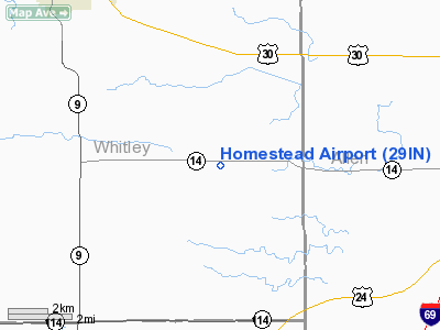
Location
& QuickFacts
|
FAA
Information Effective: |
2008-06-05 |
|
Airport
Identifier: |
29IN |
|
Airport
Status: |
Operational |
|
Longitude/Latitude: |
085-23-09.9130W/41-04-33.1680N
-85.386087/41.075880 (Estimated) |
|
Elevation: |
863 ft / 263.04 m (Estimated) |
|
Land: |
60 acres |
|
From nearest
city: |
7 nautical miles SE of Columbia City, IN |
|
Location: |
Whitley County, IN |
|
Magnetic
Variation: |
03W (1985) |
Owner
& Manager
|
Ownership: |
Privately
owned |
|
Owner: |
John Bormann |
|
Address: |
9917 White Cedar Road
Fort Wayne, IN 46804 |
|
Phone
number: |
260-625-5145 |
|
Manager: |
John Bormann |
|
Address: |
9917 White Cedar Road
Fort Wayne, IN 46804 |
|
Phone
number: |
260-625-5145 |
Airport
Operations and Facilities
|
Airport
Use: |
Private |
|
Wind indicator: |
Yes |
|
Segmented
Circle: |
No |
|
Control
Tower: |
No |
|
Sectional
chart: |
Chicago |
|
Region: |
AGL - Great Lakes |
|
Boundary
ARTCC: |
ZAU - Chicago |
|
Tie-in
FSS: |
HUF - Terre Haute |
|
FSS on
Airport: |
No |
|
FSS Toll
Free: |
1-800-WX-BRIEF |
|
Runway Information
Runway 18/36
|
Dimension: |
1950 x 75 ft
/ 594.4 x 22.9 m |
|
Surface: |
TURF, |
|
|
Runway 18 |
Runway 36 |
|
Traffic
Pattern: |
Left |
Left |
|
Obstruction: |
40 ft pline, 150.0 ft from runway |
80 ft towers, 2600.0 ft from runway |
|
Radio Navigation
Aids
|
ID |
Type |
Name |
Ch |
Freq |
Var |
Dist |
|
HHG |
NDB |
Huntington |
|
417.00 |
03W |
13.7 nm |
|
IWH |
NDB |
Wabash |
|
329.00 |
03W |
26.5 nm |
|
RCR |
NDB |
Rochester |
|
216.00 |
03W |
36.4 nm |
|
ANQ |
NDB |
Angola |
|
347.00 |
05W |
36.5 nm |
|
VFU |
NDB |
Stanley |
|
411.00 |
05W |
37.3 nm |
|
PLD |
NDB |
Portland |
|
257.00 |
03W |
41.6 nm |
|
IRS |
NDB |
Sturgis |
|
382.00 |
04W |
44.4 nm |
|
CPB |
NDB |
Culver |
|
391.00 |
01W |
46.0 nm |
|
DFI |
NDB |
Defiance |
|
246.00 |
05W |
46.1 nm |
|
BYN |
NDB |
Bryan |
|
260.00 |
04W |
48.1 nm |
|
GGP |
NDB |
Logansport |
|
263.00 |
01W |
50.0 nm |
|
OLK |
VOR |
Wolf Lake |
|
110.40 |
03W |
11.4 nm |
|
MZZ |
VOR/DME |
Marion |
023X |
108.60 |
03W |
37.5 nm |
|
FWA |
VORTAC |
Fort Wayne |
125X |
117.80 |
00E |
10.7 nm |
|
GSH |
VORTAC |
Goshen |
084X |
113.70 |
00E |
39.6 nm |
|
GUS |
VORTAC |
Grissom |
21Y |
108.45 |
02W |
43.4 nm |
|
OKK |
VORTAC |
Kokomo |
082X |
113.50 |
00E |
44.9 nm |
|
FWA |
VOT |
Fort Wayne Baer |
|
111.00 |
|
10.6 nm |
Homestead Airport
Address:
Whitley County, IN
Tel:
260-625-5145
Images
and information placed above are from
http://www.airport-data.com/airport/29IN/
We
thank them for the data!
| General
Info |
| Country |
United
States |
| State |
INDIANA
|
| FAA ID |
29IN |
| Latitude |
41-04-33.168N
|
| Longitude |
085-23-09.913W
|
| Elevation |
863 feet
|
| Near City |
COLUMBIA
CITY |
We don't guarantee the information is fresh and accurate. The data may
be wrong or outdated.
For more up-to-date information please refer to other sources.
|
|


