 |
|
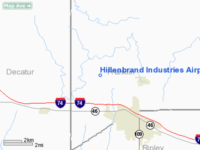
Hillenbrand Industries Airport |
|
|
Location
& QuickFacts
|
FAA
Information Effective: |
2008-06-05 |
|
Airport
Identifier: |
HLB |
|
Airport
Status: |
Operational |
|
Longitude/Latitude: |
085-15-29.8660W/39-20-40.1810N
-85.258296/39.344495 (Estimated) |
|
Elevation: |
973 ft / 296.57 m (Surveyed) |
|
Land: |
0 acres |
|
From nearest
city: |
3 nautical miles NW of Batesville, IN |
|
Location: |
Franklin County, IN |
|
Magnetic
Variation: |
03W (1985) |
Owner
& Manager
|
Ownership: |
Privately
owned |
|
Owner: |
Hillenbrand Industries |
|
Address: |
Highway 46
Batesville, IN 47006 |
|
Phone
number: |
812-934-7593 |
|
Manager: |
Ken Nobbe |
|
Address: |
25222 Enochsburg Rd
Batesville, IN 47006 |
|
Phone
number: |
812-934-7593 |
Airport
Operations and Facilities
|
Airport
Use: |
Private |
|
Wind indicator: |
Yes |
|
Segmented
Circle: |
No |
|
Control
Tower: |
No |
|
Lighting
Schedule: |
PHONE REQ
FOR LIRL RY 18/36 CALL 812-934-7593. |
|
Landing
fee charge: |
No |
|
Sectional
chart: |
St Louis |
|
Region: |
AGL - Great Lakes |
|
Boundary
ARTCC: |
ZID - Indianapolis |
|
Tie-in
FSS: |
HUF - Terre Haute |
|
FSS on
Airport: |
No |
|
FSS
Toll Free: |
1-800-WX-BRIEF |
Airport
Communications
Airport
Services
|
Airframe
Repair: |
NONE |
|
Power
Plant Repair: |
NONE |
|
Runway Information
Runway 18/36
|
Dimension: |
4948 x 100 ft
/ 1508.2 x 30.5 m |
|
Surface: |
ASPH, |
|
Edge Lights: |
Low |
|
|
Runway 18 |
Runway 36 |
|
Longitude: |
085-15-30.4100W |
085-15-30.2500W |
|
Latitude: |
39-21-04.6700N |
39-20-05.8600N |
|
Elevation: |
975.00 ft |
974.00 ft |
|
Traffic
Pattern: |
Left |
Left |
|
Crossing
Height: |
50.00 ft |
58.00 ft |
|
Displaced
threshold: |
500.00 ft |
500.00 ft |
|
VASI: |
2-box on left side |
2-box on left side |
|
Visual Glide
Angle: |
4.00° |
3.00° |
|
Runway End
Identifier: |
Yes |
Yes |
|
Obstruction: |
8 ft fence, 500.0 ft from runway |
8 ft fence, 500.0 ft from runway |
|
Radio Navigation
Aids
|
ID |
Type |
Name |
Ch |
Freq |
Var |
Dist |
|
HLB |
NDB |
Batesville |
|
254.00 |
02W |
0.3 nm |
|
OVO |
NDB |
North Vernon |
|
374.00 |
02W |
23.8 nm |
|
OXD |
NDB |
Oxford |
|
282.00 |
04W |
24.2 nm |
|
BA |
NDB |
Clifs |
|
410.00 |
03W |
26.1 nm |
|
UR |
NDB |
Burln |
|
321.00 |
04W |
28.9 nm |
|
HAO |
NDB |
Hamilton |
|
260.00 |
04W |
31.9 nm |
|
UWL |
NDB |
New Castle |
|
385.00 |
02W |
32.3 nm |
|
IMS |
NDB |
Madison |
|
404.00 |
03W |
36.3 nm |
|
HKF |
NDB |
Hook Field |
|
239.00 |
04W |
38.8 nm |
|
ISZ |
NDB |
Cincinnati-blue Ash |
|
388.00 |
04W |
40.8 nm |
|
HFY |
NDB |
Greenwood |
|
398.00 |
02W |
42.3 nm |
|
MDE |
NDB |
Madeira |
|
379.00 |
04W |
42.6 nm |
|
EQZ |
NDB |
Captain |
|
308.00 |
02W |
44.0 nm |
|
LUK |
NDB |
Cincinnati |
|
335.00 |
04W |
44.1 nm |
|
AI |
NDB |
Video |
|
371.00 |
03W |
45.1 nm |
|
RID |
VORTAC |
Richmond |
043X |
110.60 |
03W |
31.4 nm |
|
SHB |
VORTAC |
Shelbyville |
057X |
112.00 |
01E |
31.5 nm |
|
CVG |
VORTAC |
Cincinnati |
120X |
117.30 |
04W |
32.5 nm |
|
ABB |
VORTAC |
Nabb |
071X |
112.40 |
01E |
48.7 nm |
|
LUK |
VOT |
Cincinnati Muni/lunken |
|
108.40 |
|
42.2 nm |
Remarks
Based Aircraft
|
Aircraft
based on field: |
6 |
|
Jet Engine Airplanes: |
6 |
Hillenbrand Industries Airport
Address:
Franklin County, IN
Tel:
812-934-7593
Images
and information placed above are from
http://www.airport-data.com/airport/HLB/
We
thank them for the data!
| General
Info |
| Country |
United
States |
| State |
INDIANA
|
| FAA ID |
HLB |
| Latitude |
39-20-40.181N
|
| Longitude |
085-15-29.866W
|
| Elevation |
973 feet
|
| Near City |
BATESVILLE
|
We don't guarantee the information is fresh and accurate. The data may
be wrong or outdated.
For more up-to-date information please refer to other sources.
|
|


