 |
|
Location
& QuickFacts
|
FAA
Information Effective: |
2008-06-05 |
|
Airport
Identifier: |
II84 |
|
Airport
Status: |
Operational |
|
Longitude/Latitude: |
087-46-17.0800W/37-55-55.1500N
-87.771411/37.931986 (Estimated) |
|
Elevation: |
381 ft / 116.13 m (Estimated) |
|
Land: |
0 acres |
|
From nearest
city: |
7 nautical miles E of Mount Vernon, IN |
|
Location: |
Posey County, IN |
|
Magnetic
Variation: |
00W (1990) |
Owner
& Manager
|
Ownership: |
Privately
owned |
|
Owner: |
William Hilakos |
|
Address: |
6700 S. Davis Rd
Mt. Vernon, IN 47620 |
|
Phone
number: |
812-985-2828 |
|
Manager: |
William Hilakos |
|
Address: |
6700 S. Davis Rd
Mt. Vernon, IN 47620 |
|
Phone
number: |
812-985-2828 |
Airport
Operations and Facilities
|
Airport
Use: |
Private
PERSONAL USE. |
|
Segmented
Circle: |
No |
|
Control
Tower: |
No |
|
Sectional
chart: |
St Louis |
|
Region: |
AGL - Great Lakes |
|
Boundary
ARTCC: |
ZID - Indianapolis |
|
Tie-in
FSS: |
HUF - Terre Haute |
|
FSS Toll
Free: |
1-800-WX-BRIEF |
|
Runway Information
Runway 09/27
|
Dimension: |
1400 x 60 ft
/ 426.7 x 18.3 m |
|
Surface: |
TURF, |
|
|
Runway 09 |
Runway 27 |
|
Traffic
Pattern: |
Left |
Left |
|
Radio Navigation
Aids
|
ID |
Type |
Name |
Ch |
Freq |
Var |
Dist |
|
GVA |
NDB |
Geneva |
|
224.00 |
01W |
7.7 nm |
|
PDW |
NDB |
Evansville |
|
284.00 |
00E |
13.1 nm |
|
CUL |
NDB |
Carmi |
|
332.00 |
01W |
19.1 nm |
|
TWT |
NDB |
Tradewater |
|
276.00 |
00E |
29.2 nm |
|
HSB |
NDB |
Harrisburg-raleigh |
|
230.00 |
00E |
37.4 nm |
|
FWC |
NDB |
Wayne County |
|
257.00 |
01E |
40.4 nm |
|
AJG |
NDB |
Mount Carmel |
|
524.00 |
02W |
40.9 nm |
|
OEA |
NDB |
Vincennes |
|
251.00 |
00E |
46.8 nm |
|
FNZ |
NDB |
Ferdinand |
|
239.00 |
00E |
48.1 nm |
|
OWB |
VOR/DME |
Owensboro |
023X |
108.60 |
01E |
30.9 nm |
|
SAM |
VOR/DME |
Samsville |
113X |
116.60 |
03E |
36.4 nm |
|
HNB |
VOR/DME |
Huntingburg |
029X |
109.20 |
00E |
43.0 nm |
|
PXV |
VORTAC |
Pocket City |
080X |
113.30 |
03E |
0.5 nm |
|
CCT |
VORTAC |
Central City |
035X |
109.80 |
01W |
40.9 nm |
Remarks
- AVAILABLE
DATA INDICATOR MAN-MADE OR NATURAL OBJECTS EXIST WITHIN AIRSPACE NEEDED
TO ENSURE SAFETY IN TKOF/LNDG OF ACFT. THESE OBJECTS WOULD PRECLUDE
A MIN ACCEPTABLE LEVEL OF SAFETY FOR ACFT OPS.
Based Aircraft
|
Aircraft
based on field: |
1 |
|
Single Engine
Airplanes: |
1 |
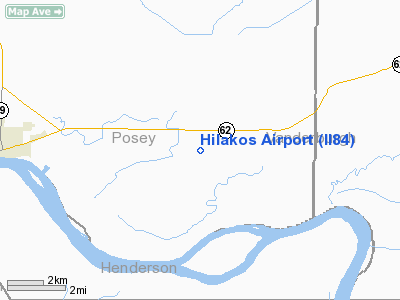
Hilakos Airport
Address:
Posey County, IN
Tel:
812-985-2828
Images
and information placed above are from
http://www.airport-data.com/airport/II84/
We
thank them for the data!
| General
Info |
| Country |
United
States |
| State |
INDIANA
|
| FAA ID |
II84 |
| Latitude |
37-55-55.150N
|
| Longitude |
087-46-17.080W
|
| Elevation |
381 feet
|
| Near City |
MOUNT
VERNON |
We don't guarantee the information is fresh and accurate. The data may
be wrong or outdated.
For more up-to-date information please refer to other sources.
|
|


