 |
|
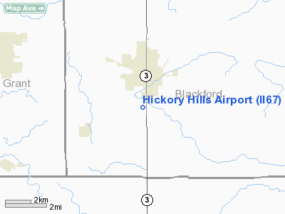
Location
& QuickFacts
|
FAA
Information Effective: |
2008-06-05 |
|
Airport
Identifier: |
II67 |
|
Airport
Status: |
Operational |
|
Longitude/Latitude: |
085-22-24.4600W/40-25-40.0600N
-85.373461/40.427794 (Estimated) |
|
Elevation: |
900 ft / 274.32 m (Estimated) |
|
Land: |
11 acres |
|
From nearest
city: |
2 nautical miles S of Hartford City, IN |
|
Location: |
Blackford County, IN |
|
Magnetic
Variation: |
04W (1995) |
Owner
& Manager
|
Ownership: |
Privately
owned |
|
Owner: |
Jess Huggins |
|
Address: |
1516 S S.r. Nr 3
Hartford City, IN 47348 |
|
Phone
number: |
317-348-3245 |
|
Manager: |
Jess Huggins |
|
Address: |
1516 S S.r. Nr 3
Hartford City, IN 47348 |
|
Phone
number: |
317-348-3245 |
Airport
Operations and Facilities
|
Airport
Use: |
Private |
|
Segmented
Circle: |
No |
|
Control
Tower: |
No |
|
Sectional
chart: |
Chicago |
|
Region: |
AGL - Great Lakes |
|
Boundary
ARTCC: |
ZID - Indianapolis |
|
Tie-in
FSS: |
HUF - Terre Haute |
|
FSS on
Airport: |
No |
|
FSS Toll
Free: |
1-800-WX-BRIEF |
|
Runway Information
Runway 12/30
|
Dimension: |
1100 x 125 ft
/ 335.3 x 38.1 m |
|
Surface: |
TURF, |
|
|
Runway 12 |
Runway 30 |
|
Traffic
Pattern: |
Left |
Left |
|
Runway 18/36
|
Dimension: |
626 x 125 ft
/ 190.8 x 38.1 m |
|
Surface: |
TURF, |
|
|
Runway 18 |
Runway 36 |
|
Traffic
Pattern: |
Right |
Left |
|
Radio Navigation
Aids
|
ID |
Type |
Name |
Ch |
Freq |
Var |
Dist |
|
PLD |
NDB |
Portland |
|
257.00 |
03W |
17.9 nm |
|
AI |
NDB |
Video |
|
371.00 |
03W |
22.4 nm |
|
HHG |
NDB |
Huntington |
|
417.00 |
03W |
26.0 nm |
|
IWH |
NDB |
Wabash |
|
329.00 |
03W |
28.0 nm |
|
UWL |
NDB |
New Castle |
|
385.00 |
02W |
33.0 nm |
|
CQA |
NDB |
Lakefield |
|
205.00 |
04W |
37.1 nm |
|
VES |
NDB |
Versailles |
|
356.00 |
04W |
41.2 nm |
|
UMP |
NDB |
Metropolitan |
|
338.00 |
03W |
42.8 nm |
|
VFU |
NDB |
Stanley |
|
411.00 |
05W |
43.4 nm |
|
GGP |
NDB |
Logansport |
|
263.00 |
01W |
48.7 nm |
|
HZP |
NDB |
Zionsville |
|
248.00 |
03W |
49.8 nm |
|
OLK |
VOR |
Wolf Lake |
|
110.40 |
03W |
49.6 nm |
|
MIE |
VOR/DME |
Muncie |
091X |
114.40 |
03W |
11.5 nm |
|
MZZ |
VOR/DME |
Marion |
023X |
108.60 |
03W |
14.5 nm |
|
OKK |
VORTAC |
Kokomo |
082X |
113.50 |
00E |
31.9 nm |
|
FWA |
VORTAC |
Fort Wayne |
125X |
117.80 |
00E |
34.2 nm |
|
GUS |
VORTAC |
Grissom |
21Y |
108.45 |
02W |
37.9 nm |
|
RID |
VORTAC |
Richmond |
043X |
110.60 |
03W |
47.3 nm |
|
FWA |
VOT |
Fort Wayne Baer |
|
111.00 |
|
34.1 nm |
Remarks
- OWNER
DESIRES ARPT NOT BE CHARTED.
- PRVDD
ANY OBSTN LOWERED/REMOVED OR THLD DSPLCD TO PRVD CLEAR 20:1; AREA 125
FT EITHER SIDE OF RY & 200 FT OFF RY ENDS BE CLEAR; AREA 60 FT EITHER
SIDE OF RY & 240 FT OFF ENDS BE CLEARED OR GRADED WITH NO RUTS;
BUMPS OR DEPRESSIONS.
Based Aircraft
|
Aircraft
based on field: |
2 |
|
Single Engine
Airplanes: |
1 |
|
Ultralights: |
1 |
Hickory Hills Airport
Address:
Blackford County, IN
Tel:
317-348-3245
Images
and information placed above are from
http://www.airport-data.com/airport/II67/
We
thank them for the data!
| General
Info |
| Country |
United
States |
| State |
INDIANA
|
| FAA ID |
II67 |
| Latitude |
40-25-40.060N
|
| Longitude |
085-22-24.460W
|
| Elevation |
900 feet
|
| Near City |
HARTFORD
CITY |
We don't guarantee the information is fresh and accurate. The data may
be wrong or outdated.
For more up-to-date information please refer to other sources.
|
|


