 |
|
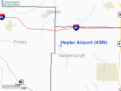
Location
& QuickFacts
|
FAA
Information Effective: |
2008-06-05 |
|
Airport
Identifier: |
43IN |
|
Airport
Status: |
Operational |
|
Longitude/Latitude: |
087-40-35.0820W/38-08-15.1570N
-87.676412/38.137544 (Estimated) |
|
Elevation: |
460 ft / 140.21 m (Estimated) |
|
Land: |
6 acres |
|
From nearest
city: |
3 nautical miles NE of St Wendel, IN |
|
Location: |
Vanderburgh County, IN |
|
Magnetic
Variation: |
00W (1985) |
Owner
& Manager
|
Ownership: |
Privately
owned |
|
Owner: |
William C. Hepler |
|
Address: |
16820 Hepler Rd
Evansville, IN 47720 |
|
Phone
number: |
812-963-5028 |
|
Manager: |
William C. Hepler |
|
Address: |
16820 Hepler Rd
Evansville, IN 47720 |
|
Phone
number: |
812-963-5028 |
Airport
Operations and Facilities
|
Airport
Use: |
Private |
|
Wind indicator: |
Yes |
|
Segmented
Circle: |
No |
|
Control
Tower: |
No |
|
Landing
fee charge: |
No |
|
Sectional
chart: |
St Louis |
|
Region: |
AGL - Great Lakes |
|
Boundary
ARTCC: |
ZID - Indianapolis |
|
Tie-in
FSS: |
HUF - Terre Haute |
|
FSS on
Airport: |
No |
|
FSS Toll
Free: |
1-800-WX-BRIEF |
|
Runway Information
Runway 09/27
|
Dimension: |
2600 x 90 ft
/ 792.5 x 27.4 m |
|
Surface: |
TURF, |
|
|
Runway 09 |
Runway 27 |
|
Traffic
Pattern: |
Left |
Left |
|
Radio Navigation
Aids
|
ID |
Type |
Name |
Ch |
Freq |
Var |
Dist |
|
PDW |
NDB |
Evansville |
|
284.00 |
00E |
9.0 nm |
|
GVA |
NDB |
Geneva |
|
224.00 |
01W |
20.6 nm |
|
CUL |
NDB |
Carmi |
|
332.00 |
01W |
21.1 nm |
|
AJG |
NDB |
Mount Carmel |
|
524.00 |
02W |
28.6 nm |
|
OEA |
NDB |
Vincennes |
|
251.00 |
00E |
33.8 nm |
|
FWC |
NDB |
Wayne County |
|
257.00 |
01E |
37.6 nm |
|
FNZ |
NDB |
Ferdinand |
|
239.00 |
00E |
40.2 nm |
|
OLY |
NDB |
Olney |
|
272.00 |
00W |
42.0 nm |
|
DCY |
NDB |
Washington |
|
212.00 |
03W |
42.2 nm |
|
TWT |
NDB |
Tradewater |
|
276.00 |
00E |
42.3 nm |
|
HSB |
NDB |
Harrisburg-raleigh |
|
230.00 |
00E |
45.6 nm |
|
TEL |
NDB |
Tell City |
|
206.00 |
02W |
47.2 nm |
|
FOA |
NDB |
Elm River |
|
353.00 |
00E |
48.6 nm |
|
SAM |
VOR/DME |
Samsville |
113X |
116.60 |
03E |
28.5 nm |
|
OWB |
VOR/DME |
Owensboro |
023X |
108.60 |
01E |
33.9 nm |
|
HNB |
VOR/DME |
Huntingburg |
029X |
109.20 |
00E |
34.7 nm |
|
LWV |
VOR/DME |
Lawrenceville |
025X |
108.80 |
01W |
38.2 nm |
|
PXV |
VORTAC |
Pocket City |
080X |
113.30 |
03E |
13.2 nm |
|
CCT |
VORTAC |
Central City |
035X |
109.80 |
01W |
49.4 nm |
Remarks
- PROVIDED
RWY THRS ARE CLEARLY MARKED AND DSPLCD AS NECESSARY SO AS TO PROVIDE
A MIN OF 20:1 APCH CLEARANCE OVER ALL OBSTACLES WITHIN THE RWY;. APCH
SURFACE AREAS AND SUFFICIENT REMAINING USABLE RWY LENGTH IS AVAILABLE
TO PERMIT SAFE LANDINGS/DEPARTURES BY TYPE ACFT USING THE RWY.
Based Aircraft
|
Aircraft
based on field: |
5 |
|
Single Engine
Airplanes: |
5 |
Hepler Airport
Address:
Vanderburgh County, IN
Tel:
812-963-5028
Images
and information placed above are from
http://www.airport-data.com/airport/43IN/
We
thank them for the data!
| General
Info |
| Country |
United
States |
| State |
INDIANA
|
| FAA ID |
43IN |
| Latitude |
38-08-15.157N
|
| Longitude |
087-40-35.082W
|
| Elevation |
460 feet
|
| Near City |
ST WENDEL
|
We don't guarantee the information is fresh and accurate. The data may
be wrong or outdated.
For more up-to-date information please refer to other sources.
|
|


