 |
|
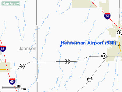
Location
& QuickFacts
|
FAA
Information Effective: |
2008-06-05 |
|
Airport
Identifier: |
58II |
|
Airport
Status: |
Operational |
|
Longitude/Latitude: |
085-53-59.9300W/39-31-15.1700N
-85.899981/39.520881 (Estimated) |
|
Elevation: |
770 ft / 234.70 m (Estimated) |
|
Land: |
0 acres |
|
From nearest
city: |
2 nautical miles S of Boggstown, IN |
|
Location: |
Shelby County, IN |
|
Magnetic
Variation: |
02W (1990) |
Owner
& Manager
|
Ownership: |
Privately
owned |
|
Owner: |
Brian Henneman |
|
Address: |
6279 W. Range Rd
Boggstown, IN 46110 |
|
Phone
number: |
317-729-5588 |
|
Manager: |
Brian Henneman |
|
Address: |
6279 W. Range Rd
Boggstown, IN 46110 |
|
Phone
number: |
317-729-5588 |
Airport
Operations and Facilities
|
Airport
Use: |
Private |
|
Segmented
Circle: |
No |
|
Control
Tower: |
No |
|
Sectional
chart: |
Chicago |
|
Region: |
AGL - Great Lakes |
|
Boundary
ARTCC: |
ZID - Indianapolis |
|
Tie-in
FSS: |
HUF - Terre Haute |
|
FSS Toll
Free: |
1-800-WX-BRIEF |
|
Runway Information
Runway 18/36
|
Dimension: |
2350 x 80 ft
/ 716.3 x 24.4 m |
|
Surface: |
TURF, |
|
|
Runway 18 |
Runway 36 |
|
Traffic
Pattern: |
Left |
Left |
|
Obstruction: |
30 ft pline, 600.0 ft from runway |
|
|
Radio Navigation
Aids
|
ID |
Type |
Name |
Ch |
Freq |
Var |
Dist |
|
HFY |
NDB |
Greenwood |
|
398.00 |
02W |
11.1 nm |
|
BA |
NDB |
Clifs |
|
410.00 |
03W |
12.5 nm |
|
UMP |
NDB |
Metropolitan |
|
338.00 |
03W |
26.0 nm |
|
HZP |
NDB |
Zionsville |
|
248.00 |
03W |
29.9 nm |
|
HLB |
NDB |
Batesville |
|
254.00 |
02W |
31.5 nm |
|
OVO |
NDB |
North Vernon |
|
374.00 |
02W |
31.5 nm |
|
UWL |
NDB |
New Castle |
|
385.00 |
02W |
34.5 nm |
|
AI |
NDB |
Video |
|
371.00 |
03W |
37.6 nm |
|
EQZ |
NDB |
Captain |
|
308.00 |
02W |
39.4 nm |
|
BM |
NDB |
Claye |
|
382.00 |
02W |
42.9 nm |
|
TVX |
NDB |
Greencastle |
|
521.00 |
03W |
43.5 nm |
|
BFR |
NDB |
Bedford |
|
344.00 |
02W |
48.0 nm |
|
MIE |
VOR/DME |
Muncie |
091X |
114.40 |
03W |
49.0 nm |
|
SHB |
VORTAC |
Shelbyville |
057X |
112.00 |
01E |
7.6 nm |
|
VHP |
VORTAC |
Brickyard |
110X |
116.30 |
01E |
27.9 nm |
|
OOM |
VORTAC |
Hoosier |
039X |
110.20 |
02W |
40.2 nm |
|
IND |
VOT |
Indianapolis Intl |
|
109.60 |
|
21.6 nm |
Remarks
- PRVDD
OBSTNS IN APCH ARE REMOVED/LOWERED OR RY DSPLCD TO PRVD A 20:1 APCH
SLOPE.
Based Aircraft
|
Aircraft
based on field: |
1 |
|
Single Engine
Airplanes: |
1 |
Henneman Airport
Address:
Shelby County, IN
Tel:
317-729-5588
Images
and information placed above are from
http://www.airport-data.com/airport/58II/
We
thank them for the data!
| General
Info |
| Country |
United
States |
| State |
INDIANA
|
| FAA ID |
58II |
| Latitude |
39-31-15.170N
|
| Longitude |
085-53-59.930W
|
| Elevation |
770 feet
|
| Near City |
BOGGSTOWN
|
We don't guarantee the information is fresh and accurate. The data may
be wrong or outdated.
For more up-to-date information please refer to other sources.
|
|


