 |
|
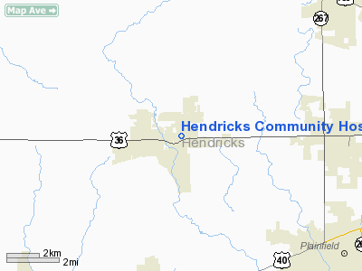
Hendricks Community Hospital Heliport |
|
|
Location
& QuickFacts
|
FAA
Information Effective: |
2008-06-05 |
|
Airport
Identifier: |
74II |
|
Airport
Status: |
Operational |
|
Longitude/Latitude: |
086-30-06.0000W/39-45-46.0000N
-86.501667/39.762778 (Estimated) |
|
Elevation: |
893 ft / 272.19 m (Estimated) |
|
Land: |
0 acres |
|
From nearest
city: |
1 nautical miles E of Danville, IN |
|
Location: |
Hendricks County, IN |
|
Magnetic
Variation: |
02W (1990) |
Owner
& Manager
|
Ownership: |
Privately
owned |
|
Owner: |
Hendricks Community Hospital |
|
Address: |
1000 East Main St
Danville, IN 46122 |
|
Phone
number: |
317-745-3500 |
|
Manager: |
Bernard R. Orender |
|
Address: |
1000 East Main St
Danville, IN 46122 |
|
Phone
number: |
317-745-3468 |
Airport
Operations and Facilities
|
Airport
Use: |
Private |
|
Wind indicator: |
Yes |
|
Segmented
Circle: |
No |
|
Control
Tower: |
No |
|
Lighting
Schedule: |
PHONE REQ
FOR ROTG BCN CALL 317-745-3500. |
|
Beacon
Color: |
Clear-Green-Yellow (heliport) |
|
Sectional
chart: |
St Louis |
|
Region: |
AGL - Great Lakes |
|
Boundary
ARTCC: |
ZID - Indianapolis |
|
Tie-in
FSS: |
HUF - Terre Haute |
|
FSS on
Airport: |
No |
|
FSS Toll
Free: |
1-800-WX-BRIEF |
|
Runway Information
Helipad H1
|
Dimension: |
54 x 54 ft /
16.5 x 16.5 m |
|
Surface: |
CONC, |
|
|
Runway H1 |
Runway |
|
Traffic
Pattern: |
Left |
Left |
|
Radio Navigation
Aids
|
ID |
Type |
Name |
Ch |
Freq |
Var |
Dist |
|
TVX |
NDB |
Greencastle |
|
521.00 |
03W |
14.4 nm |
|
HZP |
NDB |
Zionsville |
|
248.00 |
03W |
15.8 nm |
|
HFY |
NDB |
Greenwood |
|
398.00 |
02W |
20.6 nm |
|
CFJ |
NDB |
Crawfordsville |
|
388.00 |
02W |
23.2 nm |
|
UMP |
NDB |
Metropolitan |
|
338.00 |
03W |
23.3 nm |
|
FKR |
NDB |
Frankfort |
|
278.00 |
02W |
30.6 nm |
|
BA |
NDB |
Clifs |
|
410.00 |
03W |
41.3 nm |
|
BM |
NDB |
Claye |
|
382.00 |
02W |
42.7 nm |
|
HU |
NDB |
Yinno |
|
245.00 |
02W |
47.2 nm |
|
AI |
NDB |
Video |
|
371.00 |
03W |
49.3 nm |
|
VHP |
VORTAC |
Brickyard |
110X |
116.30 |
01E |
6.9 nm |
|
SHB |
VORTAC |
Shelbyville |
057X |
112.00 |
01E |
32.3 nm |
|
OOM |
VORTAC |
Hoosier |
039X |
110.20 |
02W |
37.6 nm |
|
TTH |
VORTAC |
Terre Haute |
100X |
115.30 |
02E |
38.3 nm |
|
IND |
VOT |
Indianapolis Intl |
|
109.60 |
|
10.4 nm |
Remarks
- OPNS
ARE FM 45 DEGREES TO 90 DEGREES; AREA IS MKD; WIND INDICATOR IS MNTND.
Hendricks Community Hospital Heliport
Address:
Hendricks County, IN
Tel:
317-745-3500,
317-745-3468
Images
and information placed above are from
http://www.airport-data.com/airport/74II/
We
thank them for the data!
| General
Info |
| Country |
United
States |
| State |
INDIANA
|
| FAA ID |
74II |
| Latitude |
39-45-41.164N
|
| Longitude |
086-30-04.993W
|
| Elevation |
893 feet
|
| Near City |
DANVILLE
|
We don't guarantee the information is fresh and accurate. The data may
be wrong or outdated.
For more up-to-date information please refer to other sources.
|
|


