 |
|
Location
& QuickFacts
|
FAA
Information Effective: |
2008-06-05 |
|
Airport
Identifier: |
78IN |
|
Airport
Status: |
Operational |
|
Longitude/Latitude: |
086-58-52.0000W/40-45-05.0000N
-86.981111/40.751389 (Estimated) |
|
Elevation: |
700 ft / 213.36 m (Estimated) |
|
Land: |
0 acres |
|
From nearest
city: |
4 nautical miles E of Wolcott, IN |
|
Location: |
White County, IN |
|
Magnetic
Variation: |
02W (1995) |
Owner
& Manager
|
Ownership: |
Privately
owned |
|
Owner: |
Alexander J Alletto |
|
Address: |
Route 1 Box 217
Wolcott, IN 47995 |
|
Phone
number: |
219-279-3191 |
|
Manager: |
Alexander J Alletto |
|
Address: |
Route 1 Box 217
Wolcott, IN 47995 |
|
Phone
number: |
219-279-3191 |
Airport
Operations and Facilities
|
Airport
Use: |
Private |
|
Wind indicator: |
Yes |
|
Segmented
Circle: |
No |
|
Control
Tower: |
No |
|
Sectional
chart: |
Chicago |
|
Region: |
AGL - Great Lakes |
|
Boundary
ARTCC: |
ZAU - Chicago |
|
Tie-in
FSS: |
HUF - Terre Haute |
|
FSS on
Airport: |
No |
|
FSS Toll
Free: |
1-800-WX-BRIEF |
|
Runway Information
Helipad H1
|
Dimension: |
100 x 150 ft
/ 30.5 x 45.7 m |
|
Surface: |
TURF, |
|
|
Runway H1 |
Runway |
|
Traffic
Pattern: |
Left |
Left |
|
Radio Navigation
Aids
|
ID |
Type |
Name |
Ch |
Freq |
Var |
Dist |
|
MCX |
NDB |
White County |
|
377.00 |
03W |
10.3 nm |
|
RZL |
NDB |
Rensselaer |
|
362.00 |
02W |
14.9 nm |
|
RWN |
NDB |
Winamac/dcmsnd |
|
335.00 |
00W |
26.8 nm |
|
GGP |
NDB |
Logansport |
|
263.00 |
01W |
27.8 nm |
|
FKR |
NDB |
Frankfort |
|
278.00 |
02W |
34.7 nm |
|
CPB |
NDB |
Culver |
|
391.00 |
01W |
38.9 nm |
|
RCR |
NDB |
Rochester |
|
216.00 |
03W |
40.6 nm |
|
VP |
NDB |
Sedly |
|
212.00 |
02W |
42.3 nm |
|
IUL |
NDB |
La Porte |
|
356.00 |
03W |
45.9 nm |
|
CFJ |
NDB |
Crawfordsville |
|
388.00 |
02W |
46.4 nm |
|
OXI |
VOR/DME |
Knox |
103X |
115.60 |
00E |
37.5 nm |
|
IKK |
VOR/DME |
Kankakee |
053X |
111.60 |
00E |
44.0 nm |
|
BVT |
VORTAC |
Boiler |
098X |
115.10 |
01E |
12.4 nm |
|
DNV |
VORTAC |
Danville |
047X |
111.00 |
02E |
38.1 nm |
|
GUS |
VORTAC |
Grissom |
21Y |
108.45 |
02W |
38.3 nm |
|
OKK |
VORTAC |
Kokomo |
082X |
113.50 |
00E |
44.2 nm |
|
EON |
VORTAC |
Peotone |
079X |
113.20 |
02E |
48.2 nm |
Remarks
- PRVDD
ALL APCH/DEP FM 240 CLOCKWISE TO 080; AREA IS MKD; WIND INDICATOR IS
MAINTAINED; NO NIGHT OPNS UNLESS WIND INDICATOR IS LGTD & BCN IS
INSTALLED; FIRE PROTECTION BE PRVDD.
Based Aircraft
|
Aircraft
based on field: |
1 |
|
Helicopters: |
1 |
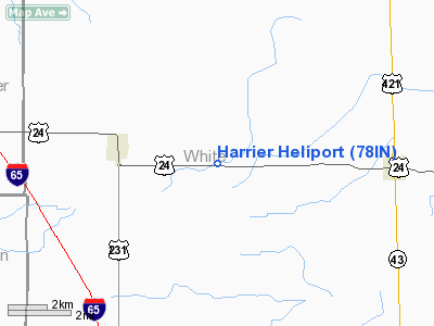
Harrier Heliport
Address:
White County, IN
Tel:
219-279-3191
Images
and information placed above are from
http://www.airport-data.com/airport/78IN/
We
thank them for the data!
| General
Info |
| Country |
United
States |
| State |
INDIANA
|
| FAA ID |
78IN |
| Latitude |
40-45-05.000N
|
| Longitude |
086-58-52.000W
|
| Elevation |
700 feet
|
| Near City |
WOLCOTT
|
We don't guarantee the information is fresh and accurate. The data may
be wrong or outdated.
For more up-to-date information please refer to other sources.
|
|


