 |
|
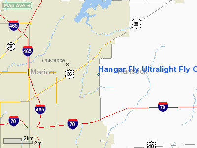
Hangar Fly Ultralight Fly Club Ultralight |
Location
& QuickFacts
|
FAA
Information Effective: |
2008-06-05 |
|
Airport
Identifier: |
4II2 |
|
Airport
Status: |
Operational |
|
Longitude/Latitude: |
085-57-14.9340W/39-51-12.1450N
-85.954148/39.853374 (Estimated) |
|
Elevation: |
860 ft / 262.13 m (Estimated) |
|
Land: |
22 acres |
|
From nearest
city: |
6 nautical miles W of Lawrence, IN |
|
Location: |
Marion County, IN |
|
Magnetic
Variation: |
02W (1985) |
Owner
& Manager
|
Ownership: |
Privately
owned |
|
Owner: |
Ultralight Hangar Fly Club |
|
Address: |
5501 Ne County Line Road
Lawrence, IN 46236 |
|
Phone
number: |
317-823-0013 |
|
Manager: |
Charles A. Carter |
|
Address: |
Rr 12, Box 399
Lawrence, IN 46236 |
|
Phone
number: |
317-823-6741 |
Airport
Operations and Facilities
|
Airport
Use: |
Private |
|
Wind indicator: |
Yes |
|
Segmented
Circle: |
No |
|
Control
Tower: |
No |
|
Landing
fee charge: |
No |
|
Sectional
chart: |
St Louis |
|
Region: |
AGL - Great Lakes |
|
Boundary
ARTCC: |
ZID - Indianapolis |
|
Tie-in
FSS: |
HUF - Terre Haute |
|
FSS on
Airport: |
No |
|
FSS Toll
Free: |
1-800-WX-BRIEF |
|
Runway Information
Runway E/W
|
Dimension: |
1320 x 330 ft
/ 402.3 x 100.6 m |
|
Surface: |
TURF, |
|
|
Runway E |
Runway W |
|
Traffic
Pattern: |
Left |
Left |
|
Displaced
threshold: |
0.00 ft |
50.00 ft |
|
Obstruction: |
|
30 ft pline, 650.0 ft from runway |
|
Runway N/S
|
Dimension: |
1320 x 330 ft
/ 402.3 x 100.6 m |
|
Surface: |
TURF, |
|
|
Runway N |
Runway S |
|
Traffic
Pattern: |
Left |
Left |
|
Radio Navigation
Aids
|
ID |
Type |
Name |
Ch |
Freq |
Var |
Dist |
|
UMP |
NDB |
Metropolitan |
|
338.00 |
03W |
6.7 nm |
|
HZP |
NDB |
Zionsville |
|
248.00 |
03W |
14.6 nm |
|
HFY |
NDB |
Greenwood |
|
398.00 |
02W |
14.7 nm |
|
AI |
NDB |
Video |
|
371.00 |
03W |
24.2 nm |
|
UWL |
NDB |
New Castle |
|
385.00 |
02W |
29.4 nm |
|
BA |
NDB |
Clifs |
|
410.00 |
03W |
32.5 nm |
|
FKR |
NDB |
Frankfort |
|
278.00 |
02W |
37.6 nm |
|
TVX |
NDB |
Greencastle |
|
521.00 |
03W |
40.2 nm |
|
HLB |
NDB |
Batesville |
|
254.00 |
02W |
44.2 nm |
|
CFJ |
NDB |
Crawfordsville |
|
388.00 |
02W |
45.0 nm |
|
MIE |
VOR/DME |
Muncie |
091X |
114.40 |
03W |
34.6 nm |
|
MZZ |
VOR/DME |
Marion |
023X |
108.60 |
03W |
40.5 nm |
|
SHB |
VORTAC |
Shelbyville |
057X |
112.00 |
01E |
14.6 nm |
|
VHP |
VORTAC |
Brickyard |
110X |
116.30 |
01E |
19.2 nm |
|
OKK |
VORTAC |
Kokomo |
082X |
113.50 |
00E |
40.8 nm |
|
GUS |
VORTAC |
Grissom |
21Y |
108.45 |
02W |
48.4 nm |
|
IND |
VOT |
Indianapolis Intl |
|
109.60 |
|
17.1 nm |
Remarks
- PROVIDED
PROPONENT ASSURES ADEQUATE CLEARANCE OVER ANY & ALL OBSTRUCTIONS
TO THE RWY APPROACHES.
Based Aircraft
|
Aircraft
based on field: |
5 |
|
Ultralights: |
5 |
Hangar Fly Ultralight Fly Club Ultralight
Address:
Marion County, IN
Tel:
317-823-0013,
317-823-6741
Images
and information placed above are from
http://www.airport-data.com/airport/4II2/
We
thank them for the data!
| General
Info |
| Country |
United
States |
| State |
INDIANA
|
| FAA ID |
4II2 |
| Latitude |
39-51-12.145N
|
| Longitude |
085-57-14.934W
|
| Elevation |
860 feet
|
| Near City |
LAWRENCE
|
We don't guarantee the information is fresh and accurate. The data may
be wrong or outdated.
For more up-to-date information please refer to other sources.
|
|


