 |
|
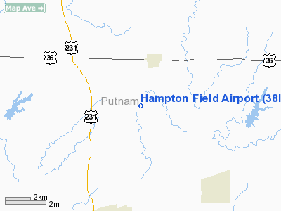
Location
& QuickFacts
|
FAA
Information Effective: |
2008-06-05 |
|
Airport
Identifier: |
38II |
|
Airport
Status: |
Operational |
|
Longitude/Latitude: |
086-49-23.0000W/39-43-43.0000N
-86.823056/39.728611 (Estimated) |
|
Elevation: |
890 ft / 271.27 m (Estimated) |
|
Land: |
0 acres |
|
From nearest
city: |
6 nautical miles NN of Greencastle, IN |
|
Location: |
Putnam County, IN |
|
Magnetic
Variation: |
() |
Owner
& Manager
|
Ownership: |
Privately
owned |
|
Owner: |
Jeff A. Hampton |
|
Address: |
1494 E. Cr 500 N
Brainbridge, IN 46105 |
|
Phone
number: |
765-364-1323 |
|
Manager: |
Jeff A. Hampton |
|
Address: |
1494 E. Cr 500 N
Brainbridge, IN 46105 |
|
Phone
number: |
765-364-1323 |
Airport
Operations and Facilities
|
Airport
Use: |
Private |
|
Control
Tower: |
No |
|
Sectional
chart: |
St Louis |
|
Region: |
AGL - Great Lakes |
|
Traffic
Pattern Alt: |
800 ft |
|
Boundary
ARTCC: |
ZID - Indianapolis |
|
Tie-in
FSS: |
HUF - Terre Haute |
|
FSS Toll
Free: |
1-800-WX-BRIEF |
|
Runway Information
Runway 01/19
|
Dimension: |
2000 x 75 ft
/ 609.6 x 22.9 m |
|
Surface: |
TURF, |
|
|
Runway 01 |
Runway 19 |
|
Traffic
Pattern: |
Left |
Left |
|
Radio Navigation
Aids
|
ID |
Type |
Name |
Ch |
Freq |
Var |
Dist |
|
TVX |
NDB |
Greencastle |
|
521.00 |
03W |
1.2 nm |
|
CFJ |
NDB |
Crawfordsville |
|
388.00 |
02W |
15.8 nm |
|
HZP |
NDB |
Zionsville |
|
248.00 |
03W |
29.4 nm |
|
HU |
NDB |
Yinno |
|
245.00 |
02W |
33.6 nm |
|
HFY |
NDB |
Greenwood |
|
398.00 |
02W |
34.4 nm |
|
FKR |
NDB |
Frankfort |
|
278.00 |
02W |
34.7 nm |
|
UMP |
NDB |
Metropolitan |
|
338.00 |
03W |
37.8 nm |
|
PRG |
NDB |
Paris |
|
341.00 |
01E |
39.4 nm |
|
BM |
NDB |
Claye |
|
382.00 |
02W |
41.7 nm |
|
SIV |
NDB |
Sullivan |
|
326.00 |
02W |
47.0 nm |
|
VHP |
VORTAC |
Brickyard |
110X |
116.30 |
01E |
21.7 nm |
|
TTH |
VORTAC |
Terre Haute |
100X |
115.30 |
02E |
24.4 nm |
|
OOM |
VORTAC |
Hoosier |
039X |
110.20 |
02W |
36.5 nm |
|
SHB |
VORTAC |
Shelbyville |
057X |
112.00 |
01E |
46.6 nm |
|
DNV |
VORTAC |
Danville |
047X |
111.00 |
02E |
47.9 nm |
|
IND |
VOT |
Indianapolis Intl |
|
109.60 |
|
25.0 nm |
Remarks
- PRVDD
CLEAR 20:1 APCHS, CLEAR OBSTACLE FREE ZONE AND MAX TFC PATTERN ALT IS
800 FT AGL.
Hampton Field Airport
Address:
Putnam County, IN
Tel:
765-364-1323
Images
and information placed above are from
http://www.airport-data.com/airport/38II/
We
thank them for the data!
We don't guarantee the information is fresh and accurate. The data may
be wrong or outdated.
For more up-to-date information please refer to other sources.
|
|


