 |
|
|
|
|
|
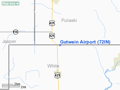
Location
& QuickFacts
|
FAA
Information Effective: |
2008-06-05 |
|
Airport
Identifier: |
72IN |
|
Airport
Status: |
Operational |
|
Longitude/Latitude: |
086-52-26.0570W/40-54-43.1410N
-86.873905/40.911984 (Estimated) |
|
Elevation: |
680 ft / 207.26 m (Estimated) |
|
Land: |
0 acres |
|
From nearest
city: |
2 nautical miles N of Monon, IN |
|
Location: |
White County, IN |
|
Magnetic
Variation: |
02W (1985) |
Owner
& Manager
|
Ownership: |
Privately
owned |
|
Owner: |
Carl L. Gutwein |
|
Address: |
Rt 2, Box 191
Monon, IN 47959 |
|
Phone
number: |
219-253-8191 |
|
Manager: |
Carl L. Gutwein |
|
Address: |
Rt 2, Box 191
Monon, IN 47959 |
|
Phone
number: |
2190253-8191 |
Airport
Operations and Facilities
|
Airport
Use: |
Private |
|
Wind indicator: |
Yes |
|
Segmented
Circle: |
No |
|
Control
Tower: |
No |
|
Lighting
Schedule: |
RDO-CTL
ACTVT LIRL RY E/W - 122.9. |
|
Beacon
Color: |
Clear-Green (lighted land airport) |
|
Sectional
chart: |
Chicago |
|
Region: |
AGL - Great Lakes |
|
Boundary
ARTCC: |
ZAU - Chicago |
|
Tie-in
FSS: |
HUF - Terre Haute |
|
FSS
on Airport: |
No |
|
FSS
Toll Free: |
1-800-WX-BRIEF |
Airport
Services
|
Fuel
available: |
MOGAS
ALSO 87 OCTANE FUEL AVBL. |
|
Runway Information
Runway E/W
|
Dimension: |
2640 x 80 ft
/ 804.7 x 24.4 m |
|
Surface: |
TURF, |
|
Edge Lights: |
Low |
|
|
Runway E |
Runway W |
|
Traffic
Pattern: |
Left |
Left |
|
Radio Navigation
Aids
|
ID |
Type |
Name |
Ch |
Freq |
Var |
Dist |
|
MCX |
NDB |
White County |
|
377.00 |
03W |
13.1 nm |
|
RZL |
NDB |
Rensselaer |
|
362.00 |
02W |
14.2 nm |
|
RWN |
NDB |
Winamac/dcmsnd |
|
335.00 |
00W |
16.4 nm |
|
GGP |
NDB |
Logansport |
|
263.00 |
01W |
25.8 nm |
|
CPB |
NDB |
Culver |
|
391.00 |
01W |
28.8 nm |
|
RCR |
NDB |
Rochester |
|
216.00 |
03W |
32.4 nm |
|
VP |
NDB |
Sedly |
|
212.00 |
02W |
32.4 nm |
|
IUL |
NDB |
La Porte |
|
356.00 |
03W |
35.6 nm |
|
FKR |
NDB |
Frankfort |
|
278.00 |
02W |
41.1 nm |
|
MGC |
NDB |
Michigan City |
|
203.00 |
01W |
47.9 nm |
|
IWH |
NDB |
Wabash |
|
329.00 |
03W |
49.7 nm |
|
OXI |
VOR/DME |
Knox |
103X |
115.60 |
00E |
26.7 nm |
|
IKK |
VOR/DME |
Kankakee |
053X |
111.60 |
00E |
45.3 nm |
|
BVT |
VORTAC |
Boiler |
098X |
115.10 |
01E |
23.2 nm |
|
GUS |
VORTAC |
Grissom |
21Y |
108.45 |
02W |
36.6 nm |
|
OKK |
VORTAC |
Kokomo |
082X |
113.50 |
00E |
43.8 nm |
|
EON |
VORTAC |
Peotone |
079X |
113.20 |
02E |
46.8 nm |
|
CGT |
VORTAC |
Chicago Heights |
089X |
114.20 |
02E |
47.8 nm |
|
DNV |
VORTAC |
Danville |
047X |
111.00 |
02E |
48.5 nm |
Remarks
- ALL
TFC PATS ARE N OF ARPT.
Based Aircraft
|
Aircraft
based on field: |
3 |
|
Single Engine
Airplanes: |
3 |
Gutwein Airport
Address:
White County, IN
Tel:
219-253-8191
Images
and information placed above are from
http://www.airport-data.com/airport/72IN/
We
thank them for the data!
| General
Info |
| Country |
United
States |
| State |
INDIANA
|
| FAA ID |
72IN |
| Latitude |
40-54-43.141N
|
| Longitude |
086-52-26.057W
|
| Elevation |
680 feet
|
| Near City |
MONON
|
We don't guarantee the information is fresh and accurate. The data may
be wrong or outdated.
For more up-to-date information please refer to other sources.
|
|


