 |
|
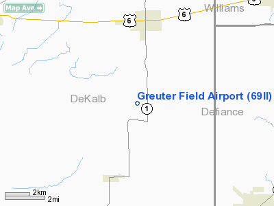
Location
& QuickFacts
|
FAA
Information Effective: |
2008-06-05 |
|
Airport
Identifier: |
69II |
|
Airport
Status: |
Operational |
|
Longitude/Latitude: |
084-52-44.0000W/41-22-10.0000N
-84.878889/41.369444 (Estimated) |
|
Elevation: |
840 ft / 256.03 m (Estimated) |
|
Land: |
0 acres |
|
From nearest
city: |
4 nautical miles S of Butler, IN |
|
Location: |
De Kalb County, IN |
|
Magnetic
Variation: |
04W (1990) |
Owner
& Manager
|
Ownership: |
Privately
owned |
|
Owner: |
Delmer E. Greuter Ii |
|
Address: |
6688 Cr. 44
Butler, IN 46721 |
|
Phone
number: |
219-868-2500 |
|
Manager: |
Delmer E. Greuter Ii |
|
Address: |
6688 Cr. 44
Butler, IN 46721 |
|
Phone
number: |
219-868-2500 |
Airport
Operations and Facilities
|
Airport
Use: |
Private |
|
Wind indicator: |
Yes |
|
Segmented
Circle: |
No |
|
Control
Tower: |
No |
|
Sectional
chart: |
Detroit |
|
Region: |
AGL - Great Lakes |
|
Boundary
ARTCC: |
ZOB - Cleveland |
|
Tie-in
FSS: |
HUF - Terre Haute |
|
FSS Toll
Free: |
1-800-WX-BRIEF |
|
Runway Information
Runway 08/26
|
Dimension: |
2000 x 85 ft
/ 609.6 x 25.9 m |
|
Surface: |
TURF, |
|
|
Runway 08 |
Runway 26 |
|
Traffic
Pattern: |
Left |
Left |
|
Radio Navigation
Aids
|
ID |
Type |
Name |
Ch |
Freq |
Var |
Dist |
|
ANQ |
NDB |
Angola |
|
347.00 |
05W |
18.8 nm |
|
BYN |
NDB |
Bryan |
|
260.00 |
04W |
19.8 nm |
|
DFI |
NDB |
Defiance |
|
246.00 |
05W |
20.5 nm |
|
VFU |
NDB |
Stanley |
|
411.00 |
05W |
32.7 nm |
|
IRS |
NDB |
Sturgis |
|
382.00 |
04W |
36.5 nm |
|
USE |
NDB |
Fulton |
|
375.00 |
05W |
36.6 nm |
|
HHG |
NDB |
Huntington |
|
417.00 |
03W |
40.7 nm |
|
PDR |
NDB |
Ottawa |
|
233.00 |
05W |
45.6 nm |
|
ADG |
NDB |
Adrian |
|
278.00 |
06W |
46.9 nm |
|
HAI |
NDB |
Three Rivers |
|
407.00 |
02W |
47.7 nm |
|
OLK |
VOR |
Wolf Lake |
|
110.40 |
03W |
28.9 nm |
|
LFD |
VOR/DME |
Litchfield |
049X |
111.20 |
05W |
42.0 nm |
|
FWA |
VORTAC |
Fort Wayne |
125X |
117.80 |
00E |
27.3 nm |
|
FWA |
VOT |
Fort Wayne Baer |
|
111.00 |
|
27.4 nm |
Remarks
- OWNER
DESIRES ARPT NOT BE CHARTED.
- PRVDD
THE AREA 125 FT EITHER SIDE OF THE RY CTR & 200 FT OFF RY END BE
CLEAR OF ANY OBSTN & ANY OBSTN IN RY SLOPE ARE REMOVED/LOWERED OR
THE RY THR IS DSPLCD & CLEARLY MKD TO PRVD A 20:1 APCH CLNC OVER
OBSTN.
Based Aircraft
|
Aircraft
based on field: |
1 |
|
Single Engine
Airplanes: |
1 |
Greuter Field Airport
Address:
De Kalb County, IN
Tel:
219-868-2500
Images
and information placed above are from
http://www.airport-data.com/airport/69II/
We
thank them for the data!
| General
Info |
| Country |
United
States |
| State |
INDIANA
|
| FAA ID |
69II |
| Latitude |
41-22-10.000N
|
| Longitude |
084-52-44.000W
|
| Elevation |
840 feet
|
| Near City |
BUTLER
|
We don't guarantee the information is fresh and accurate. The data may
be wrong or outdated.
For more up-to-date information please refer to other sources.
|
|


