 |
|
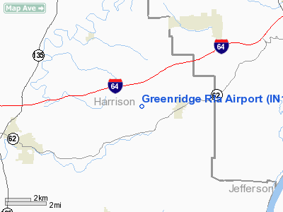
Location
& QuickFacts
|
FAA
Information Effective: |
2008-06-05 |
|
Airport
Identifier: |
IN14 |
|
Airport
Status: |
Operational |
|
Longitude/Latitude: |
086-01-09.8860W/38-14-20.2450N
-86.019413/38.238957 (Estimated) |
|
Elevation: |
858 ft / 261.52 m (Estimated) |
|
Land: |
0 acres |
|
From nearest
city: |
2 nautical miles W of Lanesville, IN |
|
Location: |
Harrison County, IN |
|
Magnetic
Variation: |
02W (1985) |
Owner & Manager
|
Ownership: |
Privately
owned |
|
Owner: |
James R. Lopp |
|
Address: |
2741 Ferree Rd.
Lanesville,
IN 47136 |
|
Phone
number: |
812-952-2772 |
|
Manager: |
James R Lopp |
|
Address: |
2741 Ferree Rd.
Lanesville,
IN 47136 |
|
Phone
number: |
812-952-2772 |
Airport Operations
and Facilities
|
Airport Use: |
Private |
|
Wind
indicator: |
Yes |
|
Segmented
Circle: |
No |
|
Control
Tower: |
No |
|
Landing
fee charge: |
No |
|
Sectional
chart: |
St Louis |
|
Region: |
AGL - Great Lakes |
|
Boundary
ARTCC: |
ZID - Indianapolis |
|
Tie-in
FSS: |
HUF - Terre Haute |
|
FSS on
Airport: |
No |
|
FSS Toll
Free: |
1-800-WX-BRIEF |
Airport Services
|
Airframe
Repair: |
NONE |
|
Power
Plant Repair: |
NONE |
|
Runway Information
Runway 05/23
|
Dimension: |
2300 x 70 ft
/ 701.0 x 21.3 m |
|
Surface: |
TURF, |
|
|
Runway 05 |
Runway 23 |
|
Traffic
Pattern: |
Left |
Left |
|
Obstruction: |
40 ft trees, 800.0 ft from runway |
|
|
Radio Navigation
Aids
|
ID |
Type |
Name |
Ch |
Freq |
Var |
Dist |
|
GOI |
NDB |
Godman |
|
396.00 |
02W |
17.0 nm |
|
RRJ |
NDB |
Oranj |
|
368.00 |
02W |
29.6 nm |
|
TEL |
NDB |
Tell City |
|
206.00 |
02W |
34.5 nm |
|
BRY |
NDB |
Bardstown/dcmsnd |
|
248.00 |
02W |
34.6 nm |
|
EQZ |
NDB |
Captain |
|
308.00 |
02W |
37.8 nm |
|
FNZ |
NDB |
Ferdinand |
|
239.00 |
00E |
38.6 nm |
|
IMS |
NDB |
Madison |
|
404.00 |
03W |
40.9 nm |
|
BFR |
NDB |
Bedford |
|
344.00 |
02W |
41.1 nm |
|
MYS |
VOR |
Mystic |
|
108.20 |
01W |
23.3 nm |
|
BQM |
VOR/DME |
Bowman |
059X |
112.20 |
01W |
16.8 nm |
|
FTK |
VOR/DME |
Fort Knox |
033X |
109.60 |
01W |
20.1 nm |
|
EWO |
VOR/DME |
New Hope |
045X |
110.80 |
01E |
40.0 nm |
|
HNB |
VOR/DME |
Huntingburg |
029X |
109.20 |
00E |
44.2 nm |
|
IIU |
VORTAC |
Louisville |
095X |
114.80 |
01E |
22.4 nm |
|
ABB |
VORTAC |
Nabb |
071X |
112.40 |
01E |
27.7 nm |
|
SDF |
VOT |
Louisville Standifd |
|
111.00 |
|
13.9 nm |
Based Aircraft
|
Aircraft
based on field: |
3 |
|
Single Engine
Airplanes: |
3 |
Greenridge Rla Airport
Address:
Harrison County, IN
Tel:
812-952-2772
Images
and information placed above are from
http://www.airport-data.com/airport/IN14/
We
thank them for the data!
| General
Info |
| Country |
United
States |
| State |
INDIANA
|
| FAA ID |
IN14 |
| Latitude |
38-14-20.245N
|
| Longitude |
086-01-09.886W
|
| Elevation |
858 feet
|
| Near City |
LANESVILLE
|
We don't guarantee the information is fresh and accurate. The data may
be wrong or outdated.
For more up-to-date information please refer to other sources.
|
|


