 |
|
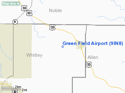
Location
& QuickFacts
|
FAA
Information Effective: |
2008-06-05 |
|
Airport
Identifier: |
9IN8 |
|
Airport
Status: |
Operational |
|
Longitude/Latitude: |
085-21-29.0000W/41-13-45.0000N
-85.358056/41.229167 (Estimated) |
|
Elevation: |
890 ft / 271.27 m (Estimated) |
|
Land: |
10 acres |
|
From nearest
city: |
2 nautical miles W of Churubusco, IN |
|
Location: |
Whitley County, IN |
|
Magnetic
Variation: |
() |
Owner & Manager
|
Ownership: |
Privately
owned |
|
Owner: |
Jack Green |
|
Address: |
6747 E. Anderson
Churubusco, IN 46723 |
|
Phone
number: |
260-693-9632 |
|
Manager: |
Jack Green |
|
Address: |
6747 E. Anderson
Churubusco, IN 46723 |
|
Phone
number: |
260-693-9632 |
Airport
Operations and Facilities
|
Airport
Use: |
Private |
|
Wind indicator: |
Yes |
|
Segmented
Circle: |
No |
|
Control
Tower: |
No |
|
Sectional
chart: |
Chicago |
|
Region: |
AGL - Great Lakes |
|
Boundary
ARTCC: |
ZAU - Chicago |
|
Tie-in
FSS: |
HUF - Terre Haute |
|
FSS Toll
Free: |
1-800-WX-BRIEF |
|
Runway Information
Runway 09/27
|
Dimension: |
2300 x 75 ft
/ 701.0 x 22.9 m |
|
Surface: |
TURF, |
|
|
Runway 09 |
Runway 27 |
|
Traffic
Pattern: |
Left |
Left |
|
Displaced
threshold: |
75.00 ft |
75.00 ft |
|
Obstruction: |
, 3930.0 ft from runway |
25 ft pline, 5280.0 ft from runway |
|
Runway 18/36
|
Dimension: |
2100 x 75 ft
/ 640.1 x 22.9 m |
|
Surface: |
TURF, |
|
|
Runway 18 |
Runway 36 |
|
Traffic
Pattern: |
Left |
Left |
|
Obstruction: |
|
20 ft pline, 620.0 ft from runway |
|
Radio Navigation
Aids
|
ID |
Type |
Name |
Ch |
Freq |
Var |
Dist |
|
HHG |
NDB |
Huntington |
|
417.00 |
03W |
23.0 nm |
|
ANQ |
NDB |
Angola |
|
347.00 |
05W |
27.5 nm |
|
IWH |
NDB |
Wabash |
|
329.00 |
03W |
34.4 nm |
|
IRS |
NDB |
Sturgis |
|
382.00 |
04W |
35.3 nm |
|
RCR |
NDB |
Rochester |
|
216.00 |
03W |
38.9 nm |
|
VFU |
NDB |
Stanley |
|
411.00 |
05W |
40.3 nm |
|
DFI |
NDB |
Defiance |
|
246.00 |
05W |
42.5 nm |
|
BYN |
NDB |
Bryan |
|
260.00 |
04W |
43.0 nm |
|
HAI |
NDB |
Three Rivers |
|
407.00 |
02W |
45.1 nm |
|
CPB |
NDB |
Culver |
|
391.00 |
01W |
46.4 nm |
|
PLD |
NDB |
Portland |
|
257.00 |
03W |
49.6 nm |
|
OLK |
VOR |
Wolf Lake |
|
110.40 |
03W |
6.4 nm |
|
MZZ |
VOR/DME |
Marion |
023X |
108.60 |
03W |
46.6 nm |
|
FWA |
VORTAC |
Fort Wayne |
125X |
117.80 |
00E |
16.9 nm |
|
GSH |
VORTAC |
Goshen |
084X |
113.70 |
00E |
35.1 nm |
|
FWA |
VOT |
Fort Wayne Baer |
|
111.00 |
|
16.9 nm |
Remarks
- PRVDD
CLEAR 20:1 APCHS AND CLEAR OBSTACLE FREE ZONE.
Based Aircraft
|
Aircraft
based on field: |
2 |
|
Single Engine
Airplanes: |
2 |
Green Field Airport
Address:
Whitley County, IN
Tel:
260-693-9632
Images
and information placed above are from
http://www.airport-data.com/airport/9IN8/
We
thank them for the data!
We don't guarantee the information is fresh and accurate. The data may
be wrong or outdated.
For more up-to-date information please refer to other sources.
|
|


