 |
|
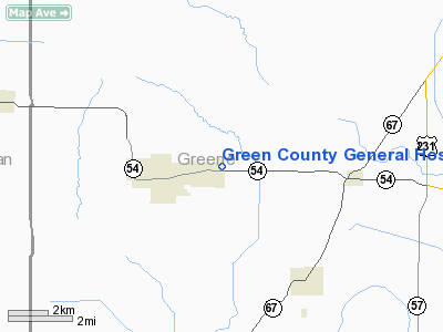
Green County General Hospital Heliport |
Location
& QuickFacts
|
FAA
Information Effective: |
2008-06-05 |
|
Airport
Identifier: |
IN17 |
|
Airport
Status: |
Operational |
|
Longitude/Latitude: |
087-07-48.0410W/39-02-25.1600N
-87.130011/39.040322 (Estimated) |
|
Elevation: |
542 ft / 165.20 m (Estimated) |
|
Land: |
0 acres |
|
From nearest
city: |
1 nautical miles W of Linton, IN |
|
Location: |
Greene County, IN |
|
Magnetic
Variation: |
01W (1985) |
Owner & Manager
|
Ownership: |
Privately
owned |
|
Owner: |
Greene County |
|
Address: |
Rr 1 Box 555
Linton, IN 47441 |
|
Phone
number: |
812-847-5212 |
|
Manager: |
Jonas Uland, Exec Director |
|
Address: |
Rr 1 Box 555
Linton, IN 47441 |
|
Phone
number: |
812-847-5212 |
Airport
Operations and Facilities
|
Airport
Use: |
Private |
|
Wind indicator: |
Yes |
|
Segmented
Circle: |
No |
|
Control
Tower: |
No |
|
Sectional
chart: |
St Louis |
|
Region: |
AGL - Great Lakes |
|
Boundary
ARTCC: |
ZID - Indianapolis |
|
Tie-in
FSS: |
HUF - Terre Haute |
|
FSS on
Airport: |
No |
|
FSS Toll
Free: |
1-800-WX-BRIEF |
|
Runway Information
Helipad H1
|
Dimension: |
70 x 70 ft /
21.3 x 21.3 m |
|
Surface: |
ASPH, |
|
|
Runway H1 |
Runway |
|
Traffic
Pattern: |
Left |
Left |
|
Radio Navigation
Aids
|
ID |
Type |
Name |
Ch |
Freq |
Var |
Dist |
|
SIV |
NDB |
Sullivan |
|
326.00 |
02W |
15.4 nm |
|
DCY |
NDB |
Washington |
|
212.00 |
03W |
20.7 nm |
|
PLX |
NDB |
Palestine |
|
391.00 |
00W |
23.9 nm |
|
HU |
NDB |
Yinno |
|
245.00 |
02W |
24.3 nm |
|
BM |
NDB |
Claye |
|
382.00 |
02W |
24.8 nm |
|
OEA |
NDB |
Vincennes |
|
251.00 |
00E |
28.9 nm |
|
BFR |
NDB |
Bedford |
|
344.00 |
02W |
34.6 nm |
|
AJG |
NDB |
Mount Carmel |
|
524.00 |
02W |
38.0 nm |
|
RRJ |
NDB |
Oranj |
|
368.00 |
02W |
41.8 nm |
|
TVX |
NDB |
Greencastle |
|
521.00 |
03W |
43.2 nm |
|
CZB |
NDB |
Casey |
|
359.00 |
00E |
43.6 nm |
|
PRG |
NDB |
Paris |
|
341.00 |
01E |
46.9 nm |
|
FNZ |
NDB |
Ferdinand |
|
239.00 |
00E |
49.5 nm |
|
RSV |
VOR/DME |
Robinson |
021X |
108.40 |
02E |
24.3 nm |
|
LWV |
VOR/DME |
Lawrenceville |
025X |
108.80 |
01W |
27.5 nm |
|
HNB |
VOR/DME |
Huntingburg |
029X |
109.20 |
00E |
48.2 nm |
|
OOM |
VORTAC |
Hoosier |
039X |
110.20 |
02W |
24.9 nm |
|
TTH |
VORTAC |
Terre Haute |
100X |
115.30 |
02E |
27.5 nm |
Remarks
- PROVIDED
ALL APCH/DEP OPNS CONDUCTED FM 360 DEG TO 010 DEG; TKOF/LNDG AREA APPROPRIATELY
MKD; NON-OBSTRUCTING WIND INDICATOR MAINTAINED.
Based Aircraft
|
Aircraft
based on field: |
1 |
|
Helicopters: |
1 |
Green County General Hospital Heliport
Address:
Greene County, IN
Tel:
812-847-5212
Images
and information placed above are from
http://www.airport-data.com/airport/IN17/
We
thank them for the data!
| General
Info |
| Country |
United
States |
| State |
INDIANA
|
| FAA ID |
IN17 |
| Latitude |
39-02-25.160N
|
| Longitude |
087-07-48.041W
|
| Elevation |
542 feet
|
| Near City |
LINTON
|
We don't guarantee the information is fresh and accurate. The data may
be wrong or outdated.
For more up-to-date information please refer to other sources.
|
|


