 |
|
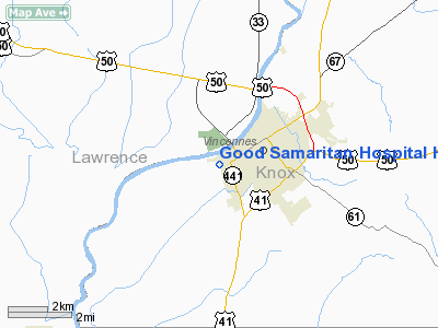
Good Samaritan Hospital Heliport |
Location
& QuickFacts
|
FAA
Information Effective: |
2008-06-05 |
|
Airport
Identifier: |
24II |
|
Airport
Status: |
Operational |
|
Longitude/Latitude: |
087-32-32.0000W/38-40-21.0000N
-87.542222/38.672500 (Estimated) |
|
Elevation: |
420 ft / 128.02 m (Estimated) |
|
Land: |
0 acres |
|
From nearest
city: |
0 nautical miles SW of Vincennes, IN |
|
Location: |
Knox County, IN |
|
Magnetic
Variation: |
01W (1990) |
Owner
& Manager
|
Ownership: |
Privately
owned |
|
Owner: |
Good Samaritan Hospital |
|
Address: |
520 S. 7th Street
Vincennes,
IN 47591 |
|
Phone
number: |
812-882-5220 |
|
Manager: |
Matthew D. Bailey |
|
Address: |
520 S. 7th Street
Vincennes,
IN 47591 |
|
Phone
number: |
812-885-3334 |
Airport Operations
and Facilities
|
Airport
Use: |
Private
MEDICAL USE. |
|
Segmented
Circle: |
No |
|
Control
Tower: |
No |
|
Sectional
chart: |
St Louis |
|
Region: |
AGL - Great Lakes |
|
Boundary
ARTCC: |
ZID - Indianapolis |
|
Tie-in
FSS: |
HUF - Terre Haute |
|
FSS Toll
Free: |
1-800-WX-BRIEF |
|
Runway Information
Helipad H1
|
Dimension: |
50 x 50 ft /
15.2 x 15.2 m |
|
Surface: |
ASPH, |
|
|
Runway H1 |
Runway |
|
Traffic
Pattern: |
Left |
Left |
|
Radio Navigation
Aids
|
ID |
Type |
Name |
Ch |
Freq |
Var |
Dist |
|
OEA |
NDB |
Vincennes |
|
251.00 |
00E |
1.3 nm |
|
AJG |
NDB |
Mount Carmel |
|
524.00 |
02W |
9.4 nm |
|
DCY |
NDB |
Washington |
|
212.00 |
03W |
19.3 nm |
|
PLX |
NDB |
Palestine |
|
391.00 |
00W |
21.0 nm |
|
SIV |
NDB |
Sullivan |
|
326.00 |
02W |
26.9 nm |
|
OLY |
NDB |
Olney |
|
272.00 |
00W |
29.7 nm |
|
PDW |
NDB |
Evansville |
|
284.00 |
00E |
38.0 nm |
|
FNZ |
NDB |
Ferdinand |
|
239.00 |
00E |
41.8 nm |
|
FOA |
NDB |
Elm River |
|
353.00 |
00E |
42.7 nm |
|
HU |
NDB |
Yinno |
|
245.00 |
02W |
43.5 nm |
|
CZB |
NDB |
Casey |
|
359.00 |
00E |
43.7 nm |
|
CUL |
NDB |
Carmi |
|
332.00 |
01W |
44.2 nm |
|
FWC |
NDB |
Wayne County |
|
257.00 |
01E |
44.4 nm |
|
RRJ |
NDB |
Oranj |
|
368.00 |
02W |
48.4 nm |
|
BM |
NDB |
Claye |
|
382.00 |
02W |
49.8 nm |
|
LWV |
VOR/DME |
Lawrenceville |
025X |
108.80 |
01W |
6.5 nm |
|
RSV |
VOR/DME |
Robinson |
021X |
108.40 |
02E |
21.4 nm |
|
SAM |
VOR/DME |
Samsville |
113X |
116.60 |
03E |
27.9 nm |
|
HNB |
VOR/DME |
Huntingburg |
029X |
109.20 |
00E |
37.5 nm |
|
PXV |
VORTAC |
Pocket City |
080X |
113.30 |
03E |
45.9 nm |
|
BIB |
VORTAC |
Bible Grove |
027X |
109.00 |
03E |
46.5 nm |
Remarks
- SEE
AIRSPACE CASE 97-AGL-412-NRA.
Good Samaritan Hospital Heliport
Address:
Knox County, IN
Tel:
812-882-5220,
812-885-3334
Images
and information placed above are from
http://www.airport-data.com/airport/24II/
We
thank them for the data!
| General
Info |
| Country |
United
States |
| State |
INDIANA
|
| FAA ID |
24II |
| Latitude |
38-40-21.000N
|
| Longitude |
087-32-32.000W
|
| Elevation |
420 feet
|
| Near City |
VINCENNES
|
We don't guarantee the information is fresh and accurate. The data may
be wrong or outdated.
For more up-to-date information please refer to other sources.
|
|


