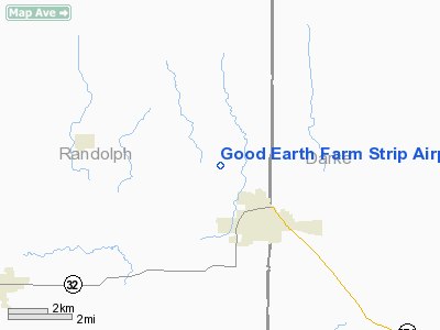
Good Earth Farm Strip Airport |
Location
& QuickFacts
|
FAA
Information Effective: |
2008-06-05 |
|
Airport
Identifier: |
II73 |
|
Airport
Status: |
Operational |
|
Longitude/Latitude: |
084-50-05.8660W/40-13-34.1650N
-84.834963/40.226157 (Estimated) |
|
Elevation: |
1080 ft / 329.18 m (Estimated) |
|
Land: |
0 acres |
|
From nearest
city: |
2 nautical miles NW of Union City, IN |
|
Location: |
Randolph County, IN |
|
Magnetic
Variation: |
03W (1985) |
Owner & Manager
|
Ownership: |
Privately
owned |
|
Owner: |
Richard G. Applegate |
|
Address: |
Rr 2
Union City, IN 47390 |
|
Phone
number: |
317-964-7712 |
|
Address: |
|
Airport
Operations and Facilities
|
Airport
Use: |
Private |
|
Segmented
Circle: |
No |
|
Control
Tower: |
No |
|
Landing
fee charge: |
No |
|
Sectional
chart: |
Detroit |
|
Region: |
AGL - Great Lakes |
|
Boundary
ARTCC: |
ZID - Indianapolis |
|
Tie-in
FSS: |
HUF - Terre Haute |
|
FSS Toll
Free: |
1-800-WX-BRIEF |
|
Runway Information
Runway N/S
|
Dimension: |
2600 x 150 ft
/ 792.5 x 45.7 m |
|
Surface: |
TURF, |
|
|
Runway N |
Runway S |
|
Traffic
Pattern: |
Left |
Left |
|
Obstruction: |
25 ft pline |
|
|
Radio Navigation
Aids
|
ID |
Type |
Name |
Ch |
Freq |
Var |
Dist |
|
VES |
NDB |
Versailles |
|
356.00 |
04W |
14.4 nm |
|
PLD |
NDB |
Portland |
|
257.00 |
03W |
15.3 nm |
|
CQA |
NDB |
Lakefield |
|
205.00 |
04W |
19.8 nm |
|
UWL |
NDB |
New Castle |
|
385.00 |
02W |
30.5 nm |
|
AI |
NDB |
Video |
|
371.00 |
03W |
32.4 nm |
|
VFU |
NDB |
Stanley |
|
411.00 |
05W |
39.6 nm |
|
OXD |
NDB |
Oxford |
|
282.00 |
04W |
43.3 nm |
|
LYL |
NDB |
Lima |
|
362.00 |
04W |
47.0 nm |
|
HKF |
NDB |
Hook Field |
|
239.00 |
04W |
47.2 nm |
|
HHG |
NDB |
Huntington |
|
417.00 |
03W |
47.5 nm |
|
EDJ |
NDB |
Bellefontaine |
|
242.00 |
05W |
47.6 nm |
|
FFO |
TACAN |
Patterson |
099X |
|
04W |
43.4 nm |
|
AOH |
VOR |
Allen County |
|
108.40 |
04W |
49.1 nm |
|
DQN |
VOR/DME |
Dayton |
092X |
114.50 |
01W |
23.8 nm |
|
MIE |
VOR/DME |
Muncie |
091X |
114.40 |
03W |
25.7 nm |
|
MZZ |
VOR/DME |
Marion |
023X |
108.60 |
03W |
41.9 nm |
|
RID |
VORTAC |
Richmond |
043X |
110.60 |
03W |
28.3 nm |
|
ROD |
VORTAC |
Rosewood |
122X |
117.50 |
05W |
36.5 nm |
|
FWA |
VORTAC |
Fort Wayne |
125X |
117.80 |
00E |
48.0 nm |
|
DAY |
VOT |
Dayton J M Cox-day |
|
111.00 |
|
34.4 nm |
|
FWA |
VOT |
Fort Wayne Baer |
|
111.00 |
|
48.0 nm |
Remarks
- FILED
FOR RECORD PURPOSES ONLY.
Based Aircraft
|
Aircraft
based on field: |
1 |
|
Multi Engine Airplanes: |
1 |
Good Earth Farm Strip Airport
Address:
Randolph County, IN
Tel:
317-964-7712
Images
and information placed above are from
http://www.airport-data.com/airport/II73/
We
thank them for the data!
| General
Info |
| Country |
United
States |
| State |
INDIANA
|
| FAA ID |
II73 |
| Latitude |
40-13-34.165N
|
| Longitude |
084-50-05.866W
|
| Elevation |
1080 feet
|
| Near City |
UNION
CITY |
We don't guarantee the information is fresh and accurate. The data may
be wrong or outdated.
For more up-to-date information please refer to other sources.
|


