 |
|
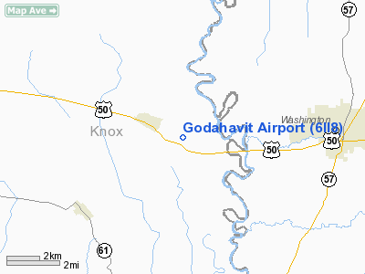
Location
& QuickFacts
|
FAA
Information Effective: |
2008-06-05 |
|
Airport
Identifier: |
6II8 |
|
Airport
Status: |
Operational |
|
Longitude/Latitude: |
087-16-58.0500W/38-39-16.1700N
-87.282792/38.654492 (Estimated) |
|
Elevation: |
495 ft / 150.88 m (Estimated) |
|
Land: |
0 acres |
|
From nearest
city: |
2 nautical miles E of Wheatland, IN |
|
Location: |
Knox County, IN |
|
Magnetic
Variation: |
01W (1990) |
Owner & Manager
|
Ownership: |
Privately
owned |
|
Owner: |
Phillip Watson |
|
Address: |
Rr 6; Box 74
Vincennes, IN 47591 |
|
Phone
number: |
812-882-3831 |
|
Manager: |
Phillip Watson |
|
Address: |
Rr 6; Box 74
Vincennes, IN 47591 |
|
Phone
number: |
812-882-3831 |
Airport
Operations and Facilities
|
Airport
Use: |
Private |
|
Segmented
Circle: |
No |
|
Control
Tower: |
No |
|
Sectional
chart: |
St Louis |
|
Region: |
AGL - Great Lakes |
|
Boundary
ARTCC: |
ZID - Indianapolis |
|
Tie-in
FSS: |
HUF - Terre Haute |
|
FSS Toll
Free: |
1-800-WX-BRIEF |
|
Runway Information
Runway 02/20
|
Dimension: |
2184 x 100 ft
/ 665.7 x 30.5 m |
|
Surface: |
TURF, |
|
|
Runway 02 |
Runway 20 |
|
Traffic
Pattern: |
Left |
Left |
|
Radio Navigation
Aids
|
ID |
Type |
Name |
Ch |
Freq |
Var |
Dist |
|
DCY |
NDB |
Washington |
|
212.00 |
03W |
7.5 nm |
|
OEA |
NDB |
Vincennes |
|
251.00 |
00E |
13.0 nm |
|
AJG |
NDB |
Mount Carmel |
|
524.00 |
02W |
21.0 nm |
|
PLX |
NDB |
Palestine |
|
391.00 |
00W |
27.3 nm |
|
SIV |
NDB |
Sullivan |
|
326.00 |
02W |
28.6 nm |
|
FNZ |
NDB |
Ferdinand |
|
239.00 |
00E |
32.1 nm |
|
RRJ |
NDB |
Oranj |
|
368.00 |
02W |
36.3 nm |
|
PDW |
NDB |
Evansville |
|
284.00 |
00E |
38.7 nm |
|
BM |
NDB |
Claye |
|
382.00 |
02W |
40.1 nm |
|
BFR |
NDB |
Bedford |
|
344.00 |
02W |
41.2 nm |
|
OLY |
NDB |
Olney |
|
272.00 |
00W |
41.9 nm |
|
HU |
NDB |
Yinno |
|
245.00 |
02W |
44.4 nm |
|
TEL |
NDB |
Tell City |
|
206.00 |
02W |
47.6 nm |
|
LWV |
VOR/DME |
Lawrenceville |
025X |
108.80 |
01W |
16.6 nm |
|
RSV |
VOR/DME |
Robinson |
021X |
108.40 |
02E |
27.8 nm |
|
HNB |
VOR/DME |
Huntingburg |
029X |
109.20 |
00E |
28.7 nm |
|
SAM |
VOR/DME |
Samsville |
113X |
116.60 |
03E |
39.1 nm |
|
OOM |
VORTAC |
Hoosier |
039X |
110.20 |
02W |
43.0 nm |
|
PXV |
VORTAC |
Pocket City |
080X |
113.30 |
03E |
49.2 nm |
Remarks
- PRVDD
THE AREA 125 FT EITHER SIDE OF RY CTR & 200 FT RY END BE CLEAR OF
ANY OBSTN; ANY OBSTN IN THE RY APCH SLOPE ARE REMOVED/LOWERED; OR THE
RY THR IS DSPLCD & CLEARLY MKD SO AS TO PRVD A MIN OF 20:1 APCH
CLNC OVER THE OBSTN.
Godahavit Airport
Address:
Knox County, IN
Tel:
812-882-3831
Images
and information placed above are from
http://www.airport-data.com/airport/6II8/
We
thank them for the data!
| General
Info |
| Country |
United
States |
| State |
INDIANA
|
| FAA ID |
6II8 |
| Latitude |
38-39-16.170N
|
| Longitude |
087-16-58.050W
|
| Elevation |
495 feet
|
| Near City |
WHEATLAND
|
We don't guarantee the information is fresh and accurate. The data may
be wrong or outdated.
For more up-to-date information please refer to other sources.
|
|


