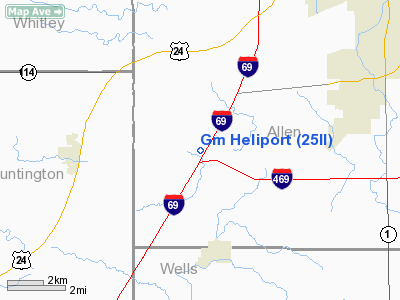
General Motors Corporation Heliport |
Location
& QuickFacts
|
FAA
Information Effective: |
2008-06-05 |
|
Airport
Identifier: |
25II |
|
Airport
Status: |
Operational |
|
Longitude/Latitude: |
085-17-26.9020W/40-57-58.1700N
-85.290806/40.966158 (Estimated) |
|
Elevation: |
837 ft / 255.12 m (Estimated) |
|
Land: |
0 acres |
|
From nearest
city: |
3 nautical miles NW of Aboite, IN |
|
Location: |
Allen County, IN |
|
Magnetic
Variation: |
03W (1985) |
Owner
& Manager
|
Ownership: |
Privately
owned |
|
Owner: |
General Motors Corp/truck/bus |
|
Address: |
12200 Lafayette Center Rd
Roanoke,
IN 46783 |
|
Phone
number: |
219-673-2000 |
|
Address: |
|
Airport Operations
and Facilities
|
Airport
Use: |
Private |
|
Wind indicator: |
Yes |
|
Segmented
Circle: |
No |
|
Control
Tower: |
No |
|
Landing
fee charge: |
No |
|
Sectional
chart: |
Chicago |
|
Region: |
AGL - Great Lakes |
|
Boundary
ARTCC: |
ZAU - Chicago |
|
Tie-in
FSS: |
HUF - Terre Haute |
|
FSS on
Airport: |
No |
|
FSS Toll
Free: |
1-800-WX-BRIEF |
|
Runway Information
Helipad H1
|
Dimension: |
80 x 80 ft /
24.4 x 24.4 m |
|
Surface: |
CONC, Good Condition |
|
Edge Lights: |
Medium |
|
|
Runway H1 |
Runway |
|
Traffic
Pattern: |
Left |
Left |
|
Radio Navigation
Aids
|
ID |
Type |
Name |
Ch |
Freq |
Var |
Dist |
|
HHG |
NDB |
Huntington |
|
417.00 |
03W |
10.3 nm |
|
IWH |
NDB |
Wabash |
|
329.00 |
03W |
26.1 nm |
|
VFU |
NDB |
Stanley |
|
411.00 |
05W |
31.4 nm |
|
PLD |
NDB |
Portland |
|
257.00 |
03W |
33.8 nm |
|
RCR |
NDB |
Rochester |
|
216.00 |
03W |
41.2 nm |
|
ANQ |
NDB |
Angola |
|
347.00 |
05W |
41.5 nm |
|
CQA |
NDB |
Lakefield |
|
205.00 |
04W |
44.1 nm |
|
DFI |
NDB |
Defiance |
|
246.00 |
05W |
44.9 nm |
|
BYN |
NDB |
Bryan |
|
260.00 |
04W |
48.4 nm |
|
OLK |
VOR |
Wolf Lake |
|
110.40 |
03W |
19.3 nm |
|
MZZ |
VOR/DME |
Marion |
023X |
108.60 |
03W |
33.5 nm |
|
MIE |
VOR/DME |
Muncie |
091X |
114.40 |
03W |
44.1 nm |
|
FWA |
VORTAC |
Fort Wayne |
125X |
117.80 |
00E |
4.7 nm |
|
GUS |
VORTAC |
Grissom |
21Y |
108.45 |
02W |
43.7 nm |
|
OKK |
VORTAC |
Kokomo |
082X |
113.50 |
00E |
43.8 nm |
|
GSH |
VORTAC |
Goshen |
084X |
113.70 |
00E |
47.3 nm |
|
FWA |
VOT |
Fort Wayne Baer |
|
111.00 |
|
4.6 nm |
Remarks
- ALL
OPNS ARE CONDUCTED IN AN AREA FM 360-210 DEGS; TFC ON ROAD IS RSTRD;
AREA IS MKD; WND INDCR IS MAINTD.
General Motors Corporation Heliport
Address:
Allen County, IN
Tel:
219-673-2000
Images
and information placed above are from
http://www.airport-data.com/airport/25II/
We
thank them for the data!
| General
Info |
| Country |
United
States |
| State |
INDIANA
|
| FAA ID |
25II |
| Latitude |
40-57-58.170N
|
| Longitude |
085-17-26.902W
|
| Elevation |
837 feet
|
| Near City |
ABOITE
|
We don't guarantee the information is fresh and accurate. The data may
be wrong or outdated.
For more up-to-date information please refer to other sources.
|


