 |
|
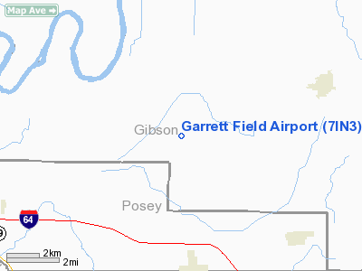
Location
& QuickFacts
|
FAA
Information Effective: |
2007-12-20 |
|
Airport
Identifier: |
7IN3 |
|
Airport
Status: |
Operational |
|
Longitude/Latitude: |
087-47-24.0000W/38-14-37.0000N
-87.790000/38.243611 (Estimated) |
|
Elevation: |
400 ft / 121.92 m (Estimated) |
|
Land: |
4 acres |
|
From nearest
city: |
5 nautical miles N of Poseyville, IN |
|
Location: |
Gibson County, IN |
|
Magnetic
Variation: |
02W (2000) |
Owner & Manager
|
Ownership: |
Privately
owned |
|
Owner: |
Scott Garrett |
|
Address: |
Rr1 Box 140
Owensville, IN 47665 |
|
Phone
number: |
812-874-2823 |
|
Manager: |
Scott Garrett |
|
Address: |
Rr1 Box 140
Owensville, IN 47665 |
|
Phone
number: |
812-874-2823 |
Airport
Operations and Facilities
|
Airport
Use: |
Private |
|
Segmented
Circle: |
Yes |
|
Control
Tower: |
No |
|
Sectional
chart: |
St Louis |
|
Region: |
AGL - Great Lakes |
|
Boundary
ARTCC: |
ZID - Indianapolis |
|
Tie-in
FSS: |
HUF - Terre Haute |
|
FSS Toll
Free: |
1-800-WX-BRIEF |
|
Runway Information
Runway 09/27
|
Dimension: |
2400 x 80 ft
/ 731.5 x 24.4 m |
|
Surface: |
TURF, |
|
|
Runway 09 |
Runway 27 |
|
Traffic
Pattern: |
Right |
Left |
|
Obstruction: |
20 ft pline, 1000.0 ft from runway |
20 ft trees, 900.0 ft from runway |
|
Radio Navigation
Aids
|
ID |
Type |
Name |
Ch |
Freq |
Var |
Dist |
|
PDW |
NDB |
Evansville |
|
284.00 |
00E |
17.3 nm |
|
CUL |
NDB |
Carmi |
|
332.00 |
01W |
18.0 nm |
|
AJG |
NDB |
Mount Carmel |
|
524.00 |
02W |
22.3 nm |
|
GVA |
NDB |
Geneva |
|
224.00 |
01W |
26.5 nm |
|
OEA |
NDB |
Vincennes |
|
251.00 |
00E |
29.1 nm |
|
FWC |
NDB |
Wayne County |
|
257.00 |
01E |
30.4 nm |
|
OLY |
NDB |
Olney |
|
272.00 |
00W |
33.7 nm |
|
FOA |
NDB |
Elm River |
|
353.00 |
00E |
40.3 nm |
|
DCY |
NDB |
Washington |
|
212.00 |
03W |
41.2 nm |
|
HSB |
NDB |
Harrisburg-raleigh |
|
230.00 |
00E |
44.2 nm |
|
FNZ |
NDB |
Ferdinand |
|
239.00 |
00E |
44.9 nm |
|
PLX |
NDB |
Palestine |
|
391.00 |
00W |
46.8 nm |
|
TWT |
NDB |
Tradewater |
|
276.00 |
00E |
47.3 nm |
|
SAM |
VOR/DME |
Samsville |
113X |
116.60 |
03E |
20.1 nm |
|
LWV |
VOR/DME |
Lawrenceville |
025X |
108.80 |
01W |
32.8 nm |
|
HNB |
VOR/DME |
Huntingburg |
029X |
109.20 |
00E |
39.4 nm |
|
OWB |
VOR/DME |
Owensboro |
023X |
108.60 |
01E |
42.2 nm |
|
RSV |
VOR/DME |
Robinson |
021X |
108.40 |
02E |
47.0 nm |
|
VNN |
VOR/DME |
Mount Vernon |
085X |
113.80 |
02E |
48.5 nm |
|
PXV |
VORTAC |
Pocket City |
080X |
113.30 |
03E |
19.0 nm |
Remarks
- ALL
TRAFFIC PATTERNS WILL BE FLOWN SOUTH OF THE AIRPORT, ANY OBSTRUCTION
TO THE RUNWAY APPROACH SURFACE OR PRIMARY SURFACE SHOULD BE LOWERED
OR REMOVED, OBJECT FREE ZONE IS KEPT CLEAR OF ANY AND ALL OBSTRUCTIONS,
RUNWAY SAFETY AREA.
Based Aircraft
|
Aircraft
based on field: |
2 |
|
Single Engine
Airplanes: |
2 |
Garrett Field Airport
Address:
Gibson County, IN
Tel:
812-874-2823
Images
and information placed above are from
http://www.airport-data.com/airport/7IN3/
We
thank them for the data!
| General
Info |
| Country |
United
States |
| State |
INDIANA
|
| FAA ID |
7IN3 |
| Latitude |
38-14-37.000N
|
| Longitude |
087-47-24.000W
|
| Elevation |
400 feet
|
| Near City |
POSEYVILLE
|
We don't guarantee the information is fresh and accurate. The data may
be wrong or outdated.
For more up-to-date information please refer to other sources.
|
|


