|
|
| Galveston Airport |
| IATA: none – ICAO: none – FAA LID: 5I6 |
| Summary |
| Airport type |
Public |
| Owner |
Galveston BOAC |
| Serves |
Galveston, Indiana |
| Elevation AMSL |
786 ft / 240 m |
| Coordinates |
40°35′03″N 086°15′25″W / 40.58417°N 86.25694°W / 40.58417; -86.25694 |
| Runways |
| Direction |
Length |
Surface |
| ft |
m |
| 18/36 |
2,720 |
829 |
Turf |
| Source: Federal Aviation Administration |
Galveston Airport (FAA LID: 5I6) is a public-use airport in unincorporated Cass County, Indiana, United States. The airport is located three nautical miles (6 km) northwest of the central business district of Galveston, Indiana.
Facilities
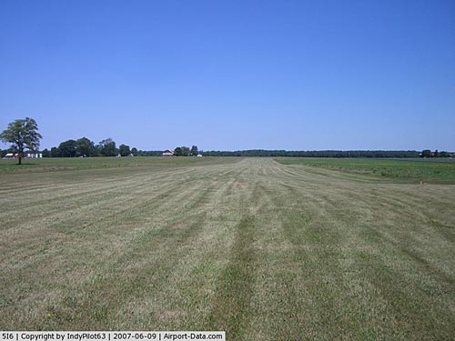
Galveston Airport covers an area of 272 acres (110 ha) at an elevation of 786 feet (240 m) above mean sea level. It has one runway designated 18/36 with a turf surface measuring 2,720 by 75 feet (829 x 23 m).
The above content comes from Wikipedia and is published under free licenses – click here to read more.
|
 |
(Click on the photo to enlarge) |
|
 |
(Click on the photo to enlarge) |
|
 |
(Click on the photo to enlarge) |
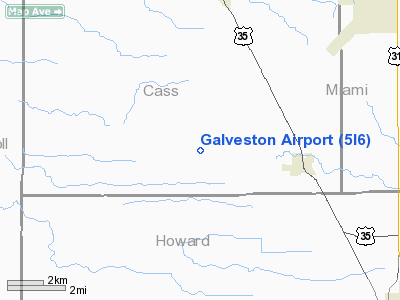
Location
& QuickFacts
|
FAA
Information Effective: |
2007-12-20 |
|
Airport
Identifier: |
5I6 |
|
Airport
Status: |
Operational |
|
Longitude/Latitude: |
086-15-24.9850W/40-35-03.1380N
-86.256940/40.584205 (Estimated) |
|
Elevation: |
786 ft / 239.57 m (Estimated) |
|
Land: |
272 acres |
|
From nearest
city: |
3 nautical miles NW of Galveston, IN |
|
Location: |
Cass County, IN |
|
Magnetic
Variation: |
02W (1985) |
Owner
& Manager
|
Ownership: |
Publicly
owned |
|
Owner: |
Galveston Boac |
|
Address: |
P O Box 597
Galveston,
IN 46932 |
|
Phone
number: |
574-699-6664 |
|
Manager: |
Bill Young & John Roberson |
|
Address: |
P O Box 597
Galveston,
IN 46932 |
|
Phone
number: |
574-699-6440 |
Airport Operations
and Facilities
|
Airport
Use: |
Open
to public |
|
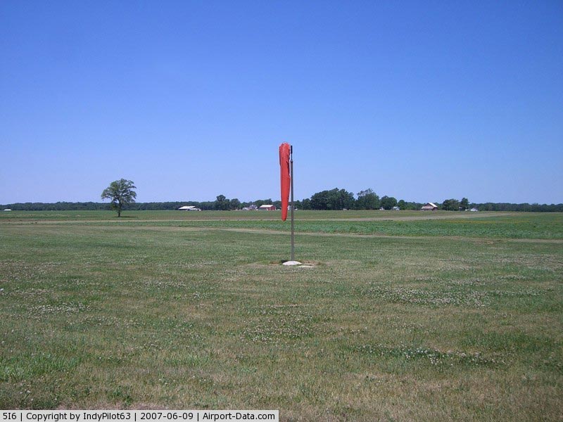
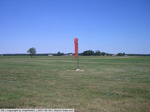
Wind indicator: |
Yes |
|
Segmented
Circle: |
Yes
BLACK & YELLOW GND LEVEL SEGMENTED CIRCLE. |
|
Control
Tower: |
No |
|
Landing
fee charge: |
No |
|
Sectional
chart: |
Chicago |
|
Region: |
AGL - Great Lakes |
|
Boundary
ARTCC: |
ZAU - Chicago |
|
Tie-in
FSS: |
HUF - Terre Haute |
|
FSS on
Airport: |
No |
|
FSS Toll
Free: |
1-800-WX-BRIEF |
|
NOTAMs
Facility: |
HUF (NOTAM-d service avaliable) |
|
Federal
Agreements: |
R |
Airport Communications
Airport
Services
|
Airframe
Repair: |
NONE |
|
Power
Plant Repair: |
NONE |
|
Bottled
Oxygen: |
NONE |
|
Bulk Oxygen: |
NONE |
|
Runway Information
Runway 18/36
|
Dimension: |
2720 x 75 ft
/ 829.1 x 22.9 m |
|
Surface: |
TURF, Good Condition |
|
|
Runway 18 |
Runway 36 |
|
Longitude: |
086-15-24.9800W |
086-15-24.9800W |
|
Latitude: |
40-35-26.6000N |
40-35-02.8800N |
|
Elevation: |
770.00 ft |
780.00 ft |
|
Traffic
Pattern: |
Right |
Left |
|
Displaced
threshold: |
200.00 ft |
200.00 ft |
|
Obstruction: |
10 ft crops, 8.0 ft from runway
APCH RATIO 25:1 TO DSPLCD THLD; 26 FT PLINE 650 FT FM THLD. |
10 ft crops, 0.0 ft from runway
APCH RATIO 20:1 TO DSPLCD THLD; 10 FT CROPS 200 FT FM THLD. |
|
Radio Navigation
Aids
|
ID |
Type |
Name |
Ch |
Freq |
Var |
Dist |
|
GGP |
NDB |
Logansport |
|
263.00 |
01W |
9.2 nm |
|
FKR |
NDB |
Frankfort |
|
278.00 |
02W |
23.5 nm |
|
IWH |
NDB |
Wabash |
|
329.00 |
03W |
23.6 nm |
|
MCX |
NDB |
White County |
|
377.00 |
03W |
24.3 nm |
|
RCR |
NDB |
Rochester |
|
216.00 |
03W |
29.1 nm |
|
RWN |
NDB |
Winamac/dcmsnd |
|
335.00 |
00W |
34.5 nm |
|
CPB |
NDB |
Culver |
|
391.00 |
01W |
38.5 nm |
|
HZP |
NDB |
Zionsville |
|
248.00 |
03W |
38.7 nm |
|
HHG |
NDB |
Huntington |
|
417.00 |
03W |
39.6 nm |
|
UMP |
NDB |
Metropolitan |
|
338.00 |
03W |
40.0 nm |
|
AI |
NDB |
Video |
|
371.00 |
03W |
46.1 nm |
|
CFJ |
NDB |
Crawfordsville |
|
388.00 |
02W |
47.2 nm |
|
RZL |
NDB |
Rensselaer |
|
362.00 |
02W |
47.5 nm |
|
MZZ |
VOR/DME |
Marion |
023X |
108.60 |
03W |
26.9 nm |
|
MIE |
VOR/DME |
Muncie |
091X |
114.40 |
03W |
44.7 nm |
|
OXI |
VOR/DME |
Knox |
103X |
115.60 |
00E |
47.8 nm |
|
GUS |
VORTAC |
Grissom |
21Y |
108.45 |
02W |
6.0 nm |
|
OKK |
VORTAC |
Kokomo |
082X |
113.50 |
00E |
9.7 nm |
|
BVT |
VORTAC |
Boiler |
098X |
115.10 |
01E |
37.1 nm |
|
VHP |
VORTAC |
Brickyard |
110X |
116.30 |
01E |
46.5 nm |
Remarks
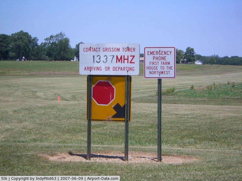
- INGRESS/EGRESS
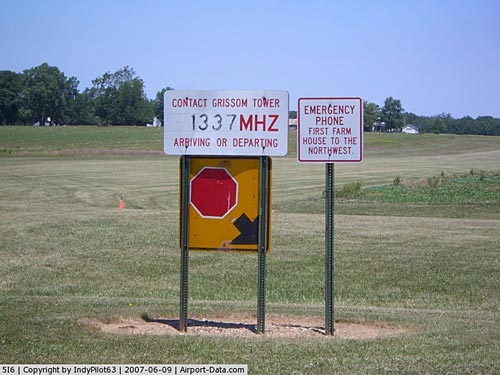
MUST BE COORDINATED WITH GRISSOM AFB APCH CTL & ATCT ON FREQ 133.7.
- CROPS
100 FT E & W OF CL ENTIRE LENGTH RY 18/36.
- EXISTED
PRIOR TO 1959.
Operational Statistics
Time
Period: 2004-01-02 - 2004-12-31
|
Aircraft
Operations: |
3/Month |
|
General Aviation
Itinerant: |
100.0% |
Galveston Airport
Address:
Cass County, IN
Tel:
574-699-6664,
574-699-6440
Images
and information placed above are from
http://www.airport-data.com/airport/5I6/
We
thank them for the data!
| General
Info |
| Country |
United
States |
| State |
INDIANA
|
| FAA ID |
5I6 |
| Latitude |
40-35-03.138N
|
| Longitude |
086-15-24.985W
|
| Elevation |
786 feet
|
| Near City |
GALVESTON
|
We don't guarantee the information is fresh and accurate. The data may
be wrong or outdated.
For more up-to-date information please refer to other sources.
|
|