 |
|
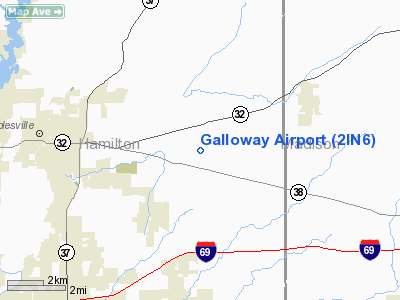
Location
& QuickFacts
|
FAA
Information Effective: |
2007-12-20 |
|
Airport
Identifier: |
2IN6 |
|
Airport
Status: |
Operational |
|
Longitude/Latitude: |
085-55-01.0000W/40-02-31.0000N
-85.916944/40.041944 (Estimated) |
|
Elevation: |
830 ft / 252.98 m (Estimated) |
|
Land: |
4 acres |
|
From nearest
city: |
5 nautical miles E of Noblesville, IN |
|
Location: |
Hamilton County, IN |
|
Magnetic
Variation: |
03W (1995) |
Owner & Manager
|
Ownership: |
Privately
owned |
|
Owner: |
Jim Galloway |
|
Address: |
17410 Middletown Ave
Noblesville,
IN 46060 |
|
Phone
number: |
317-773-0037 |
|
Manager: |
Jim Galloway |
|
Address: |
17410 Middletown Ave
Noblesville,
IN 46060 |
|
Phone
number: |
317-773-0037 |
Airport
Operations and Facilities
|
Airport
Use: |
Private |
|
Segmented
Circle: |
No |
|
Control
Tower: |
No |
|
Sectional
chart: |
Chicago |
|
Region: |
AGL - Great Lakes |
|
Boundary
ARTCC: |
ZID - Indianapolis |
|
Tie-in
FSS: |
HUF - Terre Haute |
|
FSS Toll
Free: |
1-800-WX-BRIEF |
|
Runway Information
Runway 09/27
|
Dimension: |
2000 x 85 ft
/ 609.6 x 25.9 m |
|
Surface: |
TURF, |
|
|
Runway 09 |
Runway 27 |
|
Traffic
Pattern: |
Right |
Left |
|
Displaced
threshold: |
0.00 ft |
500.00 ft
DSPLCD THLD MKD WITH 3 WHITE TIRES ON EACH SIDE OF RY. |
|
Obstruction: |
|
40 ft trees, 400.0 ft from runway |
|
Radio Navigation
Aids
|
ID |
Type |
Name |
Ch |
Freq |
Var |
Dist |
|
UMP |
NDB |
Metropolitan |
|
338.00 |
03W |
8.8 nm |
|
HZP |
NDB |
Zionsville |
|
248.00 |
03W |
16.5 nm |
|
AI |
NDB |
Video |
|
371.00 |
03W |
18.8 nm |
|
HFY |
NDB |
Greenwood |
|
398.00 |
02W |
25.9 nm |
|
UWL |
NDB |
New Castle |
|
385.00 |
02W |
29.2 nm |
|
FKR |
NDB |
Frankfort |
|
278.00 |
02W |
32.7 nm |
|
BA |
NDB |
Clifs |
|
410.00 |
03W |
43.5 nm |
|
IWH |
NDB |
Wabash |
|
329.00 |
03W |
43.7 nm |
|
GGP |
NDB |
Logansport |
|
263.00 |
01W |
45.2 nm |
|
TVX |
NDB |
Greencastle |
|
521.00 |
03W |
45.5 nm |
|
CFJ |
NDB |
Crawfordsville |
|
388.00 |
02W |
46.1 nm |
|
PLD |
NDB |
Portland |
|
257.00 |
03W |
49.5 nm |
|
MIE |
VOR/DME |
Muncie |
091X |
114.40 |
03W |
26.7 nm |
|
MZZ |
VOR/DME |
Marion |
023X |
108.60 |
03W |
29.2 nm |
|
VHP |
VORTAC |
Brickyard |
110X |
116.30 |
01E |
24.9 nm |
|
SHB |
VORTAC |
Shelbyville |
057X |
112.00 |
01E |
25.0 nm |
|
OKK |
VORTAC |
Kokomo |
082X |
113.50 |
00E |
29.9 nm |
|
GUS |
VORTAC |
Grissom |
21Y |
108.45 |
02W |
37.8 nm |
|
IND |
VOT |
Indianapolis Intl |
|
109.60 |
|
25.5 nm |
Remarks
- PRVDD
CLEAR 20:1 APCHS, CLEAR OBSTACLE FREE ZONE, AND TFC PATERN FLOWN TO
THE SOUTH SIDE OF APT TO AVOID LAZY 'B' ARPT.
Based Aircraft
|
Aircraft
based on field: |
1 |
|
Single Engine
Airplanes: |
1 |
Galloway Airport
Address:
Hamilton County, IN
Tel:
317-773-0037
Images
and information placed above are from
http://www.airport-data.com/airport/2IN6/
We
thank them for the data!
| General
Info |
| Country |
United
States |
| State |
INDIANA
|
| FAA ID |
2IN6 |
| Latitude |
40-02-31.000N
|
| Longitude |
085-55-01.000W
|
| Elevation |
830 feet
|
| Near City |
NOBLESVILLE
|
We don't guarantee the information is fresh and accurate. The data may
be wrong or outdated.
For more up-to-date information please refer to other sources.
|
|


