 |
|
|
|
|
|
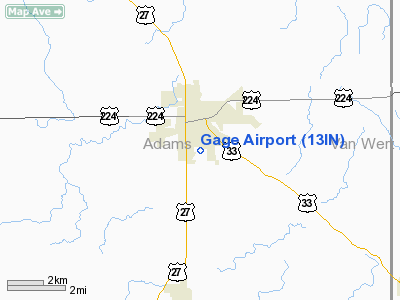
Location
& QuickFacts
|
FAA
Information Effective: |
2007-12-20 |
|
Airport
Identifier: |
13IN |
|
Airport
Status: |
Operational |
|
Longitude/Latitude: |
084-55-39.8780W/40-48-55.1700N
-84.927744/40.815325 (Estimated) |
|
Elevation: |
814 ft / 248.11 m (Estimated) |
|
Land: |
80 acres |
|
From nearest
city: |
1 nautical miles S of Decatur, IN |
|
Location: |
Adams County, IN |
|
Magnetic
Variation: |
04W (1985) |
Owner
& Manager
|
Ownership: |
Privately
owned |
|
Owner: |
Edward A.. Gage |
|
Address: |
1069 South Winchester Street
Decatur,
IN 46733 |
|
Phone
number: |
219-728-9462 |
|
Manager: |
Edward A.. Gage |
|
Address: |
1069 South Winchester Street
Decatur,
IN 46733 |
|
Phone
number: |
219-728-9462 |
Airport Operations
and Facilities
|
Airport
Use: |
Private |
|
Wind indicator: |
Yes |
|
Segmented
Circle: |
No |
|
Control
Tower: |
No |
|
Lighting
Schedule: |
PHONE REQ
FOR LIRL RY 18/36 & WINDSOCK CALL 219-728-9462. |
|
Landing
fee charge: |
Yes |
|
Sectional
chart: |
Detroit |
|
Region: |
AGL - Great Lakes |
|
Boundary
ARTCC: |
ZAU - Chicago |
|
Tie-in
FSS: |
HUF - Terre Haute |
|
FSS on
Airport: |
No |
|
FSS Toll
Free: |
1-800-WX-BRIEF |
Airport Services
|
Airframe
Repair: |
MINOR |
|
Power
Plant Repair: |
MINOR |
|
Runway Information
Runway 18/36
|
Dimension: |
2200 x 60 ft
/ 670.6 x 18.3 m |
|
Surface: |
TURF, Poor Condition |
|
Edge Lights: |
Low |
|
|
Runway 18 |
Runway 36 |
|
Traffic
Pattern: |
Left |
Left |
|
Markings: |
Basic, Good Condition |
Basic, Good Condition |
|
Displaced
threshold: |
400.00 ft |
0.00 ft |
|
Runway End
Identifier: |
No |
No |
|
Centerline
Lights: |
No |
No |
|
Touchdown
Lights: |
No |
No |
|
Radio Navigation
Aids
|
ID |
Type |
Name |
Ch |
Freq |
Var |
Dist |
|
VFU |
NDB |
Stanley |
|
411.00 |
05W |
14.6 nm |
|
PLD |
NDB |
Portland |
|
257.00 |
03W |
21.9 nm |
|
HHG |
NDB |
Huntington |
|
417.00 |
03W |
24.5 nm |
|
CQA |
NDB |
Lakefield |
|
205.00 |
04W |
26.0 nm |
|
DFI |
NDB |
Defiance |
|
246.00 |
05W |
38.6 nm |
|
IWH |
NDB |
Wabash |
|
329.00 |
03W |
39.7 nm |
|
VES |
NDB |
Versailles |
|
356.00 |
04W |
41.0 nm |
|
LYL |
NDB |
Lima |
|
362.00 |
04W |
41.7 nm |
|
BYN |
NDB |
Bryan |
|
260.00 |
04W |
45.1 nm |
|
PDR |
NDB |
Ottawa |
|
233.00 |
05W |
45.2 nm |
|
OLK |
VOR |
Wolf Lake |
|
110.40 |
03W |
36.6 nm |
|
AOH |
VOR |
Allen County |
|
108.40 |
04W |
44.2 nm |
|
MZZ |
VOR/DME |
Marion |
023X |
108.60 |
03W |
39.4 nm |
|
MIE |
VOR/DME |
Muncie |
091X |
114.40 |
03W |
40.8 nm |
|
FWA |
VORTAC |
Fort Wayne |
125X |
117.80 |
00E |
15.4 nm |
|
FWA |
VOT |
Fort Wayne Baer |
|
111.00 |
|
15.5 nm |
Remarks
Based Aircraft
|
Aircraft
based on field: |
7 |
|
Single Engine
Airplanes: |
1 |
|
Ultralights: |
6 |
Operational Statistics
Time
Period: 1979-12-03 - 1980-12-01
|
Aircraft
Operations: |
38/Month |
|
General Aviation
Local: |
77.8% |
|
General Aviation
Itinerant: |
22.2% |
Gage Airport
Address:
Adams County, IN
Tel:
219-728-9462
Images
and information placed above are from
http://www.airport-data.com/airport/13IN/
We
thank them for the data!
| General
Info |
| Country |
United
States |
| State |
INDIANA
|
| FAA ID |
13IN |
| Latitude |
40-48-55.170N
|
| Longitude |
084-55-39.878W
|
| Elevation |
814 feet
|
| Near City |
DECATUR
|
We don't guarantee the information is fresh and accurate. The data may
be wrong or outdated.
For more up-to-date information please refer to other sources.
|
|


