 |
|
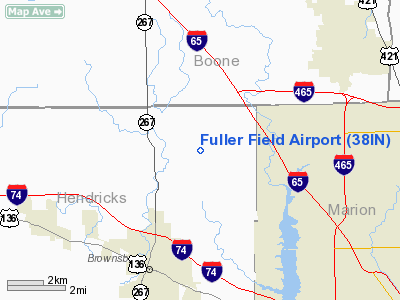
Location
& QuickFacts
|
FAA
Information Effective: |
2007-12-20 |
|
Airport
Identifier: |
38IN |
|
Airport
Status: |
Operational |
|
Longitude/Latitude: |
086-21-46.9830W/39-54-07.1510N
-86.363051/39.901986 (Estimated) |
|
Elevation: |
910 ft / 277.37 m (Estimated) |
|
Land: |
40 acres |
|
From nearest
city: |
4 nautical miles NE of Brownsburg, IN |
|
Location: |
Hendricks County, IN |
|
Magnetic
Variation: |
02W (1985) |
Owner
& Manager
|
Ownership: |
Privately
owned |
|
Owner: |
Estan L. Fuller |
|
Address: |
5980 Southwind Dr
Mulberry, FL 33860 |
|
Phone number: |
813-647-5469 |
|
Manager: |
Red Calvert |
|
Address: |
8837 Lincoln Cr. Cir.
Indianapolis, IN 46234 |
|
Phone number: |
317-299-6693 |
Airport
Operations and Facilities
|
Airport
Use: |
Private |
|
Wind indicator: |
Yes |
|
Segmented
Circle: |
No |
|
Control
Tower: |
No |
|
Landing
fee charge: |
No |
|
Sectional
chart: |
St Louis |
|
Region: |
AGL - Great Lakes |
|
Boundary
ARTCC: |
ZID - Indianapolis |
|
Tie-in FSS: |
HUF - Terre Haute |
|
FSS on Airport: |
No |
|
FSS Toll
Free: |
1-800-WX-BRIEF
OR LOCAL CALL 244-3316. |
|
Runway
Information
Runway
09/27
|
Dimension: |
2000 x 125 ft /
609.6 x 38.1 m |
|
Surface: |
TURF,
|
|
|
Runway
09 |
Runway
27 |
|
Traffic Pattern: |
Right |
Left |
|
Helipad
H1
|
Dimension: |
90 x 90 ft / 27.4
x 27.4 m |
|
Surface: |
CONC,
|
|
|
Runway
H1 |
Runway
|
|
Traffic Pattern: |
Left |
Left |
|
Radio
Navigation Aids
|
ID |
Type |
Name |
Ch |
Freq |
Var |
Dist |
|
HZP |
NDB |
Zionsville |
|
248.00 |
03W |
5.7
nm |
|
UMP |
NDB |
Metropolitan |
|
338.00 |
03W |
14.6
nm |
|
HFY |
NDB |
Greenwood |
|
398.00 |
02W |
20.5
nm |
|
TVX |
NDB |
Greencastle |
|
521.00 |
03W |
23.4
nm |
|
FKR |
NDB |
Frankfort |
|
278.00 |
02W |
24.0
nm |
|
CFJ |
NDB |
Crawfordsville |
|
388.00 |
02W |
25.9
nm |
|
AI |
NDB |
Video |
|
371.00 |
03W |
40.5
nm |
|
BA |
NDB |
Clifs |
|
410.00 |
03W |
43.0
nm |
|
UWL |
NDB |
New
Castle |
|
385.00 |
02W |
48.2
nm |
|
GGP |
NDB |
Logansport |
|
263.00 |
01W |
48.5
nm |
|
MZZ |
VOR/DME |
Marion |
023X |
108.60 |
03W |
47.4
nm |
|
MIE |
VOR/DME |
Muncie |
091X |
114.40 |
03W |
48.9
nm |
|
VHP |
VORTAC |
Brickyard |
110X |
116.30 |
01E |
5.3
nm |
|
SHB |
VORTAC |
Shelbyville |
057X |
112.00 |
01E |
29.7
nm |
|
OKK |
VORTAC |
Kokomo |
082X |
113.50 |
00E |
40.1
nm |
|
GUS |
VORTAC |
Grissom |
21Y |
108.45 |
02W |
45.7
nm |
|
OOM |
VORTAC |
Hoosier |
039X |
110.20 |
02W |
47.0
nm |
|
TTH |
VORTAC |
Terre
Haute |
100X |
115.30 |
02E |
47.9
nm |
|
IND |
VOT |
Indianapolis Intl |
|
109.60 |
|
11.3
nm |
Remarks
- (E111-2)
HEL ASP: INGRESS/EGRESS HOP ARE CONDUCTED FROM 110-360 DEGS CLKWS USING
PAD AS CENTER OF A COMPASS ROSE.
- PROVIDED
RWY THRS ARE CLEARLY MARKED AND DSPLCD AS NECESSARY; SO AS TO PROVIDE
A MIN 20:1 APCH CLEARANCE OVER ALL OBSTACLES WITHIN THE RWY;. APCH SURFACE
AREAS AND SUFFICIENT REMAINING USABLE RWY LENGTH IS AVBL TO PERMIT SAFE
LANDINGS/DEPARTURES BY TYPE ACFT USING THE RWY.
Based Aircraft
|
Aircraft
based on field: |
8 |
|
Single Engine
Airplanes: |
5 |
|
Multi Engine Airplanes: |
1 |
|
Helicopters: |
2 |
Fuller Field Airport
Address: Hendricks
County, IN
Tel:
813-647-5469,
317-299-6693
Images
and information placed above are from
http://www.airport-data.com/airport/38IN/
We
thank them for the data!
| General
Info |
| Country |
United
States |
| State |
INDIANA
|
| FAA ID |
38IN |
| Latitude |
39-54-07.151N
|
| Longitude |
086-21-46.983W
|
| Elevation |
910 feet
|
| Near City |
BROWNSBURG
|
We don't guarantee the information is fresh and accurate. The data may
be wrong or outdated.
For more up-to-date information please refer to other sources.
|
|


