 |
|
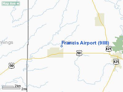
Location
& QuickFacts
|
FAA
Information Effective: |
2007-12-20 |
|
Airport
Identifier: |
9II8 |
|
Airport
Status: |
Operational |
|
Longitude/Latitude: |
085-22-16.0000W/39-05-10.0000N
-85.371111/39.086111 (Estimated) |
|
Elevation: |
920 ft / 280.42 m (Estimated) |
|
Land: |
0 acres |
|
From nearest
city: |
2 nautical miles SW of Holton, IN |
|
Location: |
Ripley County, IN |
|
Magnetic
Variation: |
03W (1995) |
Owner & Manager
|
Ownership: |
Privately
owned |
|
Owner: |
Ronald R. Francis |
|
Address: |
991 N 600 W
Holton, IN 47023 |
|
Phone
number: |
812-689-4110 |
|
Manager: |
Ronald R. Francis |
|
Address: |
991 N 600 W
Holton, IN 47023 |
|
Phone
number: |
812-689-4110 |
Airport
Operations and Facilities
|
Airport
Use: |
Private |
|
Segmented
Circle: |
No |
|
Control
Tower: |
No |
|
Sectional
chart: |
St Louis |
|
Region: |
AGL - Great Lakes |
|
Boundary
ARTCC: |
ZID - Indianapolis |
|
Tie-in
FSS: |
HUF - Terre Haute |
|
FSS on
Airport: |
No |
|
FSS Toll
Free: |
1-800-WX-BRIEF |
|
Runway Information
Runway 07/25
|
Dimension: |
1800 x 100 ft
/ 548.6 x 30.5 m |
|
Surface: |
TURF, Good Condition |
|
|
Runway 07 |
Runway 25 |
|
Traffic
Pattern: |
Left |
Left |
|
Obstruction: |
100 ft tree, 1000.0 ft from runway |
|
|
Radio Navigation
Aids
|
ID |
Type |
Name |
Ch |
Freq |
Var |
Dist |
|
OVO |
NDB |
North Vernon |
|
374.00 |
02W |
11.0 nm |
|
HLB |
NDB |
Batesville |
|
254.00 |
02W |
16.7 nm |
|
IMS |
NDB |
Madison |
|
404.00 |
03W |
20.0 nm |
|
BA |
NDB |
Clifs |
|
410.00 |
03W |
25.2 nm |
|
UR |
NDB |
Burln |
|
321.00 |
04W |
28.0 nm |
|
EQZ |
NDB |
Captain |
|
308.00 |
02W |
31.0 nm |
|
OXD |
NDB |
Oxford |
|
282.00 |
04W |
37.4 nm |
|
HAO |
NDB |
Hamilton |
|
260.00 |
04W |
41.0 nm |
|
ISZ |
NDB |
Cincinnati-blue Ash |
|
388.00 |
04W |
46.8 nm |
|
HFY |
NDB |
Greenwood |
|
398.00 |
02W |
46.9 nm |
|
UWL |
NDB |
New Castle |
|
385.00 |
02W |
47.8 nm |
|
MDE |
NDB |
Madeira |
|
379.00 |
04W |
48.1 nm |
|
LUK |
NDB |
Cincinnati |
|
335.00 |
04W |
48.2 nm |
|
HKF |
NDB |
Hook Field |
|
239.00 |
04W |
49.6 nm |
|
CVG |
VORTAC |
Cincinnati |
120X |
117.30 |
04W |
31.5 nm |
|
ABB |
VORTAC |
Nabb |
071X |
112.40 |
01E |
32.4 nm |
|
SHB |
VORTAC |
Shelbyville |
057X |
112.00 |
01E |
39.0 nm |
|
RID |
VORTAC |
Richmond |
043X |
110.60 |
03W |
47.2 nm |
|
LUK |
VOT |
Cincinnati Muni/lunken |
|
108.40 |
|
45.3 nm |
Remarks
- PRVDD
OBSTNS REMOVED/LOWERED OR THLD DSPLCD TO PROVIDE 20:1 APCH CLNC; AREA
125 FT EITHER SIDE OF RY & 200 FT OFF RY ENDS IS CLEAR OF OBSTNS;
AREA 60 FT EITHER SIDE OF RY & 240 FT OFF RY ENDS IS CLEARED &
GRADED WITH NO HAZARDOUS SFC VARIATIONS.
Based Aircraft
|
Aircraft
based on field: |
1 |
|
Single Engine
Airplanes: |
1 |
Francis Airport
Address:
Ripley County, IN
Tel:
812-689-4110
Images
and information placed above are from
http://www.airport-data.com/airport/9II8/
We
thank them for the data!
| General
Info |
| Country |
United
States |
| State |
INDIANA
|
| FAA ID |
9II8 |
| Latitude |
39-05-10.000N
|
| Longitude |
085-22-16.000W
|
| Elevation |
920 feet
|
| Near City |
HOLTON
|
We don't guarantee the information is fresh and accurate. The data may
be wrong or outdated.
For more up-to-date information please refer to other sources.
|
|


