 |
|
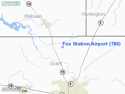
Location
& QuickFacts
|
FAA
Information Effective: |
2007-12-20 |
|
Airport
Identifier: |
78II |
|
Airport
Status: |
Operational |
|
Longitude/Latitude: |
085-41-16.9250W/40-38-10.1490N
-85.688035/40.636153 (Estimated) |
|
Elevation: |
835 ft / 254.51 m (Estimated) |
|
Land: |
0 acres |
|
From nearest
city: |
3 nautical miles SE of La Fontaine, IN |
|
Location: |
Grant County, IN |
|
Magnetic
Variation: |
03W (1990) |
Owner & Manager
|
Ownership: |
Privately
owned |
|
Owner: |
Arndt E. Mueller |
|
Address: |
2485 Breezewood Drive
Marion,
IN 46952 |
|
Phone
number: |
765-664-5134 |
|
Manager: |
Darrel Parris |
|
Address: |
899 W 600 N
Marion, IN 46952 |
|
Phone
number: |
317-981-2323 |
Airport
Operations and Facilities
|
Airport
Use: |
Private |
|
Segmented
Circle: |
No |
|
Control
Tower: |
No |
|
Sectional
chart: |
Chicago |
|
Region: |
AGL - Great Lakes |
|
Boundary
ARTCC: |
ZAU - Chicago |
|
Tie-in
FSS: |
HUF - Terre Haute |
|
FSS on
Airport: |
No |
|
FSS Toll
Free: |
1-800-WX-BRIEF |
|
Runway Information
Runway 09/27
|
Dimension: |
1850 x 100 ft
/ 563.9 x 30.5 m |
|
Surface: |
TURF, |
|
|
Runway 09 |
Runway 27 |
|
Traffic
Pattern: |
Left |
Left |
|
Obstruction: |
|
40 ft trees, 850.0 ft from runway |
|
Radio Navigation
Aids
|
ID |
Type |
Name |
Ch |
Freq |
Var |
Dist |
|
IWH |
NDB |
Wabash |
|
329.00 |
03W |
9.1 nm |
|
HHG |
NDB |
Huntington |
|
417.00 |
03W |
16.7 nm |
|
GGP |
NDB |
Logansport |
|
263.00 |
01W |
31.6 nm |
|
PLD |
NDB |
Portland |
|
257.00 |
03W |
34.0 nm |
|
RCR |
NDB |
Rochester |
|
216.00 |
03W |
34.4 nm |
|
AI |
NDB |
Video |
|
371.00 |
03W |
35.0 nm |
|
UMP |
NDB |
Metropolitan |
|
338.00 |
03W |
45.1 nm |
|
FKR |
NDB |
Frankfort |
|
278.00 |
02W |
45.6 nm |
|
CPB |
NDB |
Culver |
|
391.00 |
01W |
47.1 nm |
|
UWL |
NDB |
New Castle |
|
385.00 |
02W |
48.5 nm |
|
HZP |
NDB |
Zionsville |
|
248.00 |
03W |
49.1 nm |
|
MCX |
NDB |
White County |
|
377.00 |
03W |
49.2 nm |
|
RWN |
NDB |
Winamac/dcmsnd |
|
335.00 |
00W |
49.9 nm |
|
OLK |
VOR |
Wolf Lake |
|
110.40 |
03W |
37.7 nm |
|
MZZ |
VOR/DME |
Marion |
023X |
108.60 |
03W |
8.6 nm |
|
MIE |
VOR/DME |
Muncie |
091X |
114.40 |
03W |
27.5 nm |
|
OKK |
VORTAC |
Kokomo |
082X |
113.50 |
00E |
18.1 nm |
|
GUS |
VORTAC |
Grissom |
21Y |
108.45 |
02W |
21.2 nm |
|
FWA |
VORTAC |
Fort Wayne |
125X |
117.80 |
00E |
30.7 nm |
|
FWA |
VOT |
Fort Wayne Baer |
|
111.00 |
|
30.6 nm |
Remarks
- PROVIDED
OBSTRUCTIONS REMOVED/LOWERED OR THR DSPLCD TO PROVIDE 20:1 APCH SLOPE;
AREA 125 FT EITHER SIDE OF CENTERLINE & 200 FT AT ENDS BE CLEAR
OF OBSTRUCTIONS.
Fox Station Airport
Address:
Grant County, IN
Tel:
765-664-5134,
317-981-2323
Images
and information placed above are from
http://www.airport-data.com/airport/78II/
We
thank them for the data!
| General
Info |
| Country |
United
States |
| State |
INDIANA
|
| FAA ID |
78II |
| Latitude |
40-38-10.149N
|
| Longitude |
085-41-16.925W
|
| Elevation |
835 feet
|
| Near City |
LA FONTAINE
|
We don't guarantee the information is fresh and accurate. The data may
be wrong or outdated.
For more up-to-date information please refer to other sources.
|
|


