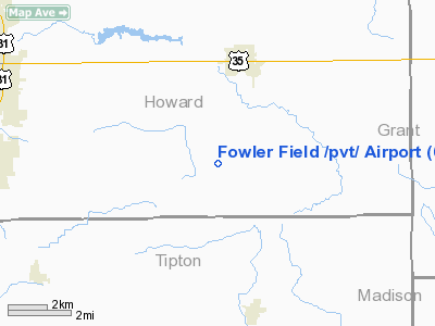
Fowler Field private Airport |
Location
& QuickFacts
|
FAA
Information Effective: |
2007-12-20 |
|
Airport
Identifier: |
62IN |
|
Airport
Status: |
Operational |
|
Longitude/Latitude: |
085-58-41.9510W/40-25-51.1370N
-85.978320/40.430871 (Estimated) |
|
Elevation: |
854 ft / 260.30 m (Estimated) |
|
Land: |
0 acres |
|
From nearest
city: |
3 nautical miles S of Greentown, IN |
|
Location: |
Howard County, IN |
|
Magnetic
Variation: |
02W (1985) |
Owner & Manager
|
Ownership: |
Privately
owned |
|
Owner: |
Vernon R. Fowler |
|
Address: |
3287 S. 800e
Kokomo, IN 46902 |
|
Phone
number: |
317-628-7213 |
|
Address: |
|
Airport
Operations and Facilities
|
Airport
Use: |
Private |
|
Segmented
Circle: |
No |
|
Control
Tower: |
No |
|
Sectional
chart: |
Chicago |
|
Region: |
AGL - Great Lakes |
|
Boundary
ARTCC: |
ZAU - Chicago |
|
Tie-in
FSS: |
HUF - Terre Haute |
|
FSS on
Airport: |
No |
|
FSS Toll
Free: |
1-800-WX-BRIEF |
|
Runway Information
Runway 09/27
|
Dimension: |
1600 x 90 ft
/ 487.7 x 27.4 m |
|
Surface: |
TURF, |
|
|
Runway 09 |
Runway 27 |
|
Traffic
Pattern: |
Left |
Right |
|
Radio Navigation
Aids
|
ID |
Type |
Name |
Ch |
Freq |
Var |
Dist |
|
IWH |
NDB |
Wabash |
|
329.00 |
03W |
21.6 nm |
|
GGP |
NDB |
Logansport |
|
263.00 |
01W |
24.6 nm |
|
FKR |
NDB |
Frankfort |
|
278.00 |
02W |
28.5 nm |
|
UMP |
NDB |
Metropolitan |
|
338.00 |
03W |
29.8 nm |
|
AI |
NDB |
Video |
|
371.00 |
03W |
30.5 nm |
|
HZP |
NDB |
Zionsville |
|
248.00 |
03W |
32.0 nm |
|
HHG |
NDB |
Huntington |
|
417.00 |
03W |
34.7 nm |
|
RCR |
NDB |
Rochester |
|
216.00 |
03W |
39.3 nm |
|
MCX |
NDB |
White County |
|
377.00 |
03W |
39.5 nm |
|
UWL |
NDB |
New Castle |
|
385.00 |
02W |
44.9 nm |
|
PLD |
NDB |
Portland |
|
257.00 |
03W |
45.5 nm |
|
HFY |
NDB |
Greenwood |
|
398.00 |
02W |
48.3 nm |
|
RWN |
NDB |
Winamac/dcmsnd |
|
335.00 |
00W |
49.0 nm |
|
MZZ |
VOR/DME |
Marion |
023X |
108.60 |
03W |
14.2 nm |
|
MIE |
VOR/DME |
Muncie |
091X |
114.40 |
03W |
29.2 nm |
|
OKK |
VORTAC |
Kokomo |
082X |
113.50 |
00E |
6.9 nm |
|
GUS |
VORTAC |
Grissom |
21Y |
108.45 |
02W |
15.1 nm |
|
VHP |
VORTAC |
Brickyard |
110X |
116.30 |
01E |
41.1 nm |
|
SHB |
VORTAC |
Shelbyville |
057X |
112.00 |
01E |
48.5 nm |
|
FWA |
VORTAC |
Fort Wayne |
125X |
117.80 |
00E |
48.8 nm |
|
IND |
VOT |
Indianapolis Intl |
|
109.60 |
|
44.7 nm |
|
FWA |
VOT |
Fort Wayne Baer |
|
111.00 |
|
48.7 nm |
Remarks
- PRVDD
COMPLIANCE IS MAINTD AS STIPULATED IN THE LETTER OF AGREEMENT WITH HOWARD
COUNTY ARPT.
Based Aircraft
|
Aircraft
based on field: |
2 |
|
Single Engine
Airplanes: |
2 |
Fowler Field /private/
Airport
Address:
Howard County, IN
Tel:
317-628-7213
Images
and information placed above are from
http://www.airport-data.com/airport/62IN/
We
thank them for the data!
| General
Info |
| Country |
United
States |
| State |
INDIANA
|
| FAA ID |
62IN |
| Latitude |
40-25-51.137N
|
| Longitude |
085-58-41.951W
|
| Elevation |
854 feet
|
| Near City |
GREENTOWN
|
We don't guarantee the information is fresh and accurate. The data may
be wrong or outdated.
For more up-to-date information please refer to other sources.
|


