 |
|
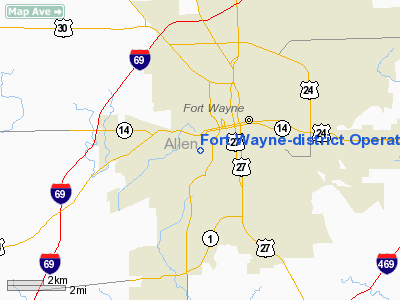
Fort Wayne-district Operations Heliport |
Location
& QuickFacts
|
FAA
Information Effective: |
2007-12-20 |
|
Airport
Identifier: |
5II7 |
|
Airport
Status: |
Operational |
|
Longitude/Latitude: |
085-09-36.0000W/41-03-52.0000N
-85.160000/41.064444 (Estimated) |
|
Elevation: |
785 ft / 239.27 m (Estimated) |
|
Land: |
0 acres |
|
From nearest
city: |
0 nautical miles N of Fort Wayne, IN |
|
Location: |
Allen County, IN |
|
Magnetic
Variation: |
04W (1995) |
Owner
& Manager
|
Ownership: |
Privately
owned |
|
Owner: |
Northern Indiana Pub Svc Co |
|
Address: |
1705 E. Main Street
Griffith,
IN 46319 |
|
Phone
number: |
219-853-5095 |
|
Manager: |
Michael Kwiat |
|
Address: |
1705 E. Main Street
Griffith,
IN 46319 |
|
Phone
number: |
219-853-5095 |
Airport Operations
and Facilities
|
Airport
Use: |
Private |
|
Wind indicator: |
Yes |
|
Segmented
Circle: |
No |
|
Control
Tower: |
No |
|
Lighting
Schedule: |
DUSK-DAWN |
|
Sectional
chart: |
Chicago |
|
Region: |
AGL - Great Lakes |
|
Boundary
ARTCC: |
ZAU - Chicago |
|
Tie-in
FSS: |
HUF - Terre Haute |
|
FSS on
Airport: |
No |
|
FSS Toll
Free: |
1-800-WX-BRIEF |
|
Runway Information
Helipad H1
|
Dimension: |
30 x 30 ft /
9.1 x 9.1 m |
|
Surface: |
CONC, |
|
|
Runway H1 |
Runway |
|
Traffic
Pattern: |
Left |
Left |
|
Radio Navigation
Aids
|
ID |
Type |
Name |
Ch |
Freq |
Var |
Dist |
|
HHG |
NDB |
Huntington |
|
417.00 |
03W |
18.7 nm |
|
VFU |
NDB |
Stanley |
|
411.00 |
05W |
27.6 nm |
|
IWH |
NDB |
Wabash |
|
329.00 |
03W |
34.1 nm |
|
ANQ |
NDB |
Angola |
|
347.00 |
05W |
34.7 nm |
|
DFI |
NDB |
Defiance |
|
246.00 |
05W |
36.9 nm |
|
PLD |
NDB |
Portland |
|
257.00 |
03W |
37.6 nm |
|
BYN |
NDB |
Bryan |
|
260.00 |
04W |
40.1 nm |
|
CQA |
NDB |
Lakefield |
|
205.00 |
04W |
44.3 nm |
|
IRS |
NDB |
Sturgis |
|
382.00 |
04W |
46.7 nm |
|
RCR |
NDB |
Rochester |
|
216.00 |
03W |
46.7 nm |
|
OLK |
VOR |
Wolf Lake |
|
110.40 |
03W |
18.8 nm |
|
MZZ |
VOR/DME |
Marion |
023X |
108.60 |
03W |
41.7 nm |
|
FWA |
VORTAC |
Fort Wayne |
125X |
117.80 |
00E |
5.3 nm |
|
GSH |
VORTAC |
Goshen |
084X |
113.70 |
00E |
48.0 nm |
|
FWA |
VOT |
Fort Wayne Baer |
|
111.00 |
|
5.4 nm |
Remarks
- OWNER
DESIRES HELIPORT NOT BE CHARTED.
- PRVDD
ALL APCH/DEP FM 100 CLKWS TO 045; AREA IS MKD; WIND INDICATOR IS MAINTAINED;
COMPLY WITH FAR PART 91.126(B)2; TREES AT 270 LOWERED FOR CLEAR 8:1;
LGT THE POLES AT 200 DEGS, 340 & 030; NO NIGHT OPNS UNLESS WIND
INDICATOR LGTD & BCN INSTALLED.
Fort Wayne-district Operations Heliport
Address:
Allen County, IN
Tel:
219-853-5095
Images
and information placed above are from
http://www.airport-data.com/airport/5II7/
We
thank them for the data!
| General
Info |
| Country |
United
States |
| State |
INDIANA
|
| FAA ID |
5II7 |
| Latitude |
41-03-52.000N
|
| Longitude |
085-09-36.000W
|
| Elevation |
785 feet
|
| Near City |
FORT WAYNE
|
We don't guarantee the information is fresh and accurate. The data may
be wrong or outdated.
For more up-to-date information please refer to other sources.
|
|


