 |
|
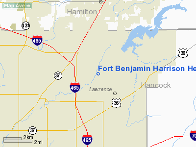
Fort Benjamin Harrison Helipad Heliport |
Location
& QuickFacts
|
FAA
Information Effective: |
2007-12-20 |
|
Airport
Identifier: |
91I |
|
Airport
Status: |
Operational |
|
Longitude/Latitude: |
086-00-59.9400W/39-53-00.1410N
-86.016650/39.883373 (Estimated) |
|
Elevation: |
860 ft / 262.13 m (Estimated) |
|
Land: |
0 acres |
|
From nearest
city: |
1 nautical miles NE of Fort Benjamin Harrison,
IN |
|
Location: |
Parke County, IN |
|
Magnetic
Variation: |
02W (1985) |
Owner & Manager
|
Ownership: |
Army
owned |
|
Owner: |
Us Army Atca-aso |
|
Address: |
Cameron Station
Alexandria, VA 22314 |
|
Manager: |
Us Army |
|
Address: |
Cameron Station
Alexandria, VA 22314 |
|
Phone
number: |
703-274-7773 |
Airport
Operations and Facilities
|
Airport
Use: |
Private |
|
Segmented
Circle: |
No |
|
Control
Tower: |
No |
|
Sectional
chart: |
St Louis |
|
Region: |
AGL - Great Lakes |
|
Boundary
ARTCC: |
ZID - Indianapolis |
|
Tie-in
FSS: |
HUF - Terre Haute |
|
FSS Toll
Free: |
1-800-WX-BRIEF |
|
Runway Information
Helipad H1
|
Dimension: |
86 x 86 ft /
26.2 x 26.2 m |
|
Surface: |
CONC, |
|
|
Runway H1 |
Runway |
|
Traffic
Pattern: |
Left |
Left |
|
Radio Navigation
Aids
|
ID |
Type |
Name |
Ch |
Freq |
Var |
Dist |
|
UMP |
NDB |
Metropolitan |
|
338.00 |
03W |
3.6 nm |
|
HZP |
NDB |
Zionsville |
|
248.00 |
03W |
11.3 nm |
|
HFY |
NDB |
Greenwood |
|
398.00 |
02W |
15.5 nm |
|
AI |
NDB |
Video |
|
371.00 |
03W |
25.9 nm |
|
UWL |
NDB |
New Castle |
|
385.00 |
02W |
32.2 nm |
|
FKR |
NDB |
Frankfort |
|
278.00 |
02W |
34.2 nm |
|
BA |
NDB |
Clifs |
|
410.00 |
03W |
35.0 nm |
|
TVX |
NDB |
Greencastle |
|
521.00 |
03W |
37.8 nm |
|
CFJ |
NDB |
Crawfordsville |
|
388.00 |
02W |
41.9 nm |
|
HLB |
NDB |
Batesville |
|
254.00 |
02W |
47.6 nm |
|
MIE |
VOR/DME |
Muncie |
091X |
114.40 |
03W |
35.7 nm |
|
MZZ |
VOR/DME |
Marion |
023X |
108.60 |
03W |
39.8 nm |
|
VHP |
VORTAC |
Brickyard |
110X |
116.30 |
01E |
16.7 nm |
|
SHB |
VORTAC |
Shelbyville |
057X |
112.00 |
01E |
17.5 nm |
|
OKK |
VORTAC |
Kokomo |
082X |
113.50 |
00E |
38.8 nm |
|
GUS |
VORTAC |
Grissom |
21Y |
108.45 |
02W |
46.2 nm |
|
IND |
VOT |
Indianapolis Intl |
|
109.60 |
|
15.6 nm |
Remarks
- PPR,
AUTOVON 699-3303/2227, COML 317-542-3303
- 50FT
TREES E, S, W. 30FT PLINES S.
- NO
FUEL OF SERVICE AVBL.
- HELIPAD
ABANDONED.
Fort Benjamin Harrison Helipad Heliport
Address:
Parke County, IN
Tel:
703-274-7773
Images
and information placed above are from
http://www.airport-data.com/airport/91I/
We
thank them for the data!
| General
Info |
| Country |
United
States |
| State |
INDIANA
|
| FAA ID |
91I |
| Latitude |
39-53-00.141N
|
| Longitude |
086-00-59.940W
|
| Elevation |
860 feet
|
| Near City |
FORT BENJAMIN
HARRISON |
We don't guarantee the information is fresh and accurate. The data may
be wrong or outdated.
For more up-to-date information please refer to other sources.
|
|


