 |
|
|
|
|
|
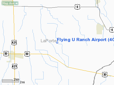
Location
& QuickFacts
|
FAA
Information Effective: |
2007-12-20 |
|
Airport
Identifier: |
4C1 |
|
Airport
Status: |
Operational |
|
Longitude/Latitude: |
086-47-32.0780W/41-27-14.1510N
-86.792244/41.453931 (Estimated) |
|
Elevation: |
740 ft / 225.55 m (Estimated) |
|
Land: |
10 acres |
|
From nearest
city: |
3 nautical miles SW of Union Mills, IN |
|
Location: |
La Porte County, IN |
|
Magnetic
Variation: |
02W (1985) |
Owner
& Manager
|
Ownership: |
Privately
owned |
|
Owner: |
Dr. L. G. Uridel |
|
Address: |
Flying U Ranch
Union Mills, IN 46382 |
|
Phone
number: |
219-767-2412 |
|
Manager: |
Dr. L. G. Uridel |
|
Address: |
Flying U Ranch
Union Mills, IN 46382 |
|
Phone
number: |
219-767-2412 |
Airport Operations
and Facilities
|
Airport
Use: |
Open
to public |
|
Wind indicator: |
Yes |
|
Segmented
Circle: |
No |
|
Control
Tower: |
No |
|
Landing
fee charge: |
No |
|
Sectional
chart: |
Chicago |
|
Region: |
AGL - Great Lakes |
|
Boundary
ARTCC: |
ZAU - Chicago |
|
Tie-in
FSS: |
HUF - Terre Haute |
|
FSS on
Airport: |
No |
|
FSS Toll
Free: |
1-800-WX-BRIEF |
|
NOTAMs
Facility: |
HUF (NOTAM-d service avaliable) |
Airport Communications
|
CTAF: |
122.800 |
|
Unicom: |
122.800
UNICOM NOT RGLRLY MONTRD. |
Airport Services
|
Fuel
available: |
100LL |
|
Bottled
Oxygen: |
NONE |
|
Bulk Oxygen: |
NONE |
|
Runway Information
Runway 18/36
|
Dimension: |
2745 x 100 ft
/ 836.7 x 30.5 m |
|
Surface: |
TURF, Good Condition |
|
|
Runway 18 |
Runway 36 |
|
Longitude: |
086-47-28.0700W |
086-47-28.0700W |
|
Latitude: |
41-27-21.9500N |
41-26-54.8200N |
|
Elevation: |
725.00 ft |
725.00 ft |
|
Traffic
Pattern: |
Left |
Left |
|
Displaced
threshold: |
400.00 ft |
470.00 ft |
|
Obstruction: |
10 ft crops, 20.0 ft from runway, 2:1 slope
to clear
APCH RATIO 42:1 TO DSPLCD THLD; TREES 40 FT TALL 450 FT FM
RY END. |
24 ft bldg, 20.0 ft from runway
APCH RATIO 19:1TO DSPLCD THLD; 24 FT BLDG 470 FT FM THLD. |
|
Radio Navigation
Aids
|
ID |
Type |
Name |
Ch |
Freq |
Var |
Dist |
|
IUL |
NDB |
La Porte |
|
356.00 |
03W |
2.9 nm |
|
VP |
NDB |
Sedly |
|
212.00 |
02W |
3.8 nm |
|
MGC |
NDB |
Michigan City |
|
203.00 |
01W |
15.3 nm |
|
RWN |
NDB |
Winamac/dcmsnd |
|
335.00 |
00W |
23.2 nm |
|
CPB |
NDB |
Culver |
|
391.00 |
01W |
23.3 nm |
|
RZL |
NDB |
Rensselaer |
|
362.00 |
02W |
35.2 nm |
|
RCR |
NDB |
Rochester |
|
216.00 |
03W |
35.9 nm |
|
MX |
NDB |
Kedzi |
|
248.00 |
01W |
43.9 nm |
|
MCX |
NDB |
White County |
|
377.00 |
03W |
44.7 nm |
|
GGP |
NDB |
Logansport |
|
263.00 |
01W |
48.6 nm |
|
HK |
NDB |
Ermin |
|
332.00 |
01W |
49.6 nm |
|
OXI |
VOR/DME |
Knox |
103X |
115.60 |
00E |
10.2 nm |
|
GIJ |
VORTAC |
Gipper |
101X |
115.40 |
00E |
28.5 nm |
|
GSH |
VORTAC |
Goshen |
084X |
113.70 |
00E |
34.7 nm |
|
CGT |
VORTAC |
Chicago Heights |
089X |
114.20 |
02E |
35.3 nm |
|
EON |
VORTAC |
Peotone |
079X |
113.20 |
02E |
46.4 nm |
|
MDW |
VOT |
Chicago Midway |
|
111.00 |
|
47.5 nm |
Remarks
- DEER
& BIRDS ON & INVOF ARPT.
Based Aircraft
|
Aircraft
based on field: |
2 |
|
Single Engine
Airplanes: |
2 |
Operational Statistics
Time
Period: 2006-01-01 - 2006-12-31
|
Aircraft
Operations: |
16/Week |
|
General Aviation
Local: |
90.8% |
|
General Aviation
Itinerant: |
9.2% |
Flying U Ranch Airport
Address:
La Porte County, IN
Tel:
219-767-2412
Images
and information placed above are from
http://www.airport-data.com/airport/4C1/
We
thank them for the data!
| General
Info |
| Country |
United
States |
| State |
INDIANA
|
| FAA ID |
4C1 |
| Latitude |
41-27-14.151N
|
| Longitude |
086-47-32.078W
|
| Elevation |
740 feet
|
| Near City |
UNION
MILLS |
We don't guarantee the information is fresh and accurate. The data may
be wrong or outdated.
For more up-to-date information please refer to other sources.
|
|


