 |
|
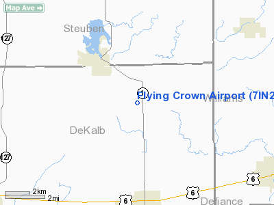
Location
& QuickFacts
|
FAA
Information Effective: |
2007-12-20 |
|
Airport
Identifier: |
7IN2 |
|
Airport
Status: |
Operational |
|
Longitude/Latitude: |
084-52-42.0000W/41-30-05.0000N
-84.878333/41.501389 (Estimated) |
|
Elevation: |
920 ft / 280.42 m (Estimated) |
|
Land: |
0 acres |
|
From nearest
city: |
3 nautical miles SE of Hamilton, IN |
|
Location: |
De Kalb County, IN |
|
Magnetic
Variation: |
05W (2000) |
Owner & Manager
|
Ownership: |
Privately
owned |
|
Owner: |
David B. Fink |
|
Address: |
1004 State Road
Butler,
IN 46721 |
|
Phone
number: |
219-868-0431 |
|
Manager: |
David B. Fink |
|
Address: |
1004 State Road
Butler,
IN 46721 |
|
Phone
number: |
219-868-0431 |
Airport
Operations and Facilities
|
Airport
Use: |
Private |
|
Segmented
Circle: |
No |
|
Control
Tower: |
No |
|
Sectional
chart: |
Detroit |
|
Region: |
AGL - Great Lakes |
|
Boundary
ARTCC: |
ZOB - Cleveland |
|
Tie-in
FSS: |
HUF - Terre Haute |
|
FSS Toll
Free: |
1-800-WX-BRIEF |
|
Runway Information
Runway 18/36
|
Dimension: |
2400 x 100 ft
/ 731.5 x 30.5 m |
|
Surface: |
TURF, |
|
|
Runway 18 |
Runway 36 |
|
Traffic
Pattern: |
Left |
Right |
|
Radio Navigation
Aids
|
ID |
Type |
Name |
Ch |
Freq |
Var |
Dist |
|
ANQ |
NDB |
Angola |
|
347.00 |
05W |
12.5 nm |
|
BYN |
NDB |
Bryan |
|
260.00 |
04W |
18.6 nm |
|
DFI |
NDB |
Defiance |
|
246.00 |
05W |
22.7 nm |
|
IRS |
NDB |
Sturgis |
|
382.00 |
04W |
31.2 nm |
|
USE |
NDB |
Fulton |
|
375.00 |
05W |
34.2 nm |
|
VFU |
NDB |
Stanley |
|
411.00 |
05W |
40.2 nm |
|
HAI |
NDB |
Three Rivers |
|
407.00 |
02W |
42.2 nm |
|
ADG |
NDB |
Adrian |
|
278.00 |
06W |
42.2 nm |
|
HHG |
NDB |
Huntington |
|
417.00 |
03W |
47.0 nm |
|
PDR |
NDB |
Ottawa |
|
233.00 |
05W |
49.6 nm |
|
TOL |
TACAN |
Toledo |
072X |
|
05W |
48.9 nm |
|
OLK |
VOR |
Wolf Lake |
|
110.40 |
03W |
31.8 nm |
|
LFD |
VOR/DME |
Litchfield |
049X |
111.20 |
05W |
34.1 nm |
|
JXN |
VOR/DME |
Jackson |
033X |
109.60 |
05W |
49.3 nm |
|
FWA |
VORTAC |
Fort Wayne |
125X |
117.80 |
00E |
34.4 nm |
|
FWA |
VOT |
Fort Wayne Baer |
|
111.00 |
|
34.5 nm |
Based Aircraft
|
Aircraft
based on field: |
1 |
|
Single Engine
Airplanes: |
1 |
Flying Crown Airport
Address:
De Kalb County, IN
Tel:
219-868-0431
Images
and information placed above are from
http://www.airport-data.com/airport/7IN2/
We
thank them for the data!
| General
Info |
| Country |
United
States |
| State |
INDIANA
|
| FAA ID |
7IN2 |
| Latitude |
41-30-05.000N
|
| Longitude |
084-52-42.000W
|
| Elevation |
920 feet
|
| Near City |
HAMILTON
|
We don't guarantee the information is fresh and accurate. The data may
be wrong or outdated.
For more up-to-date information please refer to other sources.
|
|


