 |
|
|
|
|
|
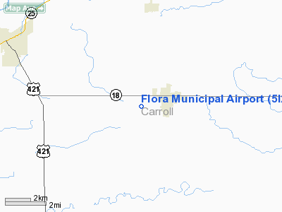
Location
& QuickFacts
|
FAA
Information Effective: |
2007-12-20 |
|
Airport
Identifier: |
5I2 |
|
Airport
Status: |
Operational |
|
Longitude/Latitude: |
086-32-53.9990W/40-32-23.1300N
-86.548333/40.539758 (Estimated) |
|
Elevation: |
710 ft / 216.41 m (Estimated) |
|
Land: |
22 acres |
|
From nearest
city: |
2 nautical miles SW of Flora, IN |
|
Location: |
Carroll County, IN |
|
Magnetic
Variation: |
02W (1985) |
Owner
& Manager
|
Ownership: |
Publicly
owned |
|
Owner: |
Town Of Flora |
|
Address: |
501 N Division St
Flora,
IN 46929 |
|
Phone
number: |
219-967-4844 |
|
Manager: |
Chuck Everett |
|
Address: |
27 W Main St
Flora,
IN 46929 |
|
Phone
number: |
219-967-3443 |
Airport Operations
and Facilities
|
Airport
Use: |
Open
to public |
|
Wind indicator: |
Yes
AMBIENT LGT ONLY FM ADJ DUSK-DAWN SECURITY LGT. |
|
Segmented
Circle: |
No |
|
Control
Tower: |
No |
|
Lighting
Schedule: |
DUSK-DAWN |
|
Landing
fee charge: |
No |
|
Sectional
chart: |
Chicago |
|
Region: |
AGL - Great Lakes |
|
Boundary
ARTCC: |
ZAU - Chicago |
|
Tie-in
FSS: |
HUF - Terre Haute |
|
FSS on
Airport: |
No |
|
FSS Toll
Free: |
1-800-WX-BRIEF |
|
NOTAMs
Facility: |
HUF (NOTAM-d service avaliable) |
Airport Communications
Airport Services
|
Airframe
Repair: |
NONE |
|
Power
Plant Repair: |
NONE |
|
Bottled
Oxygen: |
NONE |
|
Bulk Oxygen: |
NONE |
|
Runway Information
Runway 09/27
|
Dimension: |
2143 x 93 ft
/ 653.2 x 28.3 m |
|
Surface: |
TURF, Fair Condition |
|
Edge Lights: |
Low |
|
|
Runway 09 |
Runway 27 |
|
Longitude: |
086-33-09.1100W |
086-32-40.8700W |
|
Latitude: |
40-32-25.1300N |
40-32-25.1300N |
|
Elevation: |
710.00 ft |
710.00 ft |
|
Traffic
Pattern: |
Left |
Left |
|
Runway End
Identifier: |
No |
No |
|
Centerline
Lights: |
No |
No |
|
Touchdown
Lights: |
No |
No |
|
Obstruction: |
14 ft road, 285.0 ft from runway, 20:1 slope
to clear |
10 ft crops, 201.0 ft from runway, 20:1 slope
to clear |
|
Radio Navigation
Aids
|
ID |
Type |
Name |
Ch |
Freq |
Var |
Dist |
|
GGP |
NDB |
Logansport |
|
263.00 |
01W |
12.9 nm |
|
MCX |
NDB |
White County |
|
377.00 |
03W |
14.2 nm |
|
FKR |
NDB |
Frankfort |
|
278.00 |
02W |
16.2 nm |
|
RWN |
NDB |
Winamac/dcmsnd |
|
335.00 |
00W |
33.4 nm |
|
RCR |
NDB |
Rochester |
|
216.00 |
03W |
35.5 nm |
|
IWH |
NDB |
Wabash |
|
329.00 |
03W |
36.8 nm |
|
CFJ |
NDB |
Crawfordsville |
|
388.00 |
02W |
37.6 nm |
|
RZL |
NDB |
Rensselaer |
|
362.00 |
02W |
37.9 nm |
|
HZP |
NDB |
Zionsville |
|
248.00 |
03W |
38.6 nm |
|
CPB |
NDB |
Culver |
|
391.00 |
01W |
41.4 nm |
|
UMP |
NDB |
Metropolitan |
|
338.00 |
03W |
42.8 nm |
|
MZZ |
VOR/DME |
Marion |
023X |
108.60 |
03W |
39.8 nm |
|
OXI |
VOR/DME |
Knox |
103X |
115.60 |
00E |
47.2 nm |
|
GUS |
VORTAC |
Grissom |
21Y |
108.45 |
02W |
19.2 nm |
|
OKK |
VORTAC |
Kokomo |
082X |
113.50 |
00E |
22.4 nm |
|
BVT |
VORTAC |
Boiler |
098X |
115.10 |
01E |
23.8 nm |
|
VHP |
VORTAC |
Brickyard |
110X |
116.30 |
01E |
44.4 nm |
|
DNV |
VORTAC |
Danville |
047X |
111.00 |
02E |
48.5 nm |
Based Aircraft
|
Aircraft
based on field: |
7 |
|
Single Engine
Airplanes: |
4 |
|
Ultralights: |
3 |
Operational Statistics
Time
Period: 2004-03-18 - 2005-03-17
|
Aircraft
Operations: |
33/Week |
|
General Aviation
Local: |
79.9% |
|
General Aviation
Itinerant: |
20.1% |
Flora Municipal Airport
Address:
Carroll County, IN
Tel:
219-967-4844,
219-967-3443
Images
and information placed above are from
http://www.airport-data.com/airport/5I2/
We
thank them for the data!
| General
Info |
| Country |
United
States |
| State |
INDIANA
|
| FAA ID |
5I2 |
| Latitude |
40-32-23.130N
|
| Longitude |
086-32-53.999W
|
| Elevation |
710 feet
|
| Near City |
FLORA
|
We don't guarantee the information is fresh and accurate. The data may
be wrong or outdated.
For more up-to-date information please refer to other sources.
|
|


