 |
|
| Elwood Airport |
| IATA: none – ICAO: none – FAA LID: 3I1 |
| Summary |
| Airport type |
Public |
| Owner |
Ann Brewer |
| Serves |
Elwood, Indiana |
| Elevation AMSL |
866 ft / 264 m |
| Coordinates |
40°15′10.1″N 085°49′59.9″W / 40.252806°N 85.833306°W / 40.252806; -85.833306 |
| Runways |
| Direction |
Length |
Surface |
| ft |
m |
| 9/27 |
2,243 |
684 |
Turf |
| 18/36 |
2,076 |
633 |
Turf |
| Statistics (2005) |
| Aircraft operations |
2,604 |
| Source: Federal Aviation Administration |
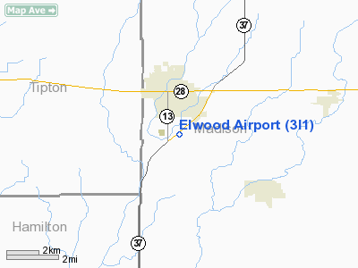
Elwood Airport (FAA LID: 3I1) is a public use airport located two nautical miles (3.7 km) south of the central business district of Elwood, in Madison County, Indiana, United States.
Facilities and aircraft
Elwood Airport covers an area of 74 acres (30 ha) at an elevation of 866 feet (264 m) above mean sea level. It has two runways with turf surfaces: 9/27 measures 2,243 by 300 feet (684 x 91 m) and 18/36 is 2,076 by 300 feet (633 x 91 m). For the 12-month period ending August 23, 2005, the airport had 2,604 general aviation aircraft operations, an average of 217 per month.
The above content comes from Wikipedia and is published under free licenses – click here to read more.
Location
& QuickFacts
|
FAA
Information Effective: |
2007-12-20 |
|
Airport
Identifier: |
3I1 |
|
Airport
Status: |
Operational |
|
Longitude/Latitude: |
085-49-59.9260W/40-15-10.1400N
-85.833313/40.252817 (Estimated) |
|
Elevation: |
866 ft / 263.96 m (Estimated) |
|
Land: |
74 acres |
|
From nearest
city: |
2 nautical miles S of Elwood, IN |
|
Location: |
Madison County, IN |
|
Magnetic
Variation: |
02W (1985) |
Owner
& Manager
|
Ownership: |
Privately
owned |
|
Owner: |
Ann Brewer |
|
Address: |
121 W. North C. Street
Elwood,
IN 46036 |
|
Phone
number: |
765-552-3627 |
|
Manager: |
Larry A. Brewer |
|
Address: |
121 W. North C. Street
Elwood,
IN 46036 |
|
Phone
number: |
765-552-3627 |
Airport Operations
and Facilities
|
Airport
Use: |
Open
to public |
|
Wind indicator: |
Yes |
|
Segmented
Circle: |
No |
|
Control
Tower: |
No |
|
Landing
fee charge: |
No |
|
Sectional
chart: |
Chicago |
|
Region: |
AGL - Great Lakes |
|
Boundary
ARTCC: |
ZAU - Chicago |
|
Tie-in
FSS: |
HUF - Terre Haute |
|
FSS on
Airport: |
No |
|
FSS Toll
Free: |
1-800-WX-BRIEF |
|
NOTAMs
Facility: |
HUF (NOTAM-d service avaliable) |
Airport Communications
Airport Services
|
Bottled
Oxygen: |
NONE |
|
Bulk Oxygen: |
NONE |
|
Runway Information
Runway 09/27
|
Dimension: |
2243 x 300 ft
/ 683.7 x 91.4 m |
|
Surface: |
TURF, Fair Condition |
|
|
Runway 09 |
Runway 27 |
|
Longitude: |
085-50-30.6100W |
085-50-01.6800W |
|
Latitude: |
40-14-55.1200N |
40-14-55.1200N |
|
Elevation: |
860.00 ft |
860.00 ft |
|
Traffic
Pattern: |
Left |
Left |
|
Displaced
threshold: |
661.00 ft |
291.00 ft |
|
Runway End
Identifier: |
No |
No |
|
Centerline
Lights: |
No |
No |
|
Touchdown
Lights: |
No |
No |
|
Obstruction: |
30 ft trees
APCH RATIO 22:1 AT DSPLCD THLD. |
10 ft crops, 0.0 ft from runway
APCH RATIO 29:1 AT DSPLCD THLD; 10 FT SEASONAL CROPS 291 FT
FM DSPLCD THLD. |
|
Runway 18/36
|
Dimension: |
2076 x 300 ft
/ 632.8 x 91.4 m |
|
Surface: |
TURF, Fair Condition |
|
|
Runway 18 |
Runway 36 |
|
Longitude: |
085-49-59.8600W |
085-49-59.8600W |
|
Latitude: |
40-15-17.3200N |
40-14-56.8000N |
|
Elevation: |
862.00 ft |
860.00 ft |
|
Traffic
Pattern: |
Left |
Left |
|
Displaced
threshold: |
274.00 ft |
320.00 ft |
|
Runway End
Identifier: |
No |
No |
|
Centerline
Lights: |
No |
No |
|
Touchdown
Lights: |
No |
No |
|
Obstruction: |
15 ft road, 45.0 ft from runway, 125 ft right
of centerline, 3:1 slope to clear
CLOSEST INTERCEPT POINT OF ROAD ADJ TO RWY END.
APCH RATIO 21:1 AT DSPLCD THLD; 15 FT ROAD 319 FT FM DSPLCD
THLD. |
15 ft road, 40.0 ft from runway, 2:1 slope
to clear
APCH RATIO 24:1 AT DSPLCD THLD; 15 FT ROAD 360 FT FM DSPLCD
THLD. |
|
Radio Navigation
Aids
|
ID |
Type |
Name |
Ch |
Freq |
Var |
Dist |
|
AI |
NDB |
Video |
|
371.00 |
03W |
18.5 nm |
|
UMP |
NDB |
Metropolitan |
|
338.00 |
03W |
21.4 nm |
|
HZP |
NDB |
Zionsville |
|
248.00 |
03W |
26.8 nm |
|
IWH |
NDB |
Wabash |
|
329.00 |
03W |
30.7 nm |
|
UWL |
NDB |
New Castle |
|
385.00 |
02W |
32.6 nm |
|
FKR |
NDB |
Frankfort |
|
278.00 |
02W |
33.5 nm |
|
GGP |
NDB |
Logansport |
|
263.00 |
01W |
36.9 nm |
|
HFY |
NDB |
Greenwood |
|
398.00 |
02W |
39.1 nm |
|
HHG |
NDB |
Huntington |
|
417.00 |
03W |
40.0 nm |
|
PLD |
NDB |
Portland |
|
257.00 |
03W |
40.8 nm |
|
MZZ |
VOR/DME |
Marion |
023X |
108.60 |
03W |
16.1 nm |
|
MIE |
VOR/DME |
Muncie |
091X |
114.40 |
03W |
20.2 nm |
|
OKK |
VORTAC |
Kokomo |
082X |
113.50 |
00E |
19.5 nm |
|
GUS |
VORTAC |
Grissom |
21Y |
108.45 |
02W |
27.7 nm |
|
VHP |
VORTAC |
Brickyard |
110X |
116.30 |
01E |
36.0 nm |
|
SHB |
VORTAC |
Shelbyville |
057X |
112.00 |
01E |
37.3 nm |
|
IND |
VOT |
Indianapolis Intl |
|
109.60 |
|
37.9 nm |
Remarks
- ROLLING
TERRAIN BOTH RWY SFCS.
- EXISTED
PRIOR TO 1959.
Based Aircraft
|
Aircraft
based on field: |
8 |
|
Single Engine
Airplanes: |
4 |
|
Ultralights: |
4 |
Operational Statistics
Time
Period: 2004-08-24 - 2005-08-23
|
Aircraft
Operations: |
51/Week |
|
General Aviation
Local: |
87.1% |
|
General Aviation
Itinerant: |
12.9% |
Elwood Airport
Address:
Madison County, IN
Tel:
765-552-3627
Images
and information placed above are from
http://www.airport-data.com/airport/3I1/
We
thank them for the data!
| General
Info |
| Country |
United
States |
| State |
INDIANA
|
| FAA ID |
3I1 |
| Latitude |
40-15-10.140N
|
| Longitude |
085-49-59.926W
|
| Elevation |
866 feet
|
| Near City |
ELWOOD
|
We don't guarantee the information is fresh and accurate. The data may
be wrong or outdated.
For more up-to-date information please refer to other sources.
|
|


