 |
|
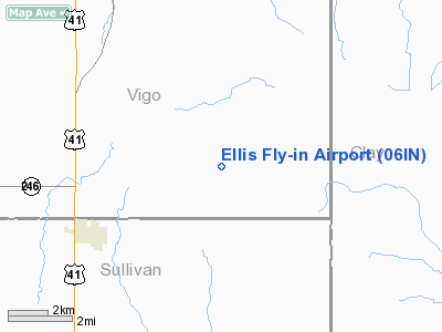
Location
& QuickFacts
|
FAA
Information Effective: |
2007-12-20 |
|
Airport
Identifier: |
06IN |
|
Airport
Status: |
Operational |
|
Longitude/Latitude: |
087-18-13.0610W/39-16-58.1440N
-87.303628/39.282818 (Estimated) |
|
Elevation: |
575 ft / 175.26 m (Estimated) |
|
Land: |
0 acres |
|
From nearest
city: |
0 nautical miles of Blackhawk, IN |
|
Location: |
Vigo County, IN |
|
Magnetic
Variation: |
01W (1985) |
Owner
& Manager
|
Ownership: |
Privately
owned |
|
Address: |
|
|
Manager: |
Robert L. Marlowe |
|
Address: |
Rr 25, Box 322
Terre Haute, IN 47802 |
|
Phone
number: |
812-894-2457 |
Airport Operations
and Facilities
|
Airport Use: |
Private |
|
Wind
indicator: |
Yes |
|
Segmented
Circle: |
No |
|
Control
Tower: |
No |
|
Landing
fee charge: |
No |
|
Sectional
chart: |
St Louis |
|
Region: |
AGL - Great Lakes |
|
Boundary
ARTCC: |
ZID - Indianapolis |
|
Tie-in
FSS: |
HUF - Terre Haute |
|
FSS on
Airport: |
No |
|
FSS Toll
Free: |
1-800-WX-BRIEF |
Airport Services
|
Airframe
Repair: |
NONE |
|
Power
Plant Repair: |
NONE |
|
Runway Information
Runway N/S
|
Dimension: |
1600 x 75 ft
/ 487.7 x 22.9 m |
|
Surface: |
TURF, |
|
|
Runway N |
Runway S |
|
Traffic
Pattern: |
Left |
Left |
|
Radio Navigation
Aids
|
ID |
Type |
Name |
Ch |
Freq |
Var |
Dist |
|
HU |
NDB |
Yinno |
|
245.00 |
02W |
7.7 nm |
|
SIV |
NDB |
Sullivan |
|
326.00 |
02W |
12.2 nm |
|
PLX |
NDB |
Palestine |
|
391.00 |
00W |
22.6 nm |
|
PRG |
NDB |
Paris |
|
341.00 |
01E |
30.3 nm |
|
CZB |
NDB |
Casey |
|
359.00 |
00E |
32.5 nm |
|
TVX |
NDB |
Greencastle |
|
521.00 |
03W |
34.7 nm |
|
BM |
NDB |
Claye |
|
382.00 |
02W |
35.5 nm |
|
DCY |
NDB |
Washington |
|
212.00 |
03W |
36.2 nm |
|
OEA |
NDB |
Vincennes |
|
251.00 |
00E |
37.4 nm |
|
MT |
NDB |
Zebre |
|
347.00 |
00E |
41.5 nm |
|
AJG |
NDB |
Mount Carmel |
|
524.00 |
02W |
44.9 nm |
|
CFJ |
NDB |
Crawfordsville |
|
388.00 |
02W |
45.6 nm |
|
BFR |
NDB |
Bedford |
|
344.00 |
02W |
48.4 nm |
|
RSV |
VOR/DME |
Robinson |
021X |
108.40 |
02E |
22.6 nm |
|
LWV |
VOR/DME |
Lawrenceville |
025X |
108.80 |
01W |
33.9 nm |
|
MTO |
VOR/DME |
Mattoon |
031X |
109.40 |
03E |
47.1 nm |
|
TTH |
VORTAC |
Terre Haute |
100X |
115.30 |
02E |
12.6 nm |
|
OOM |
VORTAC |
Hoosier |
039X |
110.20 |
02W |
33.2 nm |
Based Aircraft
|
Aircraft
based on field: |
1 |
|
Single Engine
Airplanes: |
1 |
Ellis Fly-in Airport
Address:
Vigo County, IN
Tel:
812-894-2457
Images
and information placed above are from
http://www.airport-data.com/airport/06IN/
We
thank them for the data!
| General
Info |
| Country |
United
States |
| State |
INDIANA
|
| FAA ID |
06IN |
| Latitude |
39-16-58.144N
|
| Longitude |
087-18-13.061W
|
| Elevation |
575 feet
|
| Near City |
BLACKHAWK
|
We don't guarantee the information is fresh and accurate. The data may
be wrong or outdated.
For more up-to-date information please refer to other sources.
|
|


