|
|
Elkhart Municipal Airport |
| Elkhart Municipal Airport |
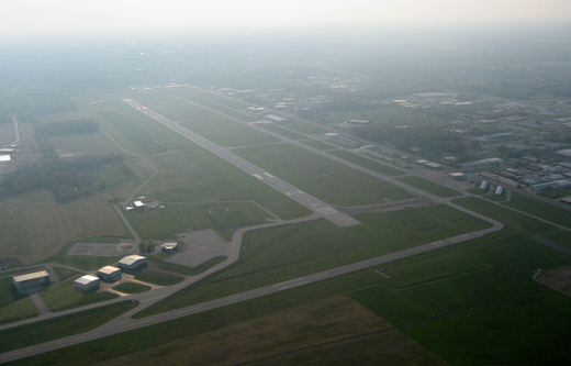 |
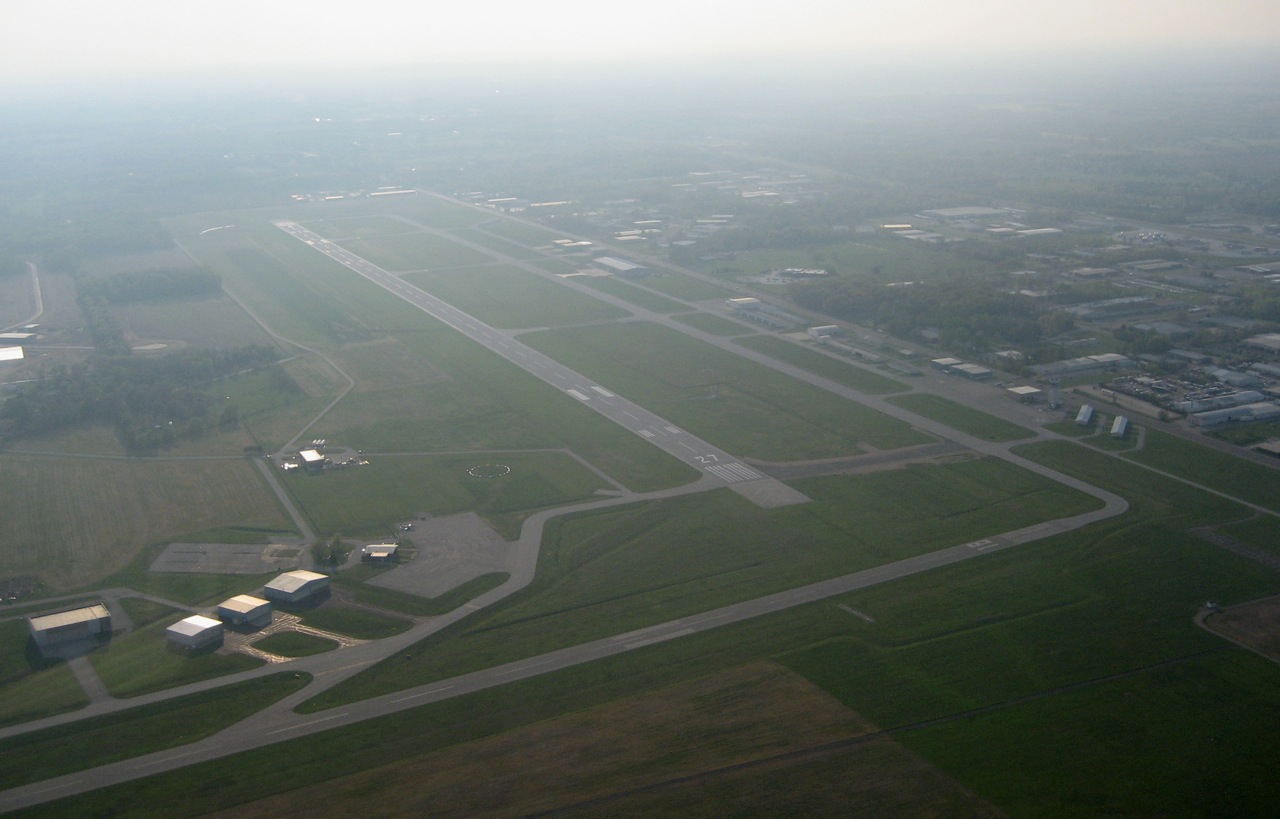
| Aerial view of the airport, facing northwest |
| IATA: EKI â ICAO: KEKM â FAA LID: EKM |
| Summary |
| Airport type |
Public |
| Owner |
City of Elkhart |
| Serves |
Elkhart, Indiana |
| Elevation AMSL |
778 ft / 237 m |
| Coordinates |
41°43â²10â³N 086°00â²12â³W / 41.71944°N 86.00333°W / 41.71944; -86.00333 |
| Runways |
| Direction |
Length |
Surface |
| ft |
m |
| 9/27 |
6,500 |
1,981 |
Asphalt |
| 18/36 |
4,001 |
1,220 |
Asphalt |
| 8/26 |
2,500 |
762 |
Turf |
| Statistics (2005) |
| Aircraft operations |
33,211 |
| Based aircraft |
73 |
| Source: Federal Aviation Administration |
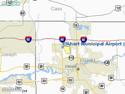
Elkhart Municipal Airport (IATA: EKI, ICAO: KEKM, FAA LID: EKM) is a city-owned public-use airport located three nautical miles (6 km) northwest of the central business district of Elkhart, a city in Elkhart County, Indiana, United States.
Although most U.S. airports use the same three-letter location identifier for the FAA and IATA, Elkhart Municipal Airport is assigned EKM by the FAA and EKI by the IATA. The airport's ICAO identifier is KEKM. Facilities and aircraft
Elkhart Municipal Airport covers an area of 640 acres (259 ha) at an elevation of 778 feet (237 m) above mean sea level. It has two asphalt paved runways: 9/27 is 6,500 by 120 feet (1,981 x 37 m) and 18/36 is 4,001 by 75 feet (1,220 x 23 m). It also has one turf runway designated 8/26 which measures 2,500 by 100 feet (762 x 30 m).
For the 12-month period ending December 31, 2005, the airport had 33,211 aircraft operations, an average of 90 per day: 96% general aviation, 3% air taxi and 1% military. At that time there were 73 aircraft based at this airport: 62% single-engine, 23% multi-engine, 8% jet, 4% helicopter and 3% military.
Former airlines and destinations
- Air Wisconsin - Operated in the 1970s through the 1980s. (Battle Creek, Chicago-O'Hare, Fort Wayne)
The above content comes from Wikipedia and is published under free licenses – click here to read more.
|
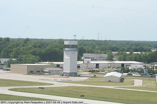 |
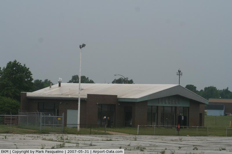
(Click on the photo to enlarge) |
|
 |
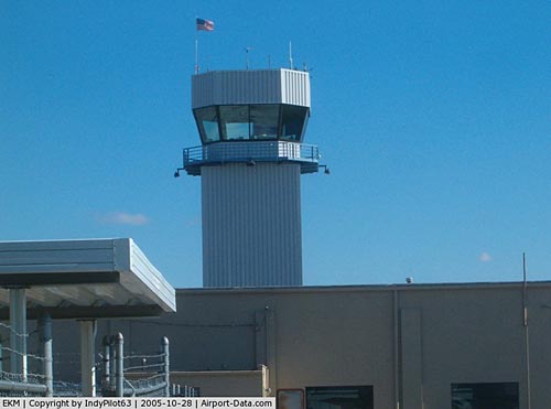
(Click on the photo to enlarge) |
|
 |
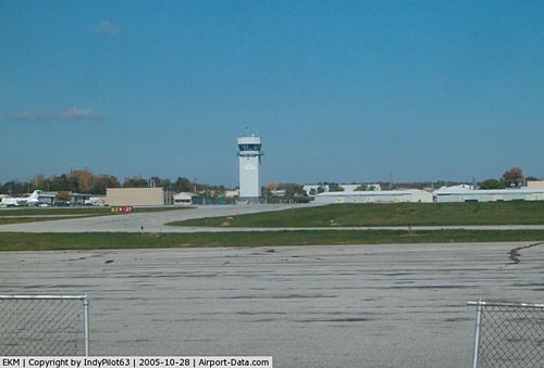
(Click on the photo to enlarge) |
|
 |
(Click on the photo to enlarge) |
Location
& QuickFacts
|
FAA
Information Effective: |
2007-12-20 |
|
Airport
Identifier: |
EKM |
|
Airport
Status: |
Operational |
|
Longitude/Latitude: |
086-00-11.6240W/41-43-09.8940N
-86.003229/41.719415 (Estimated) |
|
Elevation: |
778 ft / 237.13 m (Surveyed) |
|
Land: |
640 acres |
|
From nearest
city: |
3 nautical miles NW of Elkhart, IN |
|
Location: |
Elkhart County, IN |
|
Magnetic
Variation: |
04W (2005) |
Owner & Manager
|
Ownership: |
Publicly
owned |
|
Owner: |
City Of Elkhart |
|
Address: |
2246 Airport Dr.
Elkhart,
IN 46515 |
|
Phone
number: |
574-294-5471 |
|
Manager: |
Andrew Maksymovich |
|
Address: |
2246 Airport Dr.
Elkhart,
IN 46515 |
|
Phone
number: |
574-264-5217 |
Airport
Operations and Facilities
|
Airport
Use: |
Open
to public |
|
Wind indicator: |
Yes |
|
Segmented
Circle: |
Yes |
|
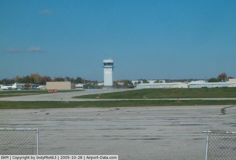
Control
Tower: |
Yes |
|
Lighting
Schedule: |
DUSK-DAWN
WHEN ATCT CLSD MIRL RY 18/36 & HIRL RY 09/27 PRESET
LOW INTST; TO INCR INTST & ACTVT VASI RYS 09 & 27
& 35; REIL RYS 18 & 36 & 09 & MALSR RY 27
- CTAF. |
|
Beacon
Color: |
Clear-Green (lighted land airport) |
|
Landing
fee charge: |
No |
|
Sectional
chart: |
Chicago |
|
Region: |
AGL - Great Lakes |
|
Traffic
Pattern Alt: |
1000 ft |
|
Boundary
ARTCC: |
ZAU - Chicago |
|
Tie-in
FSS: |
HUF - Terre Haute |
|
FSS on
Airport: |
No |
|
FSS Toll
Free: |
1-800-WX-BRIEF |
|
NOTAMs
Facility: |
EKM (NOTAM-d service avaliable) |
|
Certification
type/date: |
IV A U 04/197
CLSD TO SCHEDULED ACR OPNS WITH GREATER THAN 9 PSGR SEATS
& UNSCHEDULED ACR OPS GREATER THAN 30 PSGR SEATS. 90-DAY
PPR;CALL AMGR 574-264-5217; AFT HRS CONTACT CITY COMM CTR
574-293-2175. |
|
Federal
Agreements: |
NGY |
Airport Communications
|
CTAF: |
119.500 |
|
Unicom: |
122.950
|
Airport
Services
|
Fuel
available: |
100LLA |
|
Airframe
Repair: |
MAJOR |
|
Power
Plant Repair: |
MAJOR |
|
Bottled
Oxygen: |
LOW |
|
Bulk Oxygen: |
NONE |
|
Runway Information
Runway 08/26
|
Dimension: |
2500 x 100
ft / 762.0 x 30.5 m
RY 08/26 MARKED WITH WHITE CORNER MARKERS. VFR
ONLY AND ONLY OPR DURING ATCT HRS. |
|
Surface: |
TURF, |
|
|
Runway 08 |
Runway 26 |
|
Traffic
Pattern: |
Left |
Left |
|
Runway 09/27
|
Dimension: |
6500 x 120
ft / 1981.2 x 36.6 m
RY 08/26 MARKED WITH WHITE CORNER MARKERS. VFR
ONLY AND ONLY OPR DURING ATCT HRS. |
|
Surface: |
ASPH, Fair Condition |
|
Surface Treatment: |
Saw-cut or plastic Grooved |
|
Weight Limit: |
Single wheel: 40000 lbs.
Dual wheel: 60000 lbs. |
|
Edge Lights: |
High |
|
|
Runway 09 |
Runway 27 |
|
Longitude: |
086-01-09.8100W |
085-59-44.0980W |
|
Latitude: |
41-43-15.2500N |
41-43-15.3700N |
|
Elevation: |
771.00 ft |
777.00 ft |
|
Alignment: |
90 |
127 |
|
ILS Type: |
|
ILS |
|
Traffic
Pattern: |
Left |
Left |
|
Markings: |
Precision instrument, Fair Condition |
Precision instrument, Fair Condition |
|
Crossing
Height: |
49.00 ft |
45.00 ft |
|
VASI: |
4-box on left side |
4-box on left side |
|
Visual Glide
Angle: |
3.00° |
3.00° |
|
RVR Equipment: |
|
touchdown |
|
Approach
lights: |
|
MALSR |
|
Runway End
Identifier: |
Yes |
|
|
Obstruction: |
70 ft trees, 1987.0 ft from runway, 291 ft
right of centerline, 25:1 slope to clear |
63 ft trees, 2699.0 ft from runway, 444 ft
right of centerline, 39:1 slope to clear |
|
Runway 18/36
|
Dimension: |
4001 x 75 ft
/ 1219.5 x 22.9 m
RY 08/26 MARKED WITH WHITE CORNER MARKERS. VFR
ONLY AND ONLY OPR DURING ATCT HRS. |
|
Surface: |
ASPH, Fair Condition |
|
Surface Treatment: |
Saw-cut or plastic Grooved |
|
Weight Limit: |
Single wheel: 45000 lbs.
Dual wheel: 65000 lbs. |
|
Edge Lights: |
Medium |
|
|
Runway 18 |
Runway 36 |
|
Longitude: |
085-59-35.8140W |
085-59-28.4180W |
|
Latitude: |
41-43-20.1230N |
41-42-40.9890N |
|
Elevation: |
778.00 ft |
772.00 ft |
|
Alignment: |
127 |
127 |
|
Traffic
Pattern: |
Left |
Left |
|
Markings: |
Non-precision instrument, Good Condition |
Non-precision instrument, Good Condition |
|
Crossing
Height: |
37.00 ft |
46.00 ft |
|
VASI: |
4-light PAPI on left side |
4-box on left side |
|
Visual Glide
Angle: |
3.00° |
3.50° |
|
Runway End
Identifier: |
Yes |
Yes |
|
Obstruction: |
23 ft bldg, 844.0 ft from runway, 313 ft right
of centerline, 28:1 slope to clear |
30 ft trees, 604.0 ft from runway, 251 ft left
of centerline, 14:1 slope to clear |
|
Radio Navigation
Aids
|
ID |
Type |
Name |
Ch |
Freq |
Var |
Dist |
|
HAI |
NDB |
Three Rivers |
|
407.00 |
02W |
23.4 nm |
|
IRS |
NDB |
Sturgis |
|
382.00 |
04W |
26.1 nm |
|
CPB |
NDB |
Culver |
|
391.00 |
01W |
34.8 nm |
|
MGC |
NDB |
Michigan City |
|
203.00 |
01W |
36.5 nm |
|
IUL |
NDB |
La Porte |
|
356.00 |
03W |
37.0 nm |
|
RCR |
NDB |
Rochester |
|
216.00 |
03W |
40.2 nm |
|
ANQ |
NDB |
Angola |
|
347.00 |
05W |
41.4 nm |
|
VP |
NDB |
Sedly |
|
212.00 |
02W |
42.5 nm |
|
RWN |
NDB |
Winamac/dcmsnd |
|
335.00 |
00W |
46.3 nm |
|
OLK |
VOR |
Wolf Lake |
|
110.40 |
03W |
36.4 nm |
|
ELX |
VOR/DME |
Keeler |
113X |
116.60 |
00E |
26.1 nm |
|
AZO |
VOR/DME |
Kalamazoo |
027X |
109.00 |
01W |
37.0 nm |
|
OXI |
VOR/DME |
Knox |
103X |
115.60 |
00E |
37.6 nm |
|
PMM |
VOR/DME |
Pullman |
058X |
112.10 |
00E |
45.1 nm |
|
GSH |
VORTAC |
Goshen |
084X |
113.70 |
00E |
11.7 nm |
|
GIJ |
VORTAC |
Gipper |
101X |
115.40 |
00E |
14.4 nm |
|
BTL |
VORTAC |
Battle Creek |
031X |
109.40 |
02W |
48.8 nm |
Remarks
- TWY
A NOT AVBL TO ACFT WITH MORE THAN 30 PSGR SEATS.
Based Aircraft
|
Aircraft
based on field: |
83 |
|
Single Engine
Airplanes: |
56 |
|
Multi Engine Airplanes: |
15 |
|
Jet Engine Airplanes: |
10 |
|
Military: |
2 |
Operational Statistics
Time
Period: 2005-01-01 - 2005-12-31
|
Aircraft
Operations: |
91/Day |
|
Air Taxi: |
3.0% |
|
General Aviation
Local: |
42.2% |
|
General Aviation
Itinerant: |
53.7% |
|
Military: |
1.1% |
Elkhart Municipal Airport
Address:
Elkhart County, IN
Tel:
574-294-5471,
574-264-5217
Images
and information placed above are from
http://www.airport-data.com/airport/EKM/
We
thank them for the data!
| General
Info |
| Country |
United
States |
| State |
INDIANA
|
| FAA ID |
EKM |
| Latitude |
41-43-09.690N
|
| Longitude |
086-00-06.061W
|
| Elevation |
778 feet
|
| Near City |
ELKHART
|
We don't guarantee the information is fresh and accurate. The data may
be wrong or outdated.
For more up-to-date information please refer to other sources.
|
|