 |
|
|
|
|
|
Location
& QuickFacts
|
FAA
Information Effective: |
2007-12-20 |
|
Airport
Identifier: |
2IG4 |
|
Airport
Status: |
Operational |
|
Longitude/Latitude: |
087-29-59.0000W/38-51-05.1620N
-87.499722/38.851434 (Estimated) |
|
Elevation: |
426 ft / 129.84 m (Estimated) |
|
Land: |
0 acres |
|
From nearest
city: |
3 nautical miles SW of Oaktown, IN |
|
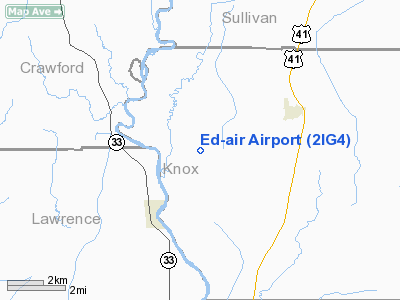
Location: |
Knox County, IN |
|
Magnetic
Variation: |
01W (1985) |
Owner
& Manager
|
Ownership: |
Privately
owned |
|
Owner: |
Edward A. Huddleston |
|
Address: |
Rr4 Box 303
Sullivan, IN 47882 |
|
Phone
number: |
812-268-5220 |
|
Manager: |
Edward A. Huddleston |
|
Address: |
2253 East Airport Road
Oaktown,
IN 47561 |
|
Phone
number: |
812-268-5220 |
Airport Operations
and Facilities
|
Airport
Use: |
Private |
|
Wind indicator: |
Yes |
|
Segmented
Circle: |
No |
|
Control
Tower: |
No |
|
Beacon
Color: |
Clear-Green (lighted land airport) |
|
Landing
fee charge: |
No |
|
Sectional
chart: |
St Louis |
|
Region: |
AGL - Great Lakes |
|
Boundary
ARTCC: |
ZID - Indianapolis |
|
Tie-in
FSS: |
HUF - Terre Haute |
|
FSS on
Airport: |
No |
|
FSS Toll
Free: |
1-800-WX-BRIEF |
Airport
Communications
Airport
Services
|
Airframe
Repair: |
MINOR |
|
Power
Plant Repair: |
MINOR |
|
Runway Information
Runway 18/36
|
Dimension: |
5800 x 100 ft
/ 1767.8 x 30.5 m |
|
Surface: |
ASPH, |
|
Edge Lights: |
Low |
|
|
Runway 18 |
Runway 36 |
|
Traffic
Pattern: |
Left |
Left |
|
Radio Navigation
Aids
|
ID |
Type |
Name |
Ch |
Freq |
Var |
Dist |
|
OEA |
NDB |
Vincennes |
|
251.00 |
00E |
10.0 nm |
|
PLX |
NDB |
Palestine |
|
391.00 |
00W |
11.8 nm |
|
SIV |
NDB |
Sullivan |
|
326.00 |
02W |
15.9 nm |
|
AJG |
NDB |
Mount Carmel |
|
524.00 |
02W |
17.9 nm |
|
DCY |
NDB |
Washington |
|
212.00 |
03W |
19.6 nm |
|
OLY |
NDB |
Olney |
|
272.00 |
00W |
32.5 nm |
|
HU |
NDB |
Yinno |
|
245.00 |
02W |
32.6 nm |
|
CZB |
NDB |
Casey |
|
359.00 |
00E |
36.0 nm |
|
BM |
NDB |
Claye |
|
382.00 |
02W |
43.9 nm |
|
FOA |
NDB |
Elm River |
|
353.00 |
00E |
46.0 nm |
|
MT |
NDB |
Zebre |
|
347.00 |
00E |
47.4 nm |
|
FNZ |
NDB |
Ferdinand |
|
239.00 |
00E |
47.8 nm |
|
PDW |
NDB |
Evansville |
|
284.00 |
00E |
48.8 nm |
|
RRJ |
NDB |
Oranj |
|
368.00 |
02W |
49.6 nm |
|
BFR |
NDB |
Bedford |
|
344.00 |
02W |
49.8 nm |
|
LWV |
VOR/DME |
Lawrenceville |
025X |
108.80 |
01W |
6.9 nm |
|
RSV |
VOR/DME |
Robinson |
021X |
108.40 |
02E |
12.2 nm |
|
SAM |
VOR/DME |
Samsville |
113X |
116.60 |
03E |
35.2 nm |
|
HNB |
VOR/DME |
Huntingburg |
029X |
109.20 |
00E |
44.2 nm |
|
TTH |
VORTAC |
Terre Haute |
100X |
115.30 |
02E |
40.1 nm |
|
OOM |
VORTAC |
Hoosier |
039X |
110.20 |
02W |
45.0 nm |
|
BIB |
VORTAC |
Bible Grove |
027X |
109.00 |
03E |
46.1 nm |
Remarks
- HANGAR
NEAR NORTH END-WEST SIDE OF RWY.
- EXISTED
PRIOR TO 1959.
Based Aircraft
|
Aircraft
based on field: |
4 |
|
Single Engine
Airplanes: |
1 |
|
Multi Engine Airplanes: |
2 |
|
Helicopters: |
1 |
Ed-air Airport
Address:
Knox County, IN
Tel:
812-268-5220
Images
and information placed above are from
http://www.airport-data.com/airport/2IG4/
We
thank them for the data!
We don't guarantee the information is fresh and accurate. The data may
be wrong or outdated.
For more up-to-date information please refer to other sources.
|
|


