 |
|
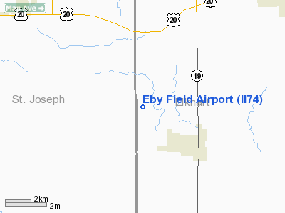
Location
& QuickFacts
|
FAA
Information Effective: |
2007-12-20 |
|
Airport
Identifier: |
II74 |
|
Airport
Status: |
Operational |
|
Longitude/Latitude: |
086-03-11.0040W/41-33-35.1740N
-86.053057/41.559771 (Estimated) |
|
Elevation: |
825 ft / 251.46 m (Estimated) |
|
Land: |
5 acres |
|
From nearest
city: |
2 nautical miles NW of Wakarusa, IN |
|
Location: |
Elkhart County, IN |
|
Magnetic
Variation: |
03W (1985) |
Owner & Manager
|
Ownership: |
Privately
owned |
|
Owner: |
David L. Eby |
|
Address: |
30688 Cr 36
Wakarusa, IN 46573 |
|
Phone
number: |
219-862-4392 |
|
Manager: |
David L. Eby |
|
Address: |
30688 Cr 36
Wakarusa, IN 46573 |
|
Phone
number: |
219-862-4392 |
Airport
Operations and Facilities
|
Airport
Use: |
Private |
|
Segmented
Circle: |
No |
|
Control
Tower: |
No |
|
Lighting
Schedule: |
PHONE REQ
FOR RXY LGTS CALL 219-862-4392 |
|
Sectional
chart: |
Chicago |
|
Region: |
AGL - Great Lakes |
|
Boundary
ARTCC: |
ZAU - Chicago |
|
Tie-in
FSS: |
HUF - Terre Haute |
|
FSS on
Airport: |
No |
|
FSS Toll
Free: |
1-800-WX-BRIEF |
Airport Services
|
Runway Information
Runway N/S
|
Dimension: |
3000 x 60 ft
/ 914.4 x 18.3 m |
|
Surface: |
TURF, |
|
Edge Lights: |
Low |
|
|
Runway N |
Runway S |
|
Traffic
Pattern: |
Left |
Left |
|
Obstruction: |
|
30 ft pline |
|
Radio Navigation
Aids
|
ID |
Type |
Name |
Ch |
Freq |
Var |
Dist |
|
CPB |
NDB |
Culver |
|
391.00 |
01W |
25.5 nm |
|
RCR |
NDB |
Rochester |
|
216.00 |
03W |
30.4 nm |
|
HAI |
NDB |
Three Rivers |
|
407.00 |
02W |
31.7 nm |
|
IRS |
NDB |
Sturgis |
|
382.00 |
04W |
31.7 nm |
|
IUL |
NDB |
La Porte |
|
356.00 |
03W |
32.5 nm |
|
MGC |
NDB |
Michigan City |
|
203.00 |
01W |
35.4 nm |
|
RWN |
NDB |
Winamac/dcmsnd |
|
335.00 |
00W |
37.5 nm |
|
VP |
NDB |
Sedly |
|
212.00 |
02W |
37.7 nm |
|
ANQ |
NDB |
Angola |
|
347.00 |
05W |
43.7 nm |
|
IWH |
NDB |
Wabash |
|
329.00 |
03W |
49.2 nm |
|
OLK |
VOR |
Wolf Lake |
|
110.40 |
03W |
31.3 nm |
|
OXI |
VOR/DME |
Knox |
103X |
115.60 |
00E |
30.4 nm |
|
ELX |
VOR/DME |
Keeler |
113X |
116.60 |
00E |
35.3 nm |
|
AZO |
VOR/DME |
Kalamazoo |
027X |
109.00 |
01W |
46.4 nm |
|
GSH |
VORTAC |
Goshen |
084X |
113.70 |
00E |
2.4 nm |
|
GIJ |
VORTAC |
Gipper |
101X |
115.40 |
00E |
17.3 nm |
Remarks
- FILED
FOR RECORD PURPOSES ONLY.
Based Aircraft
|
Aircraft
based on field: |
3 |
|
Single Engine
Airplanes: |
3 |
Eby Field Airport
Address:
Elkhart County, IN
Tel:
219-862-4392
Images
and information placed above are from
http://www.airport-data.com/airport/II74/
We
thank them for the data!
| General
Info |
| Country |
United
States |
| State |
INDIANA
|
| FAA ID |
II74 |
| Latitude |
41-33-35.174N
|
| Longitude |
086-03-11.004W
|
| Elevation |
825 feet
|
| Near City |
WAKARUSA
|
We don't guarantee the information is fresh and accurate. The data may
be wrong or outdated.
For more up-to-date information please refer to other sources.
|
|


