 |
|
Location
& QuickFacts
|
FAA
Information Effective: |
2007-12-20 |
|
Airport
Identifier: |
4IN3 |
|
Airport
Status: |
Operational |
|
Longitude/Latitude: |
084-49-22.0000W/41-44-06.0000N
-84.822778/41.735000 (Estimated) |
|
Elevation: |
1069 ft / 325.83 m (Estimated) |
|
Land: |
0 acres |
|
From nearest
city: |
0 nautical miles E of Clear Lake, IN |
|
Location: |
Steuben County, IN |
|
Magnetic
Variation: |
05W (2000) |
Owner
& Manager
|
Ownership: |
Privately
owned |
|
Owner: |
John E Mccardel |
|
Address: |
604 N Main St
Auburn,
IN 46706 |
|
Phone
number: |
219-927-1110 |
|
Manager: |
John E Mccardel |
|
Address: |
604 N Main St
Auburn,
IN 46706 |
|
Phone
number: |
219-927-1110 |
Airport Operations
and Facilities
|
Airport
Use: |
Private |
|
Segmented
Circle: |
No |
|
Control
Tower: |
No |
|
Sectional
chart: |
Detroit |
|
Region: |
AGL - Great Lakes |
|
Boundary
ARTCC: |
ZOB - Cleveland |
|
Tie-in
FSS: |
HUF - Terre Haute |
|
FSS Toll
Free: |
1-800-WX-BRIEF |
|
Runway Information
Helipad H1
|
Dimension: |
50 x 50 ft /
15.2 x 15.2 m |
|
Surface: |
TURF, |
|
|
Runway H1 |
Runway |
|
Traffic
Pattern: |
Left |
Left |
|
Radio Navigation
Aids
|
ID |
Type |
Name |
Ch |
Freq |
Var |
Dist |
|
ANQ |
NDB |
Angola |
|
347.00 |
05W |
13.2 nm |
|
BYN |
NDB |
Bryan |
|
260.00 |
04W |
22.2 nm |
|
IRS |
NDB |
Sturgis |
|
382.00 |
04W |
27.8 nm |
|
DFI |
NDB |
Defiance |
|
246.00 |
05W |
29.9 nm |
|
USE |
NDB |
Fulton |
|
375.00 |
05W |
31.9 nm |
|
ADG |
NDB |
Adrian |
|
278.00 |
06W |
34.4 nm |
|
HAI |
NDB |
Three Rivers |
|
407.00 |
02W |
37.0 nm |
|
BT |
NDB |
Batol |
|
272.00 |
04W |
41.0 nm |
|
TCU |
NDB |
Tecumseh |
|
239.00 |
04W |
45.9 nm |
|
TOL |
TACAN |
Toledo |
072X |
|
05W |
46.7 nm |
|
OLK |
VOR |
Wolf Lake |
|
110.40 |
03W |
42.2 nm |
|
LFD |
VOR/DME |
Litchfield |
049X |
111.20 |
05W |
19.9 nm |
|
JXN |
VOR/DME |
Jackson |
033X |
109.60 |
05W |
35.5 nm |
|
AZO |
VOR/DME |
Kalamazoo |
027X |
109.00 |
01W |
44.4 nm |
|
BTL |
VORTAC |
Battle Creek |
031X |
109.40 |
02W |
39.5 nm |
|
FWA |
VORTAC |
Fort Wayne |
125X |
117.80 |
00E |
48.3 nm |
|
FWA |
VOT |
Fort Wayne Baer |
|
111.00 |
|
48.4 nm |
Remarks
- PRVDD
APCH/DEP FM 140 TO 200 DEGS & 340 TO 014 DEGS, THE FULL 400 FT BY
150 FT FATO IS KEPT CLEAR OF OBSTNS.
Based Aircraft
|
Aircraft
based on field: |
1 |
|
Helicopters: |
1 |
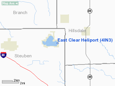
East Clear Heliport
Address:
Steuben County, IN
Tel:
219-927-1110
Images
and information placed above are from
http://www.airport-data.com/airport/4IN3/
We
thank them for the data!
| General
Info |
| Country |
United
States |
| State |
INDIANA
|
| FAA ID |
4IN3 |
| Latitude |
41-44-06.000N
|
| Longitude |
084-49-22.000W
|
| Elevation |
1069 feet
|
| Near City |
CLEAR
LAKE |
We don't guarantee the information is fresh and accurate. The data may
be wrong or outdated.
For more up-to-date information please refer to other sources.
|
|


